

No higher resolution available.
Mississippi_River_Watershed_Map.jpg (800 × 494 pixels, file size: 119 KB, MIME type: image/jpeg)
Summary
| Description |
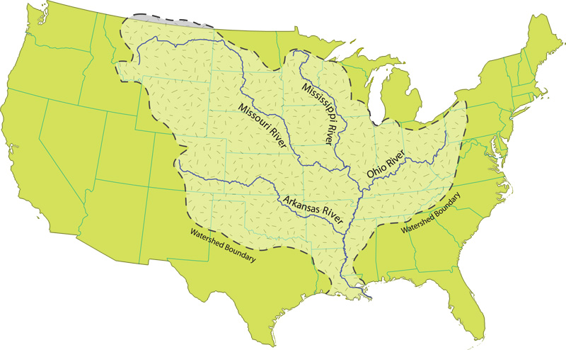
English: Map of the Mississippi River watershed, focusing on US-claimed territory. |
| Date | before 2014-04-27 |
| Source | http://www.nps.gov/miss/riverfacts.htm |
| Author | National Park Service |
Licensing
| This image or media file contains material based on a work of a National Park Service employee, created as part of that person's official duties. As a work of the U.S. federal government, such work is in the public domain in the United States. See the NPS website and NPS copyright policy for more information. |
File history
Click on a date/time to view the file as it appeared at that time.
| Date/Time | Thumbnail | Dimensions | User | Comment | |
|---|---|---|---|---|---|
| current | 22:06, 27 April 2014 | | 800 × 494 (119 KB) | Philpill691 | User created page with UploadWizard |
File usage
No pages on the English Wikipedia use this file (pages on other projects are not listed).