

Size of this preview: 548 × 600 pixels. Other resolutions: 219 × 240 pixels | 439 × 480 pixels | 806 × 882 pixels.
Original file (806 × 882 pixels, file size: 28 KB, MIME type: image/png)
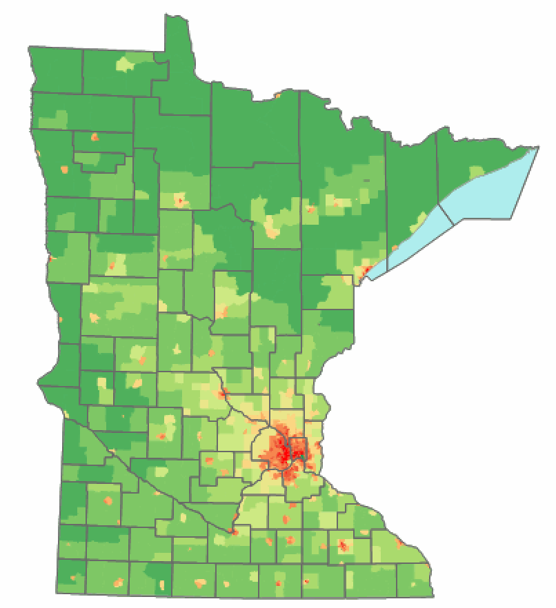
| Description | Minnesota state population density map based on Census 2000 data. Image:Population map key.png | ||||||||
| Date | |||||||||
| Source | EN.Wikipedia | ||||||||
| Author | Ravedave (original uploader at EN.Wikipedia) | ||||||||
| Permission (Reusing this file) |
Ravedave from the English Wikipedia, the copyright holder of this work, hereby publishes it under the following license:
|

Key

File history
Click on a date/time to view the file as it appeared at that time.
| Date/Time | Thumbnail | Dimensions | User | Comment | |
|---|---|---|---|---|---|
| current | 12:49, 2 June 2008 | | 806 × 882 (28 KB) | ברוקולי | {{Information |Description=Minnesota state population density map based on Census 2000 data. Image:Population map key.png |Source=[http://en.wikipedia.org/wiki/Image:Minnesota_population_map_cropped.png EN.Wikipedia] |Date=04:41, 20 October 2006 |Aut |
File usage
The following pages on the English Wikipedia use this file (pages on other projects are not listed):
Global file usage
The following other wikis use this file:
- Usage on ar.wikipedia.org
- Usage on et.wikipedia.org
- Usage on hy.wikipedia.org
- Usage on it.wikipedia.org
- Usage on ja.wikipedia.org
- Usage on no.wikipedia.org
- Usage on ro.wikipedia.org
- Usage on ru.wikipedia.org
- Usage on sv.wikipedia.org
- Usage on uk.wikipedia.org
- Usage on vi.wikipedia.org
- Usage on zh-min-nan.wikipedia.org
- Usage on zh.wikipedia.org