

Size of this preview: 671 × 600 pixels. Other resolutions: 269 × 240 pixels | 537 × 480 pixels | 859 × 768 pixels | 1,244 × 1,112 pixels.
Original file (1,244 × 1,112 pixels, file size: 231 KB, MIME type: image/jpeg)
Summary
| Description |
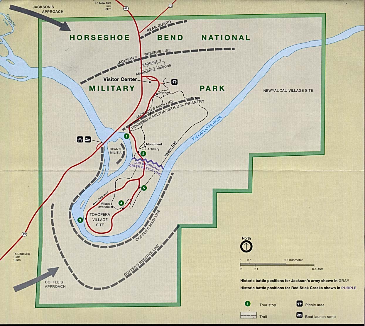
English: This image is held in the PCL Map Collection at the University of Texas Libraries, The University of Texas at Austin. (Copyrighted material in this collection is clearly marked.) The map shows the Horseshoe Bend National Military Park and is annotated with the historical battle positions of Jackson's Army and the Creek Red Sticks. |
| Date | 1 August 2005 (original upload date) |
| Source | Transferred from en.wikipedia to Commons. Retrieved from here |
| Author | "Courtesy of the University of Texas Libraries, The University of Texas at Austin." |
Licensing
See online license
| This work has been released into the public domain by its author, PCL Map Collection at the University of Texas Libraries. This applies worldwide. In some countries this may not be legally possible; if so: PCL Map Collection at the University of Texas Libraries grants anyone the right to use this work for any purpose, without any conditions, unless such conditions are required by law.
|
Original upload log
The original description page was here. All following user names refer to en.wikipedia.
- 2005-08-01 20:12 Vern Reisenleiter 1244×1112× (236405 bytes) This image is held in the PCL Map Collection at the University of Texas Libraries, The University of Texas at Austin. (Copyrighted material in this collection is clearly marked.) The map shows the Horseshoe Bend National Miltary Park and is annotat
File history
Click on a date/time to view the file as it appeared at that time.
| Date/Time | Thumbnail | Dimensions | User | Comment | |
|---|---|---|---|---|---|
| current | 15:59, 23 June 2014 | | 1,244 × 1,112 (231 KB) | Jalo | Transferred from en.wikipedia |
File usage
The following pages on the English Wikipedia use this file (pages on other projects are not listed):
Global file usage
The following other wikis use this file:
- Usage on ca.wikipedia.org
- Usage on en.wikivoyage.org
- Usage on it.wikipedia.org
- Usage on ru.wikipedia.org