


Size of this preview: 800 × 176 pixels. Other resolutions: 320 × 70 pixels | 640 × 141 pixels | 1,024 × 225 pixels | 1,280 × 282 pixels | 7,272 × 1,600 pixels.
Original file (7,272 × 1,600 pixels, file size: 7.92 MB, MIME type: image/jpeg)
| Description | ||||
| Date | ||||
| Source | Own work | |||
| Author | Mfield, Matthew Field, http://www.photography.mattfield.com | |||
| Permission (Reusing this file) |
|
|||
| Other versions |
Derivative works of this file: |

| Camera location | | View this and other nearby images on: OpenStreetMap |
|---|
File history
Click on a date/time to view the file as it appeared at that time.
| Date/Time | Thumbnail | Dimensions | User | Comment | |
|---|---|---|---|---|---|
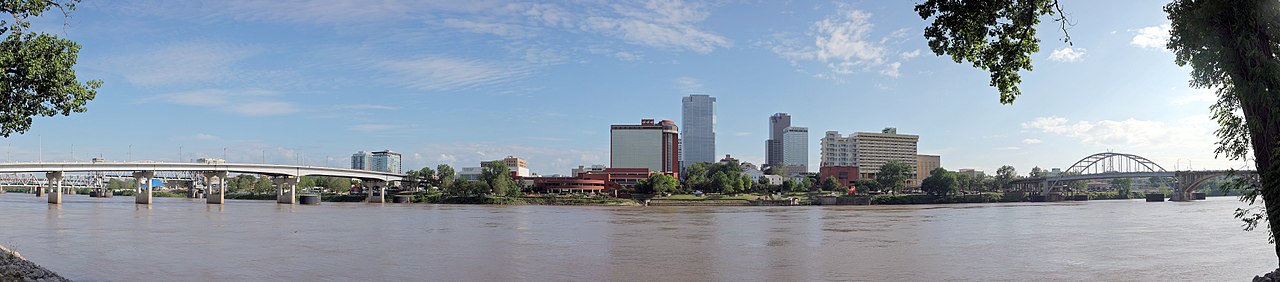
| current | 23:33, 8 February 2018 | 7,272 × 1,600 (7.92 MB) | Magnolia677 | Corrected contrast. | |
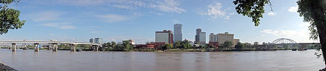
| 00:57, 29 May 2009 | 7,272 × 1,600 (3.94 MB) | Mfield | {{Information |Description={{en|1=The skyline of Little Rock, Arkansas viewed from the south bank of the Arkansas River}} |Source=Own work by uploader |Author=Mfield, Matthew Field, http |
File usage
The following pages on the English Wikipedia use this file (pages on other projects are not listed):
Global file usage
The following other wikis use this file:
- Usage on af.wikipedia.org
- Usage on az.wikipedia.org
- Usage on bs.wikipedia.org
- Usage on co.wikipedia.org
- Usage on el.wikipedia.org
- Usage on eo.wikipedia.org
- Usage on es.wikipedia.org
- Usage on fr.wikipedia.org
- Usage on ja.wikipedia.org
- Usage on mn.wikipedia.org
- Usage on mr.wikipedia.org
- Usage on pl.wikipedia.org
- Usage on ru.wikipedia.org
- Usage on sh.wikipedia.org
- Usage on tr.wikipedia.org
- Usage on vi.wikipedia.org
- Usage on vls.wikipedia.org