

Farm to Market Roads in Texas are owned and maintained by the Texas Department of Transportation (TxDOT).
RM 2900
Ranch to Market Road 2900 (RM 2900) is located in Llano County. It runs from RM 1431 near Kingsland south across the Llano River arm of Lake Lyndon B. Johnson to RM 2233, 3 miles (4.8 km) northeast of SH 71.
RM 2900 was designated on August 5, 1966, on the current route.
In October 2018, the RM 2900 bridge across the Llano River collapsed due to heavy flooding. The rebuilt bridge opened in May 2019.[2]
FM 2900
Farm to Market Road 2900 (FM 2900) was designated on May 6, 1964, from US 83, 7.2 miles (11.6 km) south of Perryton, east 7.5 miles (12.1 km) to a road intersection. FM 2900 was cancelled on May 12, 1966, and became a portion of FM 2711.[1]
FM 2901
FM 2902
FM 2903
Farm to Market Road 2903 (FM 2903) is located in southwestern Reeves County.
FM 2903 begins at I-10 exit 203, which also serves as the western terminus of Business I-10, approximately 2 miles (3.2 km) northwest of Balmorhea.[6] The two-lane roadway proceeds to the north, intersecting FM 3334,[7] before trending to the northwest toward Toyah.[8] FM 2903 enters Toyah as South Centre Street and ends at I-20 exit 22.[8]
FM 2903 was designated on May 6, 1964, from a point 10.5 miles (16.9 km) south of Toyah to US 80, which preceded the construction of I-20.[5] On July 11, 1968, FM 2903 was extended 10.0 miles (16.1 km) over FM 2954. The 1.9-mile (3.1 km) segment of FM 2903 between I-10 and SH 17 was designated as part of Business I-10 on November 21, 1991.[5][9]
FM 2904
FM 2905
FM 2906
Farm to Market Road 2906 (FM 2906) is located in Gregg County. It runs from SH 149 near Lakeport east to the Rusk County line in Easton. It was designated on May 6, 1964, along its current route.
FM 2907
FM 2908
RM 2909
FM 2910
FM 2910 (1964)
A previous route numbered FM 2910 was designated on May 6, 1964, from FM 852, 1.5 miles (2.4 km) southeast of Winnsboro, to a point 4.3 miles (6.9 km) south. On September 5, 1973, the road was extended south 2.1 miles (3.4 km). On May 7, 1974, the road was extended 2.4 miles (3.9 km) south to FM 2088/FM 3274, replacing FM 3274, though signage did not change until the connecting section was open to traffic. FM 2910 was cancelled on October 28, 1977, and became a portion of FM 2869.
FM 2911
FM 2912
FM 2913
FM 2914
FM 2915
FM 2916
FM 2916 (1964)
The first use of the FM 2916 designation was in Austin County, from FM 331 (now FM 529) near Burleigh northeast 4.8 miles (7.7 km) to a county road. FM 2916 was cancelled on April 6, 1970, and became a portion of FM 331.
FM 2916 (1970)
The next use of the FM 2916 designation was in Angelina County, from FM 1475 south 2.6 miles (4.2 km) to US 69 near Homer. On November 3, 1972, the road was extended west 1.8 miles (2.9 km) to FM 841. FM 2916 was cancelled on November 8, 1977: the section from FM 841 east 1.6 miles (2.6 km) was transferred to FM 1475 and the section from US 69 to FM 1475 was transferred to FM 326.
FM 2917
Farm to Market Road 2917 (FM 2917) is located in Brazoria County. It begins at FM 2004 between Hitchcock and Lake Jackson.[24] The route travels to the northwest, running parallel to and crossing branch lines of the Union Pacific Railroad to Monsanto and Solutia factories. Just north of a crossing of the busy Union Pacific main line at Chocolate Bayou, FM 2917 meets FM 2403 at a three-way stop.[25] FM 2917 continues northwest to its northern terminus at SH 35 north of Liverpool and southwest of Alvin.[23][25]
FM 2917 was designated on May 6, 1964, along the current route.[23]
FM 2918
Farm to Market Road 2918 (FM 2918) is located in Brazoria County.[26]
FM 2918 begins at a boat ramp at the Intracoastal Waterway.[27] The two-lane road travels to the northwest, roughly paralleling the San Bernard River and providing access to riverfront communities. The San Bernard National Wildlife Refuge lies along the south side of the road. The route ends at an intersection with FM 2611 near the community of Churchill.[26][28]
FM 2918 was commissioned on May 6, 1964, from FM 2611 southwest 5.2 miles (8.4 km) to the community of McNeel. The 4.6 miles (7.4 km) extension to the Intracoastal Waterway was designated on June 1, 1965.[26]
FM 2919
Farm to Market Road 2919 (FM 2919) is located in Fort Bend and Wharton counties. It runs from SH 60 in East Bernard southeast to US 59 in Kendleton. FM 2919 starts as a two-lane road at a stop sign on SH 60 at the southern edge of East Bernard and heads in an easterly direction for about 2.4 miles (3.9 km). After veering to the southeast for another 0.8 miles (1.3 km) the highway crosses the San Bernard River and enters Fort Bend County near the Bay Ridge Christian College. From the river to the tiny community of Powell Point is 1.1 miles (1.8 km). FM 2919 continues to the southeast for another 2.7 miles (4.3 km) to Loop 541 and the Union Pacific Railroad in Kendleton. From Loop 541 to the US 59 feeder road and overpass is a short block.[30]
FM 2919 was originally designated on May 6, 1964, to begin at US 90 Alt. in Kendleton in Fort Bend County, go about 3.8 miles (6.1 km) to the northwest and end at the San Bernard River. On January 18, 1967, a 3.5-mile (5.6 km) section of FM 1164 between SH 60 and the San Bernard River in Wharton County was transferred to FM 2919. On June 21, 1977, FM 2919 was extended about 0.1 miles (0.16 km) southeast from US 59 (now Loop 541) to the proposed US 59.[29]
-
 View east on FM 2919 near SH 60 in East Bernard
 -
 FM 2919 bridge over the San Bernard River
 -
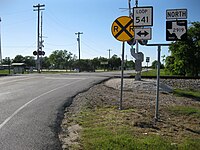 View northwest at FM 2919 and Loop 541 junction


FM 2920
Farm to Market Road 2920 (FM 2920) is located in Harris County. It runs from US 290 Business in Waller east to I-45 in Spring.[31] The highway has an interchange with US 290 and SH 6 in Waller, then heads east and intersects SH 249 and FM 2978 in Tomball before reaching its eastern terminus at I-45. The highway is mostly named Waller–Tomball Road except through Tomball, where the highway follow the city's Main Street.[32]
FM 2920 was designated on May 6, 1964, on a route from US 290 at Waller eastward to FM 149 (now SH 249) at Tomball. It was extended east to I-45 on November 7, 1964.[31]
- Junction list
The entire route is in Harris County.
| Location | mi[33][34] | km | Destinations | Notes | |
|---|---|---|---|---|---|
| Waller | 0.0 | 0.0 | Western terminus; former US 290/SH 6 | ||
| 0.8 | 1.3 | ||||
| Tomball | 18.8 | 30.3 | |||
| 19.0 | 30.6 | Former FM 149 | |||
| 21.5 | 34.6 | ||||
| Klein | 24.3 | 39.1 | |||
| Spring | 30.8 | 49.6 | Eastern terminus; I-45 exit 70A | ||
| 30.8 | 49.6 | Continuation beyond I-45[35] | |||
| 1.000 mi = 1.609 km; 1.000 km = 0.621 mi | |||||
FM 2921
FM 2921 (1964)
A previous route numbered FM 2921 was designated on May 6, 1964, from US 90 Alt. at Sheridan to a point 6.7 miles (10.8 km) south. On July 1, 1965, the road was extended 3.0 miles (4.8 km) south. FM 2921 was cancelled on December 20, 1965, and transferred to FM 2437.
FM 2922
FM 2923
Farm to Market Road 2923 (FM 2923) is located in San Augustine County. It runs from FM 1277, 2.3 miles (3.7 km) south of SH 103, west to Townsend Park.
FM 2923 was designated on October 28, 1966, on the current route. The entire route is also designated as Forest Highway (FH) 39.
FM 2923 (1964)
A previous route numbered FM 2923 was designated on May 6, 1964, from SH 71, 2.2 miles (3.5 km) north of northern El Campo, to a point 3.3 miles (5.3 km) northeast. FM 2923 was cancelled on May 18, 1966, and became a portion of FM 2546.
FM 2924
FM 2925
RM 2925
Ranch to Market Road 2925 (RM 2925) was designated on May 6, 1964, from SH 173 (now SH 16), 1.3 miles (2.1 km) north of Cross, east and north 6.3 miles (10.1 km) to 0.1 miles (0.16 km) north of the Atascosa County line. On June 2, 1967, the road was extended northeast 6.9 miles (11.1 km). RM 2925 was cancelled on August 31, 1967, and became a portion of FM 791.
FM 2926
FM 2927
Farm to Market Road 2927 (FM 2927) was located in Shackelford County. No highway currently uses the FM 2927 designation.
FM 2927 was designated on May 6, 1964, from SH 351, 4 miles (6.4 km) northeast of the Jones County line, south to the Callahan County line. FM 2927 was cancelled on May 19, 1966, and became a portion of FM 604.
FM 2928
FM 2928 (1964)
A previous route numbered FM 2928 was designated on May 6, 1964, from FM 126, 1 mile (1.6 km) east of the Nolan County line, to a point 6.4 miles (10.3 km) east. On June 1, 1965, the road was extended southeast 5.2 miles (8.4 km) to US 277. FM 2928 was cancelled on August 2, 1968, and became a portion of FM 89.
FM 2929
FM 2930
FM 2931
Farm to Market Road 2931 (FM 2931) is located in Denton County.
FM 2931 begins at an intersection with US 380 between Cross Roads and Little Elm near Providence Village. The highway runs in a northern direction and turns east at Liberty Road before turning back north at Brewer Road. FM 2931 runs in a predominately northern direction and intersects FM 428 on the eastern edge of Aubrey. FM 2931 continues to run north before ending at an intersection with Friendship Road northeast of Aubrey.
FM 2931 was designated on May 6, 1964, running from FM 428 to Friendship Road at a distance of 3.4 miles (5.5 km). The highway was extended farther south to SH 24 (now US 380) on May 5, 1966. FM 2931 was extended to the west to US 377 north of Aubrey on November 3, 1972. The section of highway along Friendship Road to US 377 was cancelled on September 5, 1973, and was re-rerouted to the east, ending at FM 1385. The section of FM 2931 along Friendship Road to FM 1385 was cancelled on August 23, 1976.
FM 2932
Farm to Market Road 2932 (FM 2932) is located in Kaufman County.
FM 2932 begins at an intersection with FM 148 southwest of Talty. The highway travels in a northwest direction and meets I-20 near Healms Trail at the Interstate's exit 491. FM 2932 turns to the west before ending at an intersection with FM 741 southeast of Forney.
FM 2932 was designated on May 6, 1964, along the current route.
FM 2933
Farm to Market Road 2933 (FM 2933) is located in Collin County.
FM 2933 begins at an intersection with FM 1827 in New Hope. The highway runs in a western direction before turning north at County Road 332. FM 2933 briefly enters McKinney where it intersects County Road 331 (Woodlawn Road) before turning in a slight northeast direction. The highway zigzags before entering Melissa. FM 2933 intersects FM 545 before ending at an intersection with SH 121.
FM 2933 was designated on May 6, 1964, running from FM 1827 to FM 545. The highway was extended farther north to SH 121 on June 1, 1965.
FM 2934
Farm to Market Road 2934 (FM 2934) is located in Denton County.
FM 2934 begins at an intersection with FM 423 in Little Elm. Between FM 423 and Legacy Drive, the highway passes by many newer subdivisions in northern Frisco. FM 2934 then runs near a shopping center before ending at the Dallas North Tollway. The entire route is known locally as Eldorado Parkway.
FM 2934 was designated on May 6, 1964, running from FM 423 eastward to the Denton–Collin county line. The highway was extended to the east to FM 720 on June 1, 1965. The last change came on January 31, 2002, when the section of FM 2934 between Dallas Parkway and FM 720 was removed from the highway system and turned over to the city of Frisco.
FM 2935
FM 2935 (1964)
The first use of the FM 2935 designation was in Upshur County, from FM 553, 0.9 miles (1.4 km) northwest of Gilmer, north and southeast to US 271 near Gilmer. FM 2935 was cancelled on May 5, 1966, and removed from the highway system.
FM 2935 (1967)
The next use of the FM 2935 designation was in Cherokee County, from SH 110, 2.4 miles (3.9 km) north of Black Jack, northeast to FM 856. FM 2935 was cancelled on October 25, 1969, and removed from the highway system in exchange for the creation of FM 1089, a parallel road to the north.[51]
FM 2936
FM 2937
FM 2938
FM 2939
FM 2940
FM 2941
FM 2942
FM 2943
FM 2943 (1964)
A previous route numbered FM 2943 was designated on June 22, 1964, from US 67, west of Akin Creek, southeast to US 59, south of Akin Creek. FM 2943 was cancelled on May 26, 1966, and became a portion of FM 2148.
FM 2944
FM 2945
Farm to Market Road 2945 (FM 2945) is a road that runs from just east of Putnam to Cisco along the former route of U.S. Highway 80.
FM 2945 was designated on October 30, 1964, on the current route.
FM 2946
FM 2947
FM 2948
FM 2949
FM 2950
FM 2951
FM 2952
FM 2953
FM 2953 runs from FM 2634 west of Lake Nocona east to FM 677 near Illinois Bend in northern Montague County.[69] The highway parallels the Red River and meets the eastern end of FM 103 northeast of Lake Nocona.[70] FM 2953 was designated on June 1, 1965, from what was then FM 2634 3 miles (4.8 km) east of FM 103 eastward about 4.8 miles (7.7 km). The highway was extended in both directions to its present termini on February 20, 1989.[69]
FM 2954
FM 2954 (1965)
A previous route numbered FM 2954 was designated on June 1, 1965, from US 290 in Balmorhea to a point 4.2 miles (6.8 km) north. FM 2954 was cancelled on August 2, 1968, and became a portion of FM 2903.
FM 2955
FM 2956
FM 2957
FM 2958
FM 2959
FM 2960
FM 2961
FM 2962
FM 2963
Farm to Market Road 2963 (FM 2963) is located in Gregg County. It runs from FM 349 near Lakeport southeast to Cherokee Trail at Lake Cherokee.
FM 2963 was designated on June 1, 1965, along the current route.
FM 2964
Farm to Market Road 2964 (FM 2964) is located in Smith County.
FM 2964 begins at an intersection with FM 346 near Whitehouse. The highway travels in a mostly northern direction through a semi-suburban area, crosses over the Loop 49 toll road, then enters Tyler near Grande Boulevard. In Tyler, FM 2964 is known locally as Rhones Quarter Road and travels through a residential area, turns east at Shiloh Road, ending at an intersection with SH 110.
FM 2964 was designated on June 1, 1965, along the current route. On June 27, 1995, the route was redesignated Urban Road 2964 (UR 2964).[82] The designation reverted to FM 2964 with the elimination of the Urban Road system on November 15, 2018.
FM 2965
Farm to Market Road 2965 (FM 2965) is located in Van Zandt and Kaufman counties.
FM 2965 begins at an intersection with Hiram Road in the Locust Grove area. The highway travels in a northeast direction through rural farming areas, has a junction with I-20 at the Interstate's exit 512, then ends at an intersection with US 80 in Wills Point.
FM 2965 was designated on June 1, 1965, running from US 80 to I-20 at a distance of 5.9 miles (9.5 km). The highway was extended 1.1 miles (1.8 km) to Hiram Road on May 5, 1966.
FM 2966
FM 2967
FM 2968
FM 2969
RM 2970
Ranch to Market Road 2970 (RM 2970) is located in Henderson County near Athens.
RM 2970 begins at County Road 1116 with the road continuing south as County Road 1113. The highway travels in a slight northeast direction through a heavily forested area and passes the Clements Scout Ranch. RM 2970 turns more towards the northeast before turning north. The highway turns northwest near County Road 1108 before ending at an intersection with FM 753. All of RM 2970 has no shoulder with a speed limit of 70 miles per hour (110 km/h).
RM 2970 was designated on June 2, 1967, along the current route.
FM 2970
RM 2970 was first designated as FM 2970 on June 1, 1965. The highway ran from FM 943 near Segno in Polk County to a point 2.5 miles (4.0 km) to the south. On May 18, 1966, FM 2970 was cancelled and combined with FM 2798.[89]
FM 2971
FM 2972
Farm to Market Road 2972 (FM 2972) is located in Cherokee County. Its western terminus is at FM 347 south of Dialville.[92] FM 2972 runs east to Rusk, intersecting FM 343 and passing the Texas Department of Criminal Justice's Hodge Unit, before ending at US 69.[93]
FM 2972 was designated on May 7, 1970, along the current route.[91]
FM 2972 (1965)
A previous route numbered FM 2972 was designated in San Jacinto County on June 1, 1965, running from Shepherd northward 0.7 miles (1.1 km). The route was extended northward by 1.2 miles (1.9 km) on July 11, 1968. FM 2972 was cancelled on December 12, 1969, and combined with FM 222.[91]
FM 2973
FM 2974
FM 2975
FM 2976
FM 2976 (1965)
A previous route numbered FM 2976 was designated on June 1, 1965, from FM 358, 1.2 miles (1.9 km) northwest of SH 94, to a point 2.4 miles (3.9 km) north. FM 2976 was cancelled on May 23, 1966, and became a portion of FM 233.
FM 2977
Farm to Market Road 2977 (FM 2977) is located in Fort Bend County. The highway begins at FM 361 near Fairchilds, goes generally to the northeast and ends at FM 762 a short distance from U.S. Highway 59 (US 59) in Rosenberg. The highway is also named Minonite Road.
FM 2977 starts as a two-lane rural road at a stop sign on FM 361 northwest of Fairchilds in Fort Bend County. From the intersection, the highway goes northeast 3.4 miles (5.5 km) to Powerline Road where it curves more toward the north. In this stretch the highway crosses Big Creek. On the east side of the road near Powerline Road is the Big Creek Oil Field. FM 2977 continues north-northeast for 2.6 miles (4.2 km) to Ricefield Road where it veers to the northeast again. FM 2977 continues straight for 1.9 miles (3.1 km) before crossing the BNSF Railway tracks and terminating at a traffic signal at FM 762 in Rosenberg. After Ricefield Road, the highway passes the Walnut Creek subdivision and the aspect becomes less rural. There is a traffic signal at Reading Road, 0.4 miles (0.64 km) southwest of FM 762. Reading Road and two other streets connect FM 2977 to a large shopping center 250 yards (229 m) to the west at FM 762 and US 59.[99]
FM 2977 was originally designated on June 1, 1965, to go from FM 361 to the northeast about 3.4 miles (5.5 km). The highway was extended an additional 4.4 miles (7.1 km) to FM 762 on July 11, 1968.[98]
-
 Southwest end of FM 2977 at FM 361 near Fairchilds
 -
 View from Powerline Road near FM 2977
 -
 Northeast end of FM 2977 at FM 762 in Rosenberg


FM 2978
Farm to Market Road 2978 (FM 2978) is located in Harris and Montgomery counties.[100]
The southern terminus of FM 2978 is at FM 2920 just east of the Tomball city limits.[101] The road travels north along Hufsmith–Kohrville Road, through the community of Hufsmith, north of which it mostly travels along Hufsmith-Conroe Road, and along the western boundary of The Woodlands. The northern terminus is at FM 1488 near the unincorporated community of Egypt.[102]
FM 2978 was designated on June 1, 1965, along the current route.[100]
- Junctions
| County | Location | mi[103] | km | Destinations | Notes |
|---|---|---|---|---|---|
| Harris | | 0.0 | 0.0 | Hufsmith-Kohrville Road | Continuation beyond FM 2920 |
| | 0.0 | 0.0 | Southern terminus | ||
| | 1.1 | 1.8 | Hufsmith-Kuykendahl Road | Interchange[104] | |
| Montgomery | | 6.3 | 10.1 | Proposed intersection; to provide access to SH 249[105] | |
| | 6.7 | 10.8 | Woodlands Parkway – The Woodlands | ||
| | 9.2 | 14.8 | Northern terminus | ||
| | 9.2 | 14.8 | Honea-Egypt Road | Continuation beyond FM 1488 | |
| 1.000 mi = 1.609 km; 1.000 km = 0.621 mi | |||||
FM 2979
FM 2980
FM 2981
FM 2982
FM 2983
Farm to Market Road 2983 (FM 2983) is located in Harrison County. It runs from US 59 northward approximately 1.5 miles (2.4 km) to FM 2625.[110][111]
FM 2983 was designated on October 5, 1972, along the current route. It is a former alignment of US 59.[110]
FM 2983 (1965)
A previous route numbered FM 2983 was designated in Williamson County on June 1, 1965, from SH 95 in Granger westward 5 miles (8 km) to a road intersection. This route was cancelled on June 6, 1967, and became a portion of FM 971.[110]
FM 2984
FM 2985
FM 2986
FM 2987
FM 2988
FM 2989
FM 2990
FM 2990 (1965)
A previous route numbered FM 2990 was designated on June 1, 1965, from I-10 and Spur 5 (now FM 1663) north and west 3.8 miles (6.1 km) to a county road. FM 2990 was cancelled on May 25, 1966, and became a portion of FM 1663.
FM 2991
FM 2992
FM 2993
FM 2994
RM 2995
FM 2996
FM 2997
FM 2998
FM 2999
References
- ^ a b c Transportation Planning and Programming Division (n.d.). "Ranch to Market Road No. 2900". Highway Designation Files. Texas Department of Transportation. Retrieved November 9, 2017.
- ^ Oak, Molly; Norwood, Kalyn (May 24, 2019). "Connecting the community: Kingsland RM 2900 bridge finally reopens". KVUE. Retrieved November 27, 2022.
- ^ a b Transportation Planning and Programming Division (n.d.). "Farm to Market Road No. 2901". Highway Designation Files. Texas Department of Transportation. Retrieved November 9, 2017.
- ^ a b Transportation Planning and Programming Division (n.d.). "Farm to Market Road No. 2902". Highway Designation Files. Texas Department of Transportation. Retrieved November 9, 2017.
- ^ a b c d Transportation Planning and Programming Division (n.d.). "Farm to Market Road No. 2903". Highway Designation Files. Texas Department of Transportation. Retrieved April 17, 2012.
- ^ Transportation Planning and Programming Division (2018). Texas County Mapbook (PDF) (Map) (2018 ed.). 1:72,224. Texas Department of Transportation. p. 1299. Retrieved December 24, 2022.
- ^ Transportation Planning and Programming Division (2018). Texas County Mapbook (PDF) (Map) (2018 ed.). 1:72,224. Texas Department of Transportation. p. 1244. Retrieved December 24, 2022.
- ^ a b Transportation Planning and Programming Division (2018). Texas County Mapbook (PDF) (Map) (2018 ed.). 1:72,224. Texas Department of Transportation. p. 1188. Retrieved December 24, 2022.
- ^ Transportation Planning and Programming Division (n.d.). "Business Interstate Highway No. 10-F". Highway Designation Files. Texas Department of Transportation. Retrieved April 17, 2012.
- ^ a b Transportation Planning and Programming Division (n.d.). "Farm to Market Road No. 2904". Highway Designation Files. Texas Department of Transportation. Retrieved November 9, 2017.
- ^ a b Transportation Planning and Programming Division (n.d.). "Farm to Market Road No. 2905". Highway Designation Files. Texas Department of Transportation. Retrieved November 9, 2017.
- ^ a b Transportation Planning and Programming Division (n.d.). "Farm to Market Road No. 2906". Highway Designation Files. Texas Department of Transportation. Retrieved November 9, 2017.
- ^ a b Transportation Planning and Programming Division (n.d.). "Farm to Market Road No. 2907". Highway Designation Files. Texas Department of Transportation. Retrieved November 9, 2017.
- ^ a b Transportation Planning and Programming Division (n.d.). "Farm to Market Road No. 2908". Highway Designation Files. Texas Department of Transportation. Retrieved November 9, 2017.
- ^ a b Transportation Planning and Programming Division (n.d.). "Ranch to Market Road No. 2909". Highway Designation Files. Texas Department of Transportation. Retrieved November 9, 2017.
- ^ a b Transportation Planning and Programming Division (n.d.). "Farm to Market Road No. 2910". Highway Designation Files. Texas Department of Transportation. Retrieved November 9, 2017.
- ^ a b Transportation Planning and Programming Division (n.d.). "Farm to Market Road No. 2911". Highway Designation Files. Texas Department of Transportation. Retrieved November 9, 2017.
- ^ a b Transportation Planning and Programming Division (n.d.). "Farm to Market Road No. 2912". Highway Designation Files. Texas Department of Transportation. Retrieved November 9, 2017.
- ^ a b Transportation Planning and Programming Division (n.d.). "Farm to Market Road No. 2913". Highway Designation Files. Texas Department of Transportation. Retrieved November 9, 2017.
- ^ a b Transportation Planning and Programming Division (n.d.). "Farm to Market Road No. 2914". Highway Designation Files. Texas Department of Transportation. Retrieved November 9, 2017.
- ^ a b Transportation Planning and Programming Division (n.d.). "Farm to Market Road No. 2915". Highway Designation Files. Texas Department of Transportation. Retrieved November 9, 2017.
- ^ a b Transportation Planning and Programming Division (n.d.). "Farm to Market Road No. 2916". Highway Designation Files. Texas Department of Transportation. Retrieved November 9, 2017.
- ^ a b c d Transportation Planning and Programming Division (n.d.). "Farm to Market Road No. 2917". Highway Designation Files. Texas Department of Transportation. Retrieved January 10, 2011.
- ^ Transportation Planning and Programming Division (2018). Texas County Mapbook (PDF) (Map) (2018 ed.). 1:72,224. Texas Department of Transportation. p. 1922. Retrieved June 30, 2023.
- ^ a b Transportation Planning and Programming Division (2018). Texas County Mapbook (PDF) (Map) (2018 ed.). 1:72,224. Texas Department of Transportation. p. 1921. Retrieved June 30, 2023.
- ^ a b c d e Transportation Planning and Programming Division (n.d.). "Farm to Market Road No. 2918". Highway Designation Files. Texas Department of Transportation. Retrieved January 6, 2011.
- ^ Transportation Planning and Programming Division (2018). Texas County Mapbook (PDF) (Map) (2018 ed.). 1:72,224. Texas Department of Transportation. p. 2010. Retrieved January 28, 2022.
- ^ Transportation Planning and Programming Division (1984). Texas County Mapbook (PDF) (Map) (1984 ed.). 1:120,000. Texas Department of Transportation. p. 1984. Retrieved January 28, 2022.
- ^ a b c Transportation Planning and Programming Division (n.d.). "Farm to Market Road No. 2919". Highway Designation Files. Texas Department of Transportation. Retrieved May 7, 2013.
- ^ Google (May 7, 2013). "List of Farm to Market Roads in Texas (2900–2999)" (Map). Google Maps. Google. Retrieved May 7, 2013.
- ^ a b c d Transportation Planning and Programming Division (n.d.). "Farm to Market Road No. 2920". Highway Designation Files. Texas Department of Transportation. Retrieved January 22, 2015.
- ^ Google (January 22, 2015). "List of Farm to Market Roads in Texas (2900–2999)" (Map). Google Maps. Google. Retrieved January 22, 2015.
- ^ Transportation Planning and Programming Division (n.d.). "Farm to Market Road No. 2920". Highway Designation Files. Texas Department of Transportation. Retrieved April 7, 2018.
- ^ Google (August 24, 2011). "Mileposts of FM 2920" (Map). Google Maps. Google. Retrieved August 24, 2011.
- ^ Google (February 2022). "1206 Spring Cypress Rd - Spring, Texas". Google Street View. Retrieved July 28, 2022.
- ^ a b Transportation Planning and Programming Division (n.d.). "Farm to Market Road No. 2921". Highway Designation Files. Texas Department of Transportation. Retrieved November 9, 2017.
- ^ a b Transportation Planning and Programming Division (n.d.). "Farm to Market Road No. 2922". Highway Designation Files. Texas Department of Transportation. Retrieved November 9, 2017.
- ^ a b Transportation Planning and Programming Division (n.d.). "Farm to Market Road No. 2923". Highway Designation Files. Texas Department of Transportation. Retrieved November 9, 2017.
- ^ a b Transportation Planning and Programming Division (n.d.). "Farm to Market Road No. 2924". Highway Designation Files. Texas Department of Transportation. Retrieved November 9, 2017.
- ^ a b Transportation Planning and Programming Division (n.d.). "Farm to Market Road No. 2925". Highway Designation Files. Texas Department of Transportation. Retrieved November 9, 2017.
- ^ a b Transportation Planning and Programming Division (n.d.). "Farm to Market Road No. 2926". Highway Designation Files. Texas Department of Transportation. Retrieved November 10, 2017.
- ^ Transportation Planning and Programming Division (n.d.). "Farm to Market Road No. 2927". Highway Designation Files. Texas Department of Transportation. Retrieved November 10, 2017.
- ^ a b Transportation Planning and Programming Division (n.d.). "Farm to Market Road No. 2928". Highway Designation Files. Texas Department of Transportation. Retrieved November 10, 2017.
- ^ a b Transportation Planning and Programming Division (n.d.). "Farm to Market Road No. 2929". Highway Designation Files. Texas Department of Transportation. Retrieved November 10, 2017.
- ^ a b Transportation Planning and Programming Division (n.d.). "Farm to Market Road No. 2930". Highway Designation Files. Texas Department of Transportation. Retrieved November 10, 2017.
- ^ a b Transportation Planning and Programming Division (n.d.). "Farm to Market Road No. 2931". Highway Designation Files. Texas Department of Transportation. Retrieved November 10, 2017.
- ^ a b Transportation Planning and Programming Division (n.d.). "Farm to Market Road No. 2932". Highway Designation Files. Texas Department of Transportation. Retrieved November 10, 2017.
- ^ a b Transportation Planning and Programming Division (n.d.). "Farm to Market Road No. 2933". Highway Designation Files. Texas Department of Transportation. Retrieved November 10, 2017.
- ^ a b Transportation Planning and Programming Division (n.d.). "Farm to Market Road No. 2934". Highway Designation Files. Texas Department of Transportation. Retrieved November 10, 2017.
- ^ a b Transportation Planning and Programming Division (n.d.). "Farm to Market Road No. 2935". Highway Designation Files. Texas Department of Transportation. Retrieved November 10, 2017.
- ^ https://publicdocs.txdot.gov/minord/MinuteOrderDocLib/003676687.pdf.
{{cite web}}: Missing or empty|title=(help) - ^ a b Transportation Planning and Programming Division (n.d.). "Farm to Market Road No. 2936". Highway Designation Files. Texas Department of Transportation. Retrieved November 10, 2017.
- ^ a b Transportation Planning and Programming Division (n.d.). "Farm to Market Road No. 2937". Highway Designation Files. Texas Department of Transportation. Retrieved November 10, 2017.
- ^ a b Transportation Planning and Programming Division (n.d.). "Farm to Market Road No. 2938". Highway Designation Files. Texas Department of Transportation. Retrieved November 10, 2017.
- ^ a b Transportation Planning and Programming Division (n.d.). "Farm to Market Road No. 2939". Highway Designation Files. Texas Department of Transportation. Retrieved November 10, 2017.
- ^ a b Transportation Planning and Programming Division (n.d.). "Farm to Market Road No. 2940". Highway Designation Files. Texas Department of Transportation. Retrieved November 10, 2017.
- ^ a b Transportation Planning and Programming Division (n.d.). "Farm to Market Road No. 2941". Highway Designation Files. Texas Department of Transportation. Retrieved November 10, 2017.
- ^ a b Transportation Planning and Programming Division (n.d.). "Farm to Market Road No. 2942". Highway Designation Files. Texas Department of Transportation. Retrieved November 10, 2017.
- ^ a b Transportation Planning and Programming Division (n.d.). "Farm to Market Road No. 2943". Highway Designation Files. Texas Department of Transportation. Retrieved November 10, 2017.
- ^ a b Transportation Planning and Programming Division (n.d.). "Farm to Market Road No. 2944". Highway Designation Files. Texas Department of Transportation. Retrieved November 10, 2017.
- ^ a b Transportation Planning and Programming Division (n.d.). "Farm to Market Road No. 2945". Highway Designation Files. Texas Department of Transportation. Retrieved November 10, 2017.
- ^ a b Transportation Planning and Programming Division (n.d.). "Farm to Market Road No. 2946". Highway Designation Files. Texas Department of Transportation. Retrieved November 10, 2017.
- ^ a b Transportation Planning and Programming Division (n.d.). "Farm to Market Road No. 2947". Highway Designation Files. Texas Department of Transportation. Retrieved November 10, 2017.
- ^ a b Transportation Planning and Programming Division (n.d.). "Farm to Market Road No. 2948". Highway Designation Files. Texas Department of Transportation. Retrieved November 10, 2017.
- ^ a b Transportation Planning and Programming Division (n.d.). "Farm to Market Road No. 2949". Highway Designation Files. Texas Department of Transportation. Retrieved November 10, 2017.
- ^ a b Transportation Planning and Programming Division (n.d.). "Farm to Market Road No. 2950". Highway Designation Files. Texas Department of Transportation. Retrieved November 10, 2017.
- ^ a b Transportation Planning and Programming Division (n.d.). "Farm to Market Road No. 2951". Highway Designation Files. Texas Department of Transportation. Retrieved November 10, 2017.
- ^ a b Transportation Planning and Programming Division (n.d.). "Farm to Market Road No. 2952". Highway Designation Files. Texas Department of Transportation. Retrieved November 10, 2017.
- ^ a b c d Transportation Planning and Programming Division (n.d.). "Farm to Market Road No. 2953". Highway Designation Files. Texas Department of Transportation. Retrieved January 22, 2015.
- ^ Google (January 22, 2015). "List of Farm to Market Roads in Texas (2900–2999)" (Map). Google Maps. Google. Retrieved January 22, 2015.
- ^ a b Transportation Planning and Programming Division (n.d.). "Farm to Market Road No. 2954". Highway Designation Files. Texas Department of Transportation. Retrieved November 10, 2017.
- ^ a b Transportation Planning and Programming Division (n.d.). "Farm to Market Road No. 2955". Highway Designation Files. Texas Department of Transportation. Retrieved November 10, 2017.
- ^ a b Transportation Planning and Programming Division (n.d.). "Farm to Market Road No. 2956". Highway Designation Files. Texas Department of Transportation. Retrieved November 10, 2017.
- ^ a b Transportation Planning and Programming Division (n.d.). "Farm to Market Road No. 2957". Highway Designation Files. Texas Department of Transportation. Retrieved November 10, 2017.
- ^ a b Transportation Planning and Programming Division (n.d.). "Farm to Market Road No. 2958". Highway Designation Files. Texas Department of Transportation. Retrieved November 10, 2017.
- ^ a b Transportation Planning and Programming Division (n.d.). "Farm to Market Road No. 2959". Highway Designation Files. Texas Department of Transportation. Retrieved November 10, 2017.
- ^ a b Transportation Planning and Programming Division (n.d.). "Farm to Market Road No. 2960". Highway Designation Files. Texas Department of Transportation. Retrieved November 10, 2017.
- ^ a b Transportation Planning and Programming Division (n.d.). "Farm to Market Road No. 2961". Highway Designation Files. Texas Department of Transportation. Retrieved November 10, 2017.
- ^ a b Transportation Planning and Programming Division (n.d.). "Farm to Market Road No. 2962". Highway Designation Files. Texas Department of Transportation. Retrieved November 10, 2017.
- ^ a b Transportation Planning and Programming Division (n.d.). "Farm to Market Road No. 2963". Highway Designation Files. Texas Department of Transportation. Retrieved November 2, 2010.
- ^ a b Transportation Planning and Programming Division (n.d.). "Farm to Market Road No. 2964". Highway Designation Files. Texas Department of Transportation. Retrieved November 10, 2017.
- ^ Transportation Planning and Programming Division (n.d.). "Urban Road No. 2964". Highway Designation Files. Texas Department of Transportation. Retrieved July 5, 2018.
- ^ a b Transportation Planning and Programming Division (n.d.). "Farm to Market Road No. 2965". Highway Designation Files. Texas Department of Transportation. Retrieved November 10, 2017.
- ^ a b Transportation Planning and Programming Division (n.d.). "Farm to Market Road No. 2966". Highway Designation Files. Texas Department of Transportation. Retrieved November 10, 2017.
- ^ a b Transportation Planning and Programming Division (n.d.). "Farm to Market Road No. 2967". Highway Designation Files. Texas Department of Transportation. Retrieved November 10, 2017.
- ^ a b Transportation Planning and Programming Division (n.d.). "Farm to Market Road No. 2968". Highway Designation Files. Texas Department of Transportation. Retrieved November 10, 2017.
- ^ a b Transportation Planning and Programming Division (n.d.). "Farm to Market Road No. 2969". Highway Designation Files. Texas Department of Transportation. Retrieved November 10, 2017.
- ^ a b Transportation Planning and Programming Division (n.d.). "Ranch to Market Road No. 2970". Highway Designation Files. Texas Department of Transportation. Retrieved August 13, 2017.
- ^ Transportation Planning and Programming Division (n.d.). "Farm to Market Road No. 2798". Highway Designation Files. Texas Department of Transportation. Retrieved August 13, 2017.
- ^ a b Transportation Planning and Programming Division (n.d.). "Farm to Market Road No. 2971". Highway Designation Files. Texas Department of Transportation. Retrieved November 11, 2017.
- ^ a b c d Transportation Planning and Programming Division (n.d.). "Farm to Market Road No. 2972". Highway Designation Files. Texas Department of Transportation. Retrieved January 22, 2015.
- ^ Transportation Planning and Programming Division (2018). Texas County Mapbook (PDF) (Map) (2018 ed.). 1:72,224. Texas Department of Transportation. p. 998. Retrieved December 27, 2022.
- ^ Transportation Planning and Programming Division (2018). Texas County Mapbook (PDF) (Map) (2018 ed.). 1:72,224. Texas Department of Transportation. p. 999. Retrieved December 27, 2022.
- ^ a b Transportation Planning and Programming Division (n.d.). "Farm to Market Road No. 2973". Highway Designation Files. Texas Department of Transportation. Retrieved November 11, 2017.
- ^ a b Transportation Planning and Programming Division (n.d.). "Farm to Market Road No. 2974". Highway Designation Files. Texas Department of Transportation. Retrieved November 11, 2017.
- ^ a b Transportation Planning and Programming Division (n.d.). "Farm to Market Road No. 2975". Highway Designation Files. Texas Department of Transportation. Retrieved November 11, 2017.
- ^ a b Transportation Planning and Programming Division (n.d.). "Farm to Market Road No. 2976". Highway Designation Files. Texas Department of Transportation. Retrieved November 11, 2017.
- ^ a b c Transportation Planning and Programming Division (n.d.). "Farm to Market Road No. 2977". Highway Designation Files. Texas Department of Transportation. Retrieved January 22, 2015.
- ^ Google (April 26, 2013). "List of Farm to Market Roads in Texas (2900–2999)" (Map). Google Maps. Google. Retrieved April 26, 2013.
- ^ a b c d Transportation Planning and Programming Division (n.d.). "Farm to Market Road No. 2978". Highway Designation Files. Texas Department of Transportation. Retrieved January 22, 2015.
- ^ Transportation Planning and Programming Division (2018). Texas County Mapbook (PDF) (Map) (2018 ed.). 1:72,224. Texas Department of Transportation. p. 1650. Retrieved January 28, 2022.
- ^ Transportation Planning and Programming Division (2018). Texas County Mapbook (PDF) (Map) (2018 ed.). 1:72,224. Texas Department of Transportation. p. 1600. Retrieved January 28, 2022.
- ^ Google (April 6, 2011). "Overview map of Farm to Market Road 2978 Distances Between Interchanges" (Map). Google Maps. Google. Retrieved April 6, 2011.
- ^ Google (March 2020). "24407 Hufsmith - Kohrville Rd". Google Street View. Retrieved January 13, 2021.
- ^ Shorten, Jessica (August 24, 2021). "Montgomery Co. Approves 2021 Thoroughfare Plan". Montgomery County Gazette. Retrieved July 28, 2022.
- ^ a b Transportation Planning and Programming Division (n.d.). "Farm to Market Road No. 2979". Highway Designation Files. Texas Department of Transportation. Retrieved November 11, 2017.
- ^ a b Transportation Planning and Programming Division (n.d.). "Farm to Market Road No. 2980". Highway Designation Files. Texas Department of Transportation. Retrieved November 11, 2017.
- ^ a b Transportation Planning and Programming Division (n.d.). "Farm to Market Road No. 2981". Highway Designation Files. Texas Department of Transportation. Retrieved November 11, 2017.
- ^ a b Transportation Planning and Programming Division (n.d.). "Farm to Market Road No. 2982". Highway Designation Files. Texas Department of Transportation. Retrieved November 11, 2017.
- ^ a b c d e Transportation Planning and Programming Division (n.d.). "Farm to Market Road No. 2983". Highway Designation Files. Texas Department of Transportation. Retrieved November 11, 2017.
- ^ Transportation Planning and Programming Division (2018). Texas County Mapbook (PDF) (Map) (2018 ed.). 1:72,224. Texas Department of Transportation. p. 802. Retrieved June 28, 2023.
- ^ a b Transportation Planning and Programming Division (n.d.). "Farm to Market Road No. 2984". Highway Designation Files. Texas Department of Transportation. Retrieved November 11, 2017.
- ^ a b Transportation Planning and Programming Division (n.d.). "Farm to Market Road No. 2985". Highway Designation Files. Texas Department of Transportation. Retrieved November 11, 2017.
- ^ a b Transportation Planning and Programming Division (n.d.). "Farm to Market Road No. 2986". Highway Designation Files. Texas Department of Transportation. Retrieved November 11, 2017.
- ^ a b Transportation Planning and Programming Division (n.d.). "Farm to Market Road No. 2987". Highway Designation Files. Texas Department of Transportation. Retrieved November 11, 2017.
- ^ a b Transportation Planning and Programming Division (n.d.). "Farm to Market Road No. 2988". Highway Designation Files. Texas Department of Transportation. Retrieved November 11, 2017.
- ^ a b Transportation Planning and Programming Division (n.d.). "Farm to Market Road No. 2989". Highway Designation Files. Texas Department of Transportation. Retrieved November 11, 2017.
- ^ a b Transportation Planning and Programming Division (n.d.). "Farm to Market Road No. 2990". Highway Designation Files. Texas Department of Transportation. Retrieved November 11, 2017.
- ^ a b Transportation Planning and Programming Division (n.d.). "Farm to Market Road No. 2991". Highway Designation Files. Texas Department of Transportation. Retrieved November 11, 2017.
- ^ a b Transportation Planning and Programming Division (n.d.). "Farm to Market Road No. 2992". Highway Designation Files. Texas Department of Transportation. Retrieved November 11, 2017.
- ^ a b Transportation Planning and Programming Division (n.d.). "Farm to Market Road No. 2993". Highway Designation Files. Texas Department of Transportation. Retrieved November 11, 2017.
- ^ a b Transportation Planning and Programming Division (n.d.). "Farm to Market Road No. 2994". Highway Designation Files. Texas Department of Transportation. Retrieved November 11, 2017.
- ^ a b Transportation Planning and Programming Division (n.d.). "Ranch to Market Road No. 2995". Highway Designation Files. Texas Department of Transportation. Retrieved November 11, 2017.
- ^ a b Transportation Planning and Programming Division (n.d.). "Farm to Market Road No. 2996". Highway Designation Files. Texas Department of Transportation. Retrieved November 11, 2017.
- ^ a b Transportation Planning and Programming Division (n.d.). "Farm to Market Road No. 2997". Highway Designation Files. Texas Department of Transportation. Retrieved November 11, 2017.
- ^ a b Transportation Planning and Programming Division (n.d.). "Farm to Market Road No. 2998". Highway Designation Files. Texas Department of Transportation. Retrieved November 11, 2017.
- ^ a b Transportation Planning and Programming Division (n.d.). "Farm to Market Road No. 2999". Highway Designation Files. Texas Department of Transportation. Retrieved November 11, 2017.