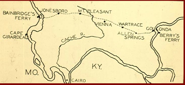
Southern_Illinois_Trail_of_Tears_map.jpg (757 × 349 pixels, file size: 69 KB, MIME type: image/jpeg)
File history
Click on a date/time to view the file as it appeared at that time.
| Date/Time | Thumbnail | Dimensions | User | Comment | |
|---|---|---|---|---|---|
| current | 04:32, 7 April 2015 |  | 757 × 349 (69 KB) | TehSharp | User created page with UploadWizard |
File usage
The following pages on the English Wikipedia use this file (pages on other projects are not listed):
Global file usage
The following other wikis use this file:
- Usage on zh.wikipedia.org


