

Size of this preview: 799 × 332 pixels. Other resolutions: 320 × 133 pixels | 640 × 266 pixels | 1,024 × 425 pixels | 1,280 × 532 pixels | 2,560 × 1,064 pixels | 5,037 × 2,093 pixels.
Original file (5,037 × 2,093 pixels, file size: 2.15 MB, MIME type: image/jpeg)
Summary
| Description |
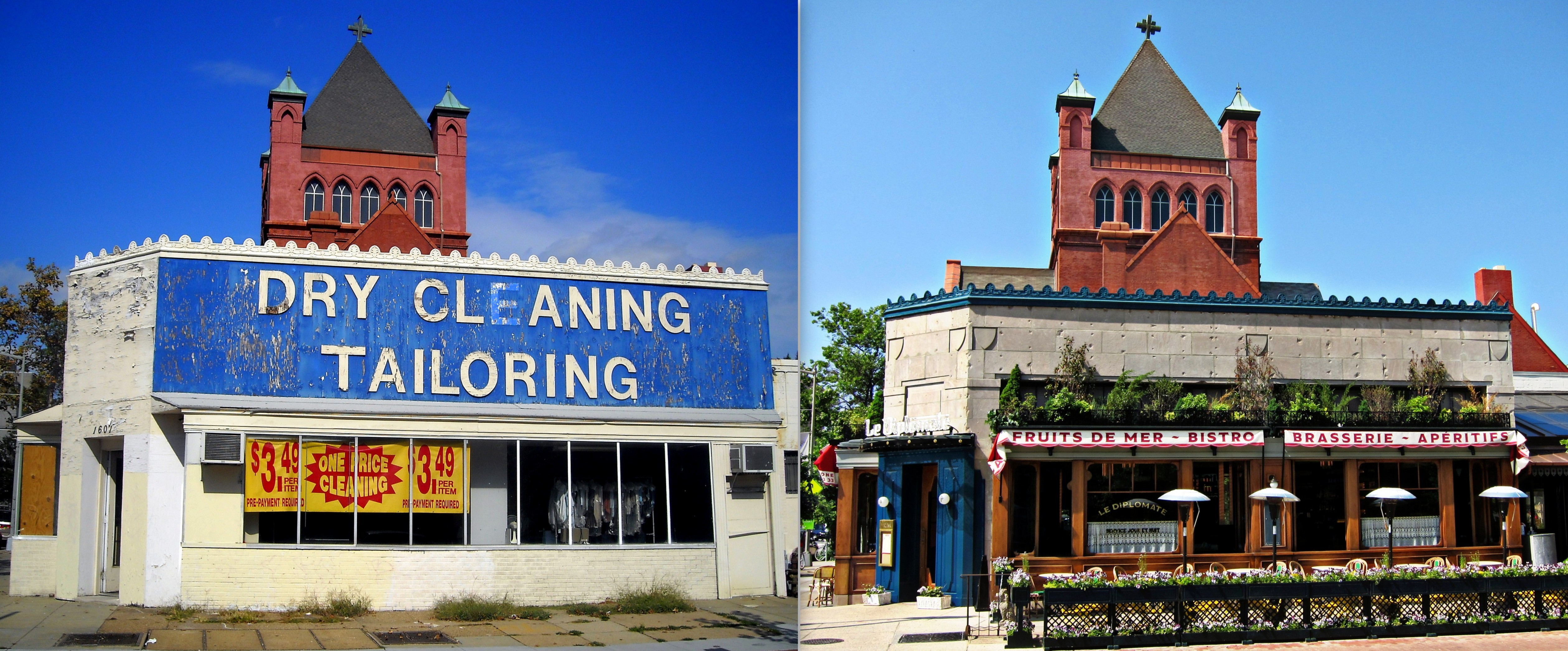
English: The photo on the left was taken in 2008. The photo on the right was taken in 2013. The commercial building located at 1601 14th Street NW in the Logan Circle neighborhood of Washington, D.C. Previous occupants include Q Street Cleaners, a longtime neighborhood business that closed in 2009. The property now serves as Le Diplomate, a French restaurant. The building is designated as a contributing property to the Greater Fourteenth Street Historic District, listed on the National Register of Historic Places in 1994. The John Wesley African Methodist Episcopal Zion Church tower is in the background. |
| Date | |
| Source | Own work |
| Author | AgnosticPreachersKid |
| Permission (Reusing this file) |
I, the copyright holder of this work, hereby publish it under the following license: This file is licensed under the Creative Commons Attribution-Share Alike 4.0 International license.
|
| Other versions |
|


| Camera location | | View this and other nearby images on: OpenStreetMap |
|---|
File history
Click on a date/time to view the file as it appeared at that time.
| Date/Time | Thumbnail | Dimensions | User | Comment | |
|---|---|---|---|---|---|
| current | 03:23, 22 October 2014 | | 5,037 × 2,093 (2.15 MB) | APK | User created page with UploadWizard |
File usage
The following pages on the English Wikipedia use this file (pages on other projects are not listed):
Global file usage
The following other wikis use this file:
- Usage on ar.wikipedia.org
- Usage on it.wikipedia.org