

Size of this preview: 800 × 600 pixels. Other resolutions: 320 × 240 pixels | 640 × 480 pixels | 1,024 × 768 pixels.
Original file (1,024 × 768 pixels, file size: 188 KB, MIME type: image/jpeg)
Summary
| Author |
Giovanni Boccardi |
||||
| Description |
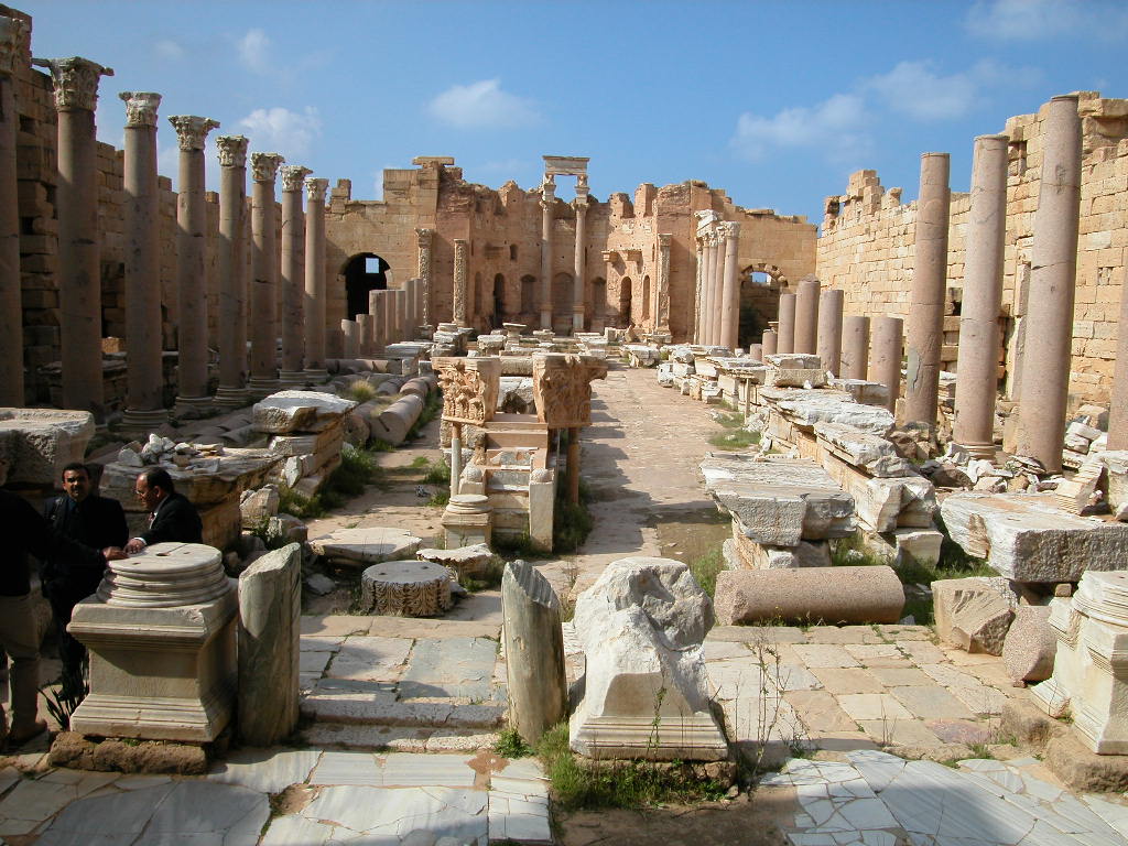
English: Archaeological Site of Leptis Magna (Libya) Français : Site archéologique de Leptis Magna (Libye) Español: Sitio arqueológico de Leptis Magna 日本語: レプティス・マグナの古代遺跡 中文:莱波蒂斯考古遗址 Nederlands: Archeologische stad Leptis Magna Русский: Археологические памятники Лептис-Магны العربية: موقع لبدة الأثري (لبتس ماغنا) (لبدة الكبرى ) Română: Situl arheologic de la Leptis Magna (Libia) |
||||
| Depicted place | Leptis Magna | ||||
| Date | 1 January 2003 | ||||
| Source |
|

|
This file was made available as part of the Connected Open Heritage project. The project is led by Wikimedia Sverige in cooperation with UNESCO, Wikimedia Italia and Cultural Heritage without Borders and is financed by a project grant from the Culture Foundation of the Swedish Postcode Lottery. |
32°38′18″N 14°17′35″E / 32.6383300000°N 14.2930600000°E
Licensing
This file is licensed under the Creative Commons Attribution-ShareAlike 3.0 IGO license.
- You are free:
- to share – to copy, distribute and transmit the work
- to remix – to adapt the work
- Under the following conditions:
- attribution – You must give appropriate credit, provide a link to the license, and indicate if changes were made. You may do so in any reasonable manner, but not in any way that suggests the licensor endorses you or your use.
- share alike – If you remix, transform, or build upon the material, you must distribute your contributions under the same or compatible license as the original.
| Camera location | | View this and other nearby images on: OpenStreetMap |
|---|
| Object location | | View this and other nearby images on: OpenStreetMap |
|---|
File history
Click on a date/time to view the file as it appeared at that time.
| Date/Time | Thumbnail | Dimensions | User | Comment | |
|---|---|---|---|---|---|
| current | 10:00, 19 April 2017 | | 1,024 × 768 (188 KB) | Eric00000007 |
File usage
The following pages on the English Wikipedia use this file (pages on other projects are not listed):
Global file usage
The following other wikis use this file:
- Usage on ar.wikipedia.org
- Usage on dag.wikipedia.org
- Usage on es.wikipedia.org
- Usage on id.wikipedia.org
- Usage on mt.wikipedia.org
- Usage on pt.wikinews.org
- Usage on ro.wikipedia.org
- Usage on sv.wikipedia.org
- Usage on ur.wikipedia.org
- Usage on www.wikidata.org