


Size of this preview: 800 × 330 pixels. Other resolutions: 320 × 132 pixels | 640 × 264 pixels | 1,024 × 422 pixels | 1,280 × 528 pixels | 2,485 × 1,025 pixels.
Original file (2,485 × 1,025 pixels, file size: 991 KB, MIME type: image/jpeg)
|
This is an image of a place or building that is listed on the National Register of Historic Places in the United States of America. Its reference number is 97000727. |
Summary
| Description |
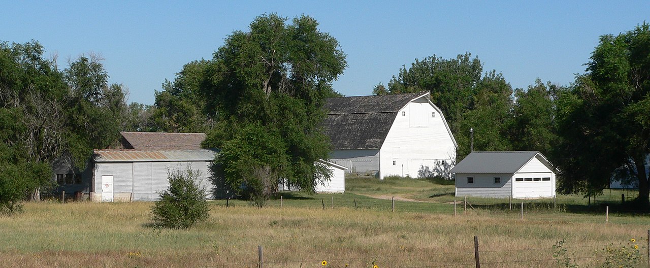
English: Brookside Farm, also known as Gridley-Howe-Faden-Atkins Farmstead, located on west side of Nebraska Highway 71 just south of Lodgepole Creek; seen from the southeast. The farm is listed in the National Register of Historic Places. |
| Date | |
| Source | Own work |
| Author | Ammodramus |
| Object location | | View this and other nearby images on: OpenStreetMap |
|---|
Licensing
| I, the copyright holder of this work, release this work into the public domain. This applies worldwide. In some countries this may not be legally possible; if so: I grant anyone the right to use this work for any purpose, without any conditions, unless such conditions are required by law. |
File history
Click on a date/time to view the file as it appeared at that time.
| Date/Time | Thumbnail | Dimensions | User | Comment | |
|---|---|---|---|---|---|
| current | 16:56, 31 August 2010 | 2,485 × 1,025 (991 KB) | Ammodramus | {{Information |Description={{en|1={{w|Brookside Farm}}, also known as {{w|Gridley-Howe-Faden-Atkins Farmstead}}, located on west side of {{w|Nebraska Highway 71}} just south of {{w|Lodgepole Creek}}; seen from the southeast.}} |Source={{own}} |Author=[[Us |
File usage
The following pages on the English Wikipedia use this file (pages on other projects are not listed):
Global file usage
The following other wikis use this file:
- Usage on de.wikipedia.org
- Usage on www.wikidata.org