

Size of this preview: 400 × 600 pixels. Other resolutions: 160 × 240 pixels | 320 × 480 pixels | 683 × 1,024 pixels.
Original file (683 × 1,024 pixels, file size: 648 KB, MIME type: image/jpeg)
Summary
| Description |
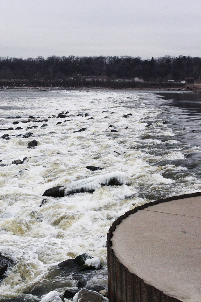
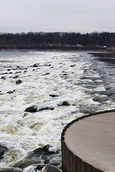
English: River Dam #27 on the Mississippi River, North Riverfront Park Lake, Missouri.
View of the 2925 foot low-water River Dam 27, the first permanent rock-fill dam across a major river in the United States. This dam was built in 1960 to ensure adequate depths over the lower sill of the old Alton Locks that was 12.5 river miles upstream. |
| Date | early 2006 |
| Source |
Own work (Original caption: " Robert Lawton (self), 2006. ")Transferred from en.wikipedia to Commons by User:Jay8g using CommonsHelper. |
| Author | Rklawton at en.wikipedia |
Licensing
Rklawton at the English-language Wikipedia, the copyright holder of this work, hereby publishes it under the following license:
| This file is licensed under the Creative Commons Attribution-Share Alike 3.0 Unported license. Subject to disclaimers. | ||
| Attribution: Rklawton at the English-language Wikipedia | ||
| ||
| This licensing tag was added to this file as part of the GFDL licensing update. |

|
Permission is granted to copy, distribute and/or modify this document under the terms of the GNU Free Documentation License, Version 1.2 or any later version published by the Free Software Foundation; with no Invariant Sections, no Front-Cover Texts, and no Back-Cover Texts. A copy of the license is included in the section entitled GNU Free Documentation License. Subject to disclaimers. |
Original upload log
The original description page was here. All following user names refer to en.wikipedia.
- 2006-02-25 02:54 Rklawton 683×1024× (664053 bytes) ''Geological River Break'', [[Mississippi River]], [[Chain of Rocks, Missouri|Chain of Rocks]], [[Missouri]]. [[User:Rklawton|Robert Lawton]] (self), 2006. The name comes from a "chain" of rocks crossing the Mississippi just below the [[Chain of Rocks B
File history
Click on a date/time to view the file as it appeared at that time.
| Date/Time | Thumbnail | Dimensions | User | Comment | |
|---|---|---|---|---|---|
| current | 23:50, 21 August 2011 | | 683 × 1,024 (648 KB) | File Upload Bot (Magnus Manske) | {{BotMoveToCommons|en.wikipedia|year={{subst:CURRENTYEAR}}|month={{subst:CURRENTMONTHNAME}}|day={{subst:CURRENTDAY}}}} {{Information |Description={{en|''River Dam #27'' on the en:Mississippi River, North Riverfront Park Lake, en:Missouri. [[ |
File usage
The following pages on the English Wikipedia use this file (pages on other projects are not listed):
Global file usage
The following other wikis use this file:
- Usage on cy.wikipedia.org
- Usage on de.wikipedia.org
- Usage on it.wikipedia.org
- Usage on pms.wikipedia.org