

No higher resolution available.
Estate_Whim,_Windmill,_Centerline_Road,_Westend_Quarter_(St._Croix_County,_Virgin_Islands).jpg (592 × 415 pixels, file size: 61 KB, MIME type: image/jpeg)
|
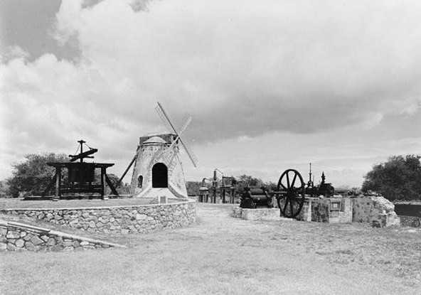
This is an image of a place or building that is listed on the National Register of Historic Places in the United States of America. Its reference number is 76001858. |
| Description |
English: Estate Whim, Windmill, Centerline Road, Westend Quarter (St. Croix County, Virgin Islands)
cropped
|
|||||||||
| Date | ||||||||||
| Source | http://memory.loc.gov/cgi-bin/displayPhoto.pl?path=/pnp/habshaer/vi/vi0100/vi0149/photos&topImages=166765pr.jpg&topLinks=166765pv.jpg,166765pu.tif&title=2.%20%20NORTH%20SIDE%20OF%20WINDMILL%20%20%20%20%20%20%3cbr%3eHABS%20VI,1-WEST,1-B-2&displayProfile=0 | |||||||||
| Author | Walter Smalling, Photographer |

.jpg¶ms=017.702639_N_-064.863056_E_globe:Earth_class:object_region:US_type:landmark_scale:1500_&language=en)
File history
Click on a date/time to view the file as it appeared at that time.
| Date/Time | Thumbnail | Dimensions | User | Comment | |
|---|---|---|---|---|---|
| current | 17:58, 5 August 2009 | | 592 × 415 (61 KB) | KudzuVine | {{Information |Description={{en|1=Estate Whim, Windmill, Centerline Road, Westend Quarter (St. Croix County, Virgin Islands) cropped {{PD-USGov-Interior-HABS VI,1-WEST,1-B-2}}}} |Source=http://memory.loc.gov/cgi-bin/displayPhoto.pl?path=/pnp/habshaer/vi/v |
File usage
The following pages on the English Wikipedia use this file (pages on other projects are not listed):
Global file usage
The following other wikis use this file:
- Usage on de.wikipedia.org
- Usage on www.wikidata.org
.jpg)