

Size of this preview: 800 × 431 pixels. Other resolutions: 320 × 172 pixels | 640 × 345 pixels | 1,024 × 551 pixels | 1,280 × 689 pixels | 2,560 × 1,378 pixels | 5,780 × 3,112 pixels.
Original file (5,780 × 3,112 pixels, file size: 3.7 MB, MIME type: image/jpeg)
Summary
| Description |
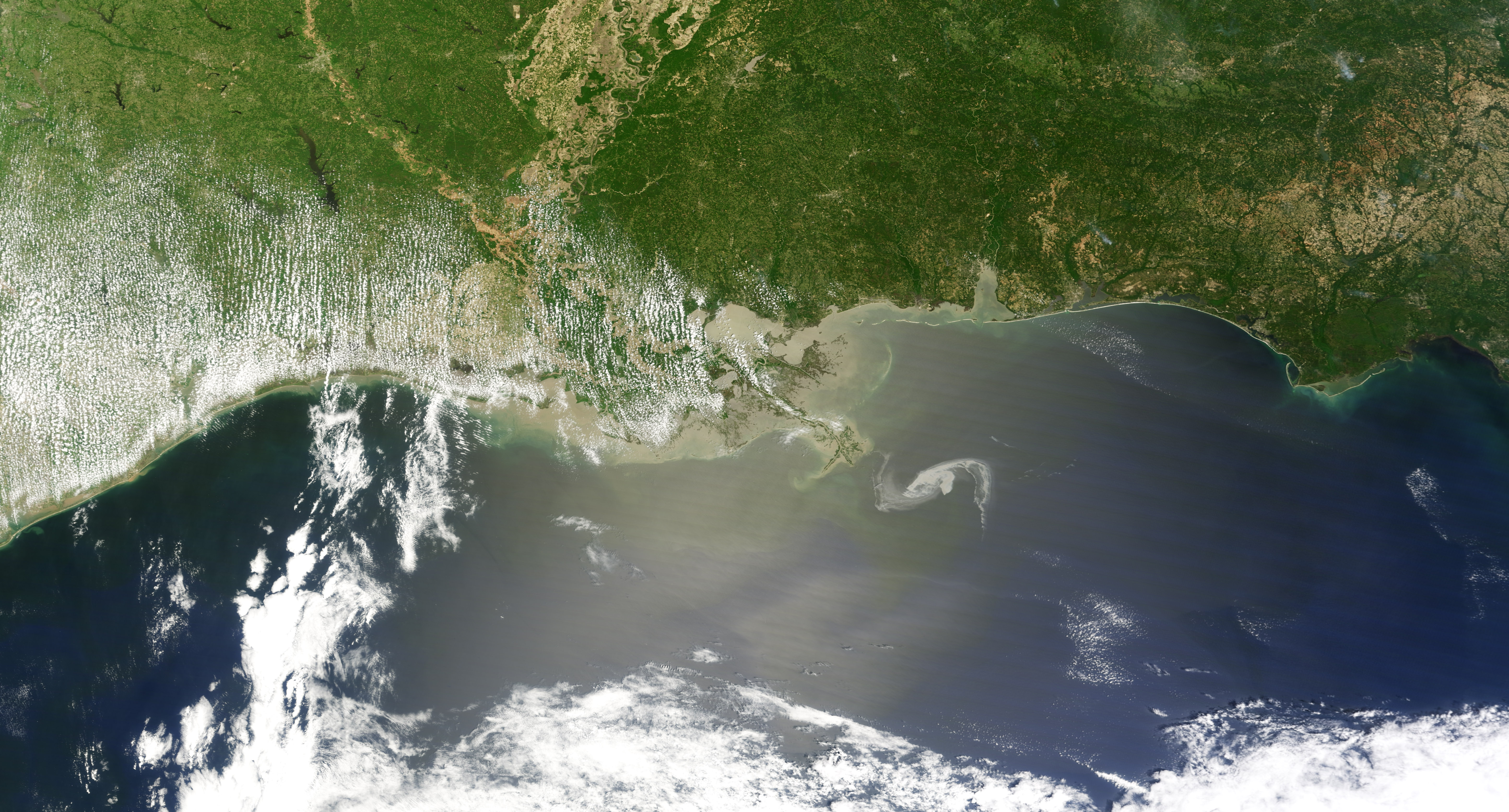
English: Natural-colour image of the oil slick just off the Louisiana coast. The oil slick appears as dull grey interlocking comma shapes, one opaque and the other nearly transparent. The north-western tip of the oil slick almost touches the Mississippi Delta. Sun-glint, the mirror-like reflection of the Sun off the water—enhances the oil slick’s visibility. |
| Date | |
| Source | NASA Earth Observatory |
| Author | Jesse Allen |
| Other versions |
|

.jpg)


Image captured by the Moderate Resolution Imaging Spectroradiometer (MODIS) on NASA’s Terra satellite.
Licensing
| This file is in the public domain in the United States because it was solely created by NASA. NASA copyright policy states that "NASA material is not protected by copyright unless noted". (See Template:PD-USGov, NASA copyright policy page or JPL Image Use Policy.) | ||
 |
Warnings:
|
| Annotations | This image is annotated: View the annotations at Commons |
File history
Click on a date/time to view the file as it appeared at that time.
| Date/Time | Thumbnail | Dimensions | User | Comment | |
|---|---|---|---|---|---|
| current | 13:46, 30 April 2010 | | 5,780 × 3,112 (3.7 MB) | Originalwana | {{Information |Description={{en|1=Natural-colour image of the oil slick just off the Louisiana coast. The oil slick appears as dull grey interlocking comma shapes, one opaque and the other nearly transparent. The north-western tip o |
File usage
The following pages on the English Wikipedia use this file (pages on other projects are not listed):
Global file usage
The following other wikis use this file:
- Usage on ar.wikipedia.org
- Usage on de.wikipedia.org
- Usage on fa.wikipedia.org
- Usage on gu.wikipedia.org
- Usage on it.wikipedia.org
- Usage on ja.wikipedia.org
- Usage on kn.wikipedia.org
- Usage on no.wikipedia.org
- Usage on ro.wikipedia.org
- Usage on ru.wikipedia.org