

Size of this preview: 800 × 600 pixels. Other resolutions: 320 × 240 pixels | 640 × 480 pixels | 1,024 × 768 pixels | 1,280 × 960 pixels | 1,600 × 1,200 pixels.
Original file (1,600 × 1,200 pixels, file size: 1.05 MB, MIME type: image/jpeg)
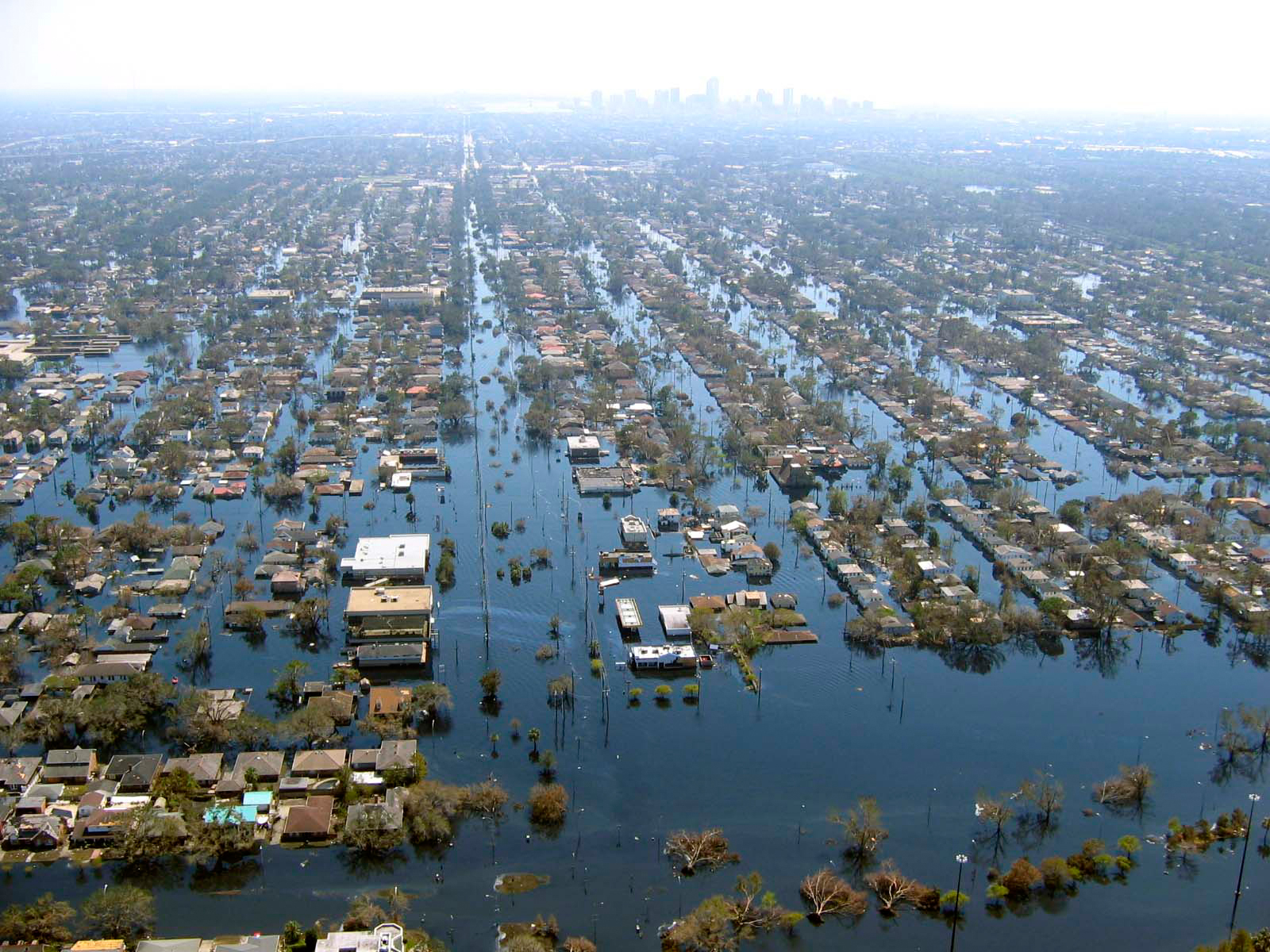
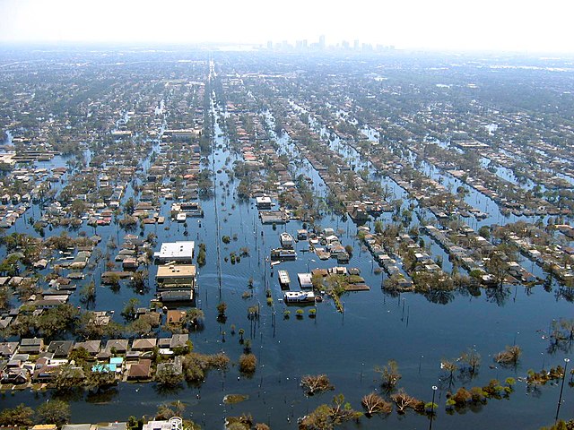
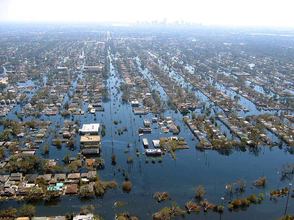
| Description | View of flooded New Orleans, Louisiana in the aftermath of Hurricane Katrina | |||
| Date | ||||
| Source | http://www.katrina.noaa.gov/helicopter/helicopter-2.html | |||
| Author | Commander Mark Moran, of the NOAA Aviation Weather Center, and Lt. Phil Eastman and Lt. Dave Demers, of the NOAA Aircraft Operations Center, all commissioned officers of the NOAA Corps, flew more than 100 hours surveying Katrina’s devastation. Eastman piloted NOAA’s Bell 212 Twin Huey Helicopter from August 31 to September 19. All three men took dozens of aerial photos from an altitude of several feet to 500 feet. | |||
| Permission (Reusing this file) |
|
File history
Click on a date/time to view the file as it appeared at that time.
| Date/Time | Thumbnail | Dimensions | User | Comment | |
|---|---|---|---|---|---|
| current | 22:10, 22 April 2008 | | 1,600 × 1,200 (1.05 MB) | Mfield | {{Information |Description=View of flooded New Orleans, Louisiana in the aftermath of Hurricane Katrina |Source=http://www.katrina.noaa.gov/helicopter/helicopter-2.html |Date=11 Sept 2005 |Author=Commander Mark Moran, of the NOAA Aviation Weather Center, |
| 22:07, 22 April 2008 |  | 1,600 × 1,200 (264 KB) | Mfield | {{Information |Description=View of flooded New Orleans, Louisiana in the aftermath of Hurricane Katrina |Source=http://www.katrina.noaa.gov/helicopter/helicopter-2.html |Date=11 Sept 2005 |Author=Commander Mark Moran, of the NOAA Aviation Weather Center, |
File usage
The following pages on the English Wikipedia use this file (pages on other projects are not listed):
Global file usage
The following other wikis use this file:
- Usage on bn.wikipedia.org
- Usage on de.wikipedia.org
- Usage on dty.wikipedia.org
- Usage on et.wikipedia.org
- Usage on eu.wikipedia.org
- Usage on fa.wikipedia.org
- Usage on fr.wikipedia.org
- Usage on hy.wikipedia.org
- Usage on id.wikipedia.org
- Usage on ig.wikipedia.org
- Usage on pl.wikipedia.org
- Usage on pt.wikipedia.org
- Usage on ru.wikipedia.org
- Usage on sk.wikipedia.org
- Usage on sv.wikipedia.org
- Usage on sw.wikipedia.org
- Usage on tr.wikipedia.org
- Usage on uk.wikipedia.org
- Usage on ur.wikipedia.org
- Usage on zh.wikipedia.org