


Size of this PNG preview of this SVG file: 800 × 538 pixels. Other resolutions: 320 × 215 pixels | 640 × 431 pixels | 1,024 × 689 pixels | 1,280 × 862 pixels | 2,560 × 1,723 pixels | 6,063 × 4,081 pixels.
Original file (SVG file, nominally 6,063 × 4,081 pixels, file size: 12 KB)
Summary
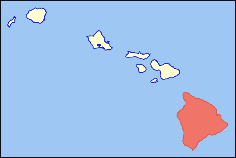
| Description | Colored locator map for the island of Hawaii |
| Date | |
| Source | Based on the SVG file that was released to the public domain by David Benbennick at Wikipedia: Image:Map_of_Hawaii_highlighting_Kalawao_County.svg |
| Author | MattWright |
Licensing
| This work has been released into the public domain by its author, I, MattWright. This applies worldwide. In some countries this may not be legally possible; if so: I, MattWright grants anyone the right to use this work for any purpose, without any conditions, unless such conditions are required by law. |
File history
Click on a date/time to view the file as it appeared at that time.
| Date/Time | Thumbnail | Dimensions | User | Comment | |
|---|---|---|---|---|---|
| current | 08:33, 30 July 2007 | | 6,063 × 4,081 (12 KB) | MattWright | == Summary == {{Information |Description=Colored locator map for the island of Kauai |Source=Based on the SVG file that was released to the public domain by [http://commons.wikimedia.org/wiki/User:Dbenbenn David Benbennick] at [http://en.wikipedia.org/wik |
File usage
The following pages on the English Wikipedia use this file (pages on other projects are not listed):
Global file usage
The following other wikis use this file:
- Usage on af.wikipedia.org
- Usage on als.wikipedia.org
- Usage on ar.wikipedia.org
- Usage on az.wiktionary.org
- Usage on bg.wikipedia.org
- Usage on br.wikipedia.org
- Usage on ca.wikipedia.org
- Usage on de.wikipedia.org
- Usage on de.wikivoyage.org
- Usage on el.wikipedia.org
- Usage on eo.wikipedia.org
- Usage on es.wikipedia.org
- Usage on fr.wiktionary.org
- Usage on fy.wikipedia.org
- Usage on ga.wikipedia.org
- Usage on haw.wikipedia.org
- Usage on hi.wikipedia.org
- Usage on hu.wikipedia.org
- Usage on ia.wikipedia.org
- Usage on id.wikipedia.org
- Usage on is.wikipedia.org
- Usage on it.wikivoyage.org
- Usage on ja.wikipedia.org
- Usage on lt.wikipedia.org
- Usage on ms.wikipedia.org
- Usage on pt.wikipedia.org
- Usage on ro.wikipedia.org
- Usage on sk.wikipedia.org
- Usage on sv.wikipedia.org
- Usage on tg.wikipedia.org
- Usage on th.wikipedia.org
- Usage on ur.wikipedia.org
- Usage on vi.wikipedia.org
- Usage on www.wikidata.org
- Usage on xmf.wikipedia.org
- Usage on zh.wikipedia.org
.svg)