

Size of this preview: 800 × 534 pixels. Other resolutions: 320 × 214 pixels | 640 × 427 pixels | 1,024 × 683 pixels | 1,500 × 1,001 pixels.
Original file (1,500 × 1,001 pixels, file size: 342 KB, MIME type: image/jpeg)
|
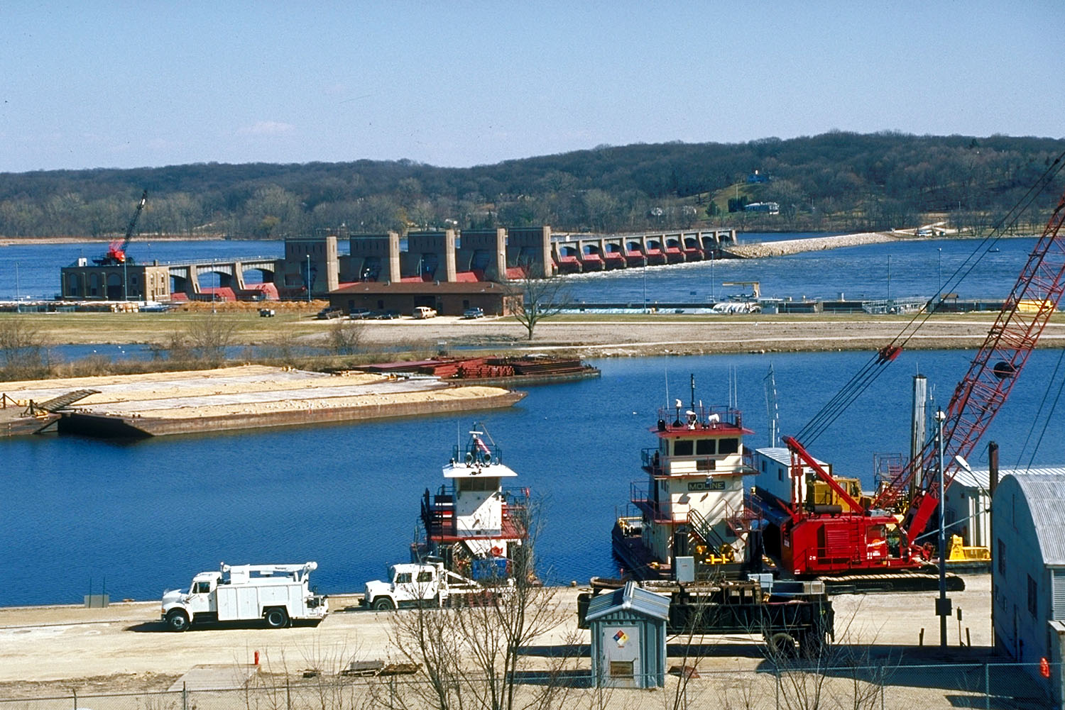
This is an image of a place or building that is listed on the National Register of Historic Places in the United States of America. Its reference number is 4000174. |
| Description | Aerial view of Lock and Dam 14 located on the Mississippi River, Le Claire, Iowa. | |||
| Date | ||||
| Source |
US Army Corps of Engineers Digital Visual Library (DVL) |
|||
| Author | US Army Corps of Engineers, photographer unknown | |||
| Permission (Reusing this file) |
|
| Camera location | | View this and other nearby images on: OpenStreetMap |
|---|
File history
Click on a date/time to view the file as it appeared at that time.
| Date/Time | Thumbnail | Dimensions | User | Comment | |
|---|---|---|---|---|---|
| current | 17:21, 16 February 2007 | | 1,500 × 1,001 (342 KB) | Dual Freq | {{Information | Description = Aerial view of Lock and Dam 14 located on the Mississippi River, Le Claire, Iowa. | Source = [http://images.usace.army.mil/main.html US Army Corps of Engineers Digital Visual Library (DVL)]<br /> [http://images.usace.ar |
File usage
The following pages on the English Wikipedia use this file (pages on other projects are not listed):
Global file usage
The following other wikis use this file:
- Usage on arz.wikipedia.org
- Usage on de.wikipedia.org
- Usage on pt.wikipedia.org
- Usage on www.wikidata.org