

No higher resolution available.
NASACandlewoodLakeConnecticut.jpg (432 × 432 pixels, file size: 68 KB, MIME type: image/jpeg)
Summary
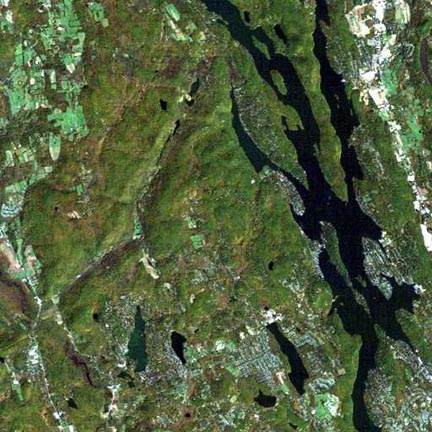
NASA satellite photograph of w:Candlewood Lake in Connecticut, USA
"Candlewood Lake, CT, in Fall "Landsat, Path: 013, Row: 031, Date: 10/09/87 "Center Latitude: 0413000S, Center Longitude: 0733000S"
Source: NASA
(image) [1]
![[1]](https://web.archive.org/web/20021223043003/http://observe.arc.nasa.gov/nasa/gallery/world/new_world/graphics/cw-lakef.jpg)
Licensing
| This file is in the public domain in the United States because it was solely created by NASA. NASA copyright policy states that "NASA material is not protected by copyright unless noted". (See Template:PD-USGov, NASA copyright policy page or JPL Image Use Policy.) | ||
 |
Warnings:
|
File history
Click on a date/time to view the file as it appeared at that time.
| Date/Time | Thumbnail | Dimensions | User | Comment | |
|---|---|---|---|---|---|
| current | 23:58, 28 March 2007 | | 432 × 432 (68 KB) | Noroton | NASA satellite photograph of Candlewood Lake in Connecticut, USA "Candlewood Lake, CT, in Fall "Landsat, Path: 013, Row: 031, Date: 10/09/87 "Center Latitude: 0413000S, Center Longitude: 0733000S" Source: NASA (image) http://observe.arc.nasa.gov/ |
File usage
The following pages on the English Wikipedia use this file (pages on other projects are not listed):