

Size of this preview: 393 × 600 pixels. Other resolutions: 157 × 240 pixels | 314 × 480 pixels | 503 × 768 pixels | 1,164 × 1,776 pixels.
Original file (1,164 × 1,776 pixels, file size: 1.39 MB, MIME type: image/jpeg)
|
This is an image of a place or building that is listed on the National Register of Historic Places in the United States of America. Its reference number is 88000640. |
Summary
| Description |
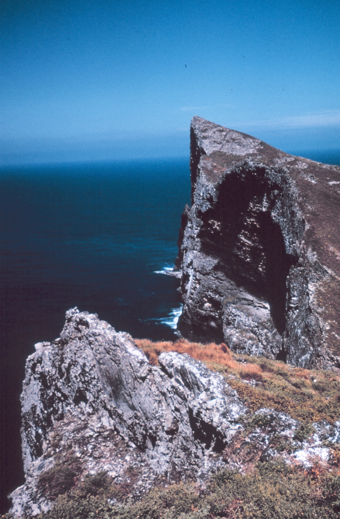
Deutsch: Das steil abfallende Kliff des Tanager-Peaks auf Nihoa, Nordwestliche Hawaii-Inseln. Ansicht vom Millers-Peak in Blickrichtung Ost
English: The cliffs of Tanager Peak, Nihoa, Northwestern Hawaiian Islands. View from Miller's Peak looking east |
| Date | |
| Source | http://www.photolib.noaa.gov/htmls/mvey0214.htm |
| Author | Dr. James P. McVey, NOAA Sea Grant Program |
| Permission (Reusing this file) |
see NOAA's About the Images |
| Object location | | View this and other nearby images on: OpenStreetMap |
|---|
Licensing
This image is in the public domain because it contains materials that originally came from the U.S. National Oceanic and Atmospheric Administration, taken or made as part of an employee's official duties.
|
Original upload log
Original Uploader was SeanMD80 (talk) at 20 May 2006.
- 16:15, 20 May 2006 . . SeanMD80 (Talk | contribs) . . 319×386 (84,895 bytes) (http://www.janeresture.com/nihoa/ Source does not state author. {{PD-USGov-Interior-FWS}})
File history
Click on a date/time to view the file as it appeared at that time.
| Date/Time | Thumbnail | Dimensions | User | Comment | |
|---|---|---|---|---|---|
| current | 11:10, 31 May 2007 | | 1,164 × 1,776 (1.39 MB) | Telim tor | == Information == {{Information |Description= {{de|Die steil abfallende Klippe des Tanager-Peaks auf Nihoa, Nordwestliche Hawaii-Inseln. Ansicht vom Millers-Peak in Blickrichtung Ost}} {{en|The cliffs of Tanager Peak, Nihoa, Northwestern Hawaiian Islands. |
File usage
The following pages on the English Wikipedia use this file (pages on other projects are not listed):
Global file usage
The following other wikis use this file: