

Size of this preview: 761 × 599 pixels. Other resolutions: 305 × 240 pixels | 610 × 480 pixels | 975 × 768 pixels | 1,280 × 1,008 pixels | 2,560 × 2,016 pixels | 4,747 × 3,739 pixels.
Original file (4,747 × 3,739 pixels, file size: 1.82 MB, MIME type: image/jpeg)
|
This is an image of a place or building that is listed on the National Register of Historic Places in the United States of America. Its reference number is 97001451. |
| Description |
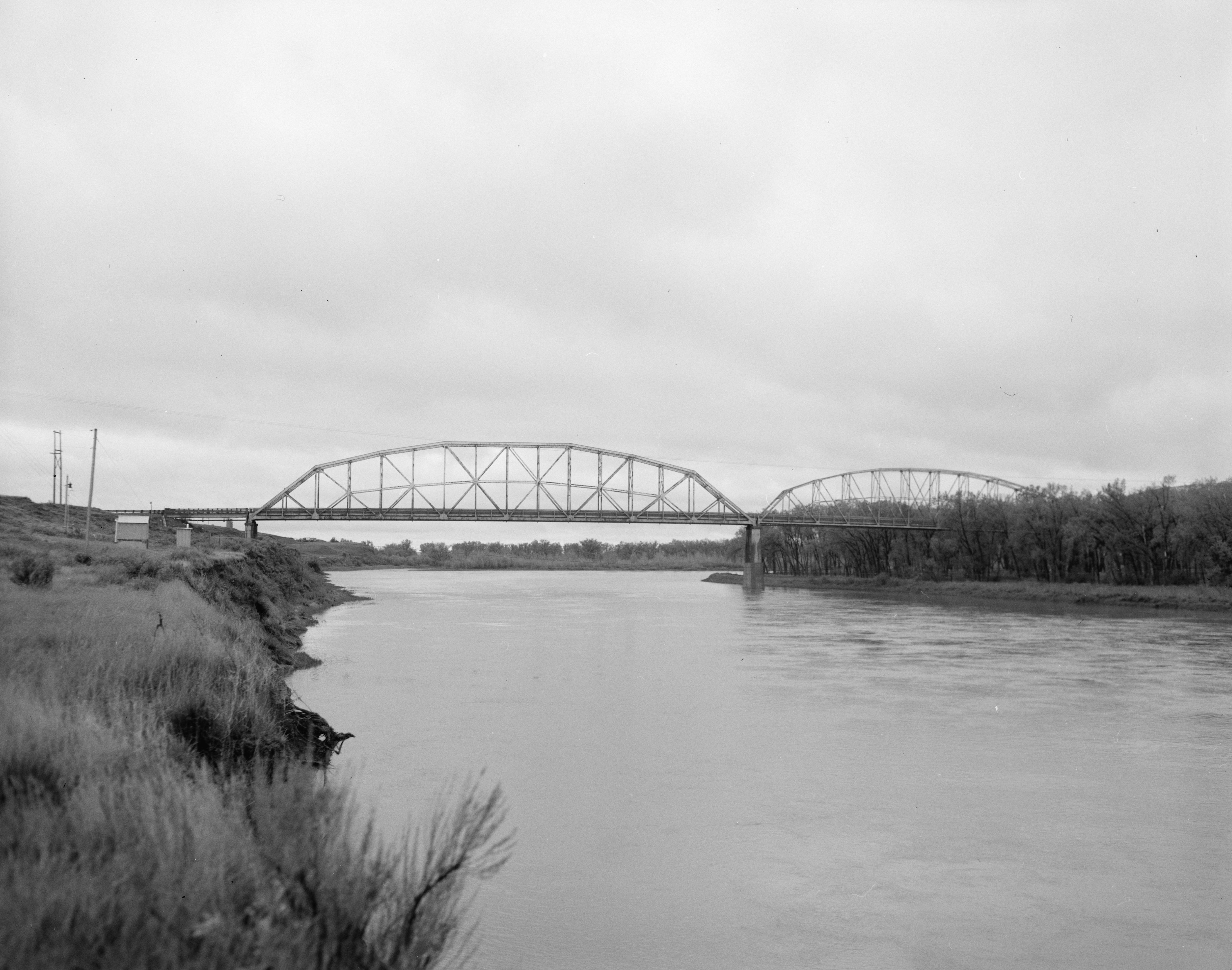
English: View from upstream of the Lewis and Clark Bridge (also called the Wolf Point Bridge) near Wolf Point, Montana, United States. The Pennsylvania through truss bridge carries Montana Highway 13 over the Missouri River between McCone and Roosevelt counties. Built in 1930, the bridge is listed on the National Register of Historic Places. |
||||
| Date | |||||
| Source | Library of Congress, Prints and Photograph Division HAER: MT-96-1 | ||||
| Author | John N. DeHaas, Jr. | ||||
| Permission (Reusing this file) |
|
| Camera location | | View this and other nearby images on: OpenStreetMap |
|---|

|
This image is available from the United States Library of Congress's Prints and Photographs division
under the digital ID hhh.mt0318. This tag does not indicate the copyright status of the attached work. A normal copyright tag is still required. See Commons:Licensing.
|
File history
Click on a date/time to view the file as it appeared at that time.
| Date/Time | Thumbnail | Dimensions | User | Comment | |
|---|---|---|---|---|---|
| current | 01:59, 10 April 2009 | | 4,747 × 3,739 (1.82 MB) | Martin H. | High res; cropped |
| 01:20, 10 April 2009 |  | 1,024 × 816 (83 KB) | Nyttend | {{Location|48|4|2|N|105|32|6|W}} {{Information |Description={{en|View from upstream of the {{w|Lewis and Clark Bridge (Wolf Point, Montana)|Lewis and Clark Bridge}} (also called the Wolf Point Bridge) near {{w|Wolf Point, Montana|Wolf Point}}, {{w|Montana |
File usage
The following pages on the English Wikipedia use this file (pages on other projects are not listed):
Global file usage
The following other wikis use this file:
- Usage on de.wikipedia.org
- Usage on es.wikipedia.org
- Usage on www.wikidata.org