

Ingalls is a city in Gray County, Kansas, United States.[1] As of the 2020 census, the population of the city was 252.[3] It is located along Highway 50.
History
The first post office was established in May 1887 with the name Soule until May 1888.[4] The community was renamed for Kansas senator John James Ingalls.[5]
Ingalls was a candidate for county seat in the late 1880s, and once held the county offices.[6]
Geography
According to the United States Census Bureau, the city has a total area of 0.26 square miles (0.67 km2), all of it land.[7]
Demographics
| Census | Pop. | Note | %± |
|---|---|---|---|
| 1930 | 273 | — | |
| 1940 | 187 | −31.5% | |
| 1950 | 173 | −7.5% | |
| 1960 | 174 | 0.6% | |
| 1970 | 235 | 35.1% | |
| 1980 | 274 | 16.6% | |
| 1990 | 301 | 9.9% | |
| 2000 | 328 | 9.0% | |
| 2010 | 306 | −6.7% | |
| 2020 | 252 | −17.6% | |
| U.S. Decennial Census | |||
2020 census
The 2020 United States census counted 252 people, 97 households, and 71 families in Ingalls.[8][9] The population density was 969.2 per square mile (374.2/km2). There were 111 housing units at an average density of 426.9 per square mile (164.8/km2).[9][10] The racial makeup was 78.17% (197) white or European American (64.68% non-Hispanic white), 1.59% (4) black or African-American, 0.4% (1) Native American or Alaska Native, 0.79% (2) Asian, 0.0% (0) Pacific Islander or Native Hawaiian, 10.71% (27) from other races, and 8.33% (21) from two or more races.[11] Hispanic or Latino of any race was 30.16% (76) of the population.[12]
Of the 97 households, 44.3% had children under the age of 18; 61.9% were married couples living together; 18.6% had a female householder with no spouse or partner present. 23.7% of households consisted of individuals and 9.3% had someone living alone who was 65 years of age or older.[9] The average household size was 3.1 and the average family size was 3.9.[13] The percent of those with a bachelor’s degree or higher was estimated to be 9.1% of the population.[14]
32.1% of the population was under the age of 18, 6.3% from 18 to 24, 24.6% from 25 to 44, 27.4% from 45 to 64, and 9.5% who were 65 years of age or older. The median age was 32.6 years. For every 100 females, there were 92.4 males.[9] For every 100 females ages 18 and older, there were 101.2 males.[9]
The 2016-2020 5-year American Community Survey estimates show that the median household income was $62,188 (with a margin of error of +/- $6,664) and the median family income was $66,563 (+/- $21,273).[15] Males had a median income of $39,583 (+/- $17,874) versus $25,833 (+/- $18,323) for females. The median income for those above 16 years old was $31,450 (+/- $5,652).[16] Approximately, 0.0% of families and 0.0% of the population were below the poverty line, including 0.0% of those under the age of 18 and 0.0% of those ages 65 or over.[17][18]
2010 census
As of the census[19] of 2010, there were 306 people, 113 households, and 87 families residing in the city. The population density was 1,176.9 inhabitants per square mile (454.4/km2). There were 121 housing units at an average density of 465.4 per square mile (179.7/km2). The racial makeup of the city was 87.3% White, 0.3% African American, 0.3% Asian, 11.4% from other races, and 0.7% from two or more races. Hispanic or Latino of any race were 22.5% of the population.
There were 113 households, of which 41.6% had children under the age of 18 living with them, 62.8% were married couples living together, 7.1% had a female householder with no husband present, 7.1% had a male householder with no wife present, and 23.0% were non-families. 19.5% of all households were made up of individuals, and 5.3% had someone living alone who was 65 years of age or older. The average household size was 2.71 and the average family size was 3.10.
The median age in the city was 32.3 years. 27.1% of residents were under the age of 18; 12.2% were between the ages of 18 and 24; 29% were from 25 to 44; 22.6% were from 45 to 64; and 9.2% were 65 years of age or older. The gender makeup of the city was 50.3% male and 49.7% female.
2000 census
As of the census[20] of 2000, there were 328 people, 111 households, and 83 families residing in the city. The population density was 1,297.4 inhabitants per square mile (500.9/km2). There were 116 housing units at an average density of 458.8 per square mile (177.1/km2). The racial makeup of the city was 87.50% White, 0.30% Native American, 10.37% from other races, and 1.83% from two or more races. Hispanic or Latino of any race were 15.55% of the population.
There were 111 households, out of which 47.7% had children under the age of 18 living with them, 69.4% were married couples living together, 3.6% had a female householder with no husband present, and 25.2% were non-families. 22.5% of all households were made up of individuals, and 6.3% had someone living alone who was 65 years of age or older. The average household size was 2.95 and the average family size was 3.52.
In the city, the population was spread out, with 35.1% under the age of 18, 6.7% from 18 to 24, 33.5% from 25 to 44, 15.9% from 45 to 64, and 8.8% who were 65 years of age or older. The median age was 31 years. For every 100 females, there were 111.6 males. For every 100 females age 18 and over, there were 106.8 males.
The median income for a household in the city was $35,357, and the median income for a family was $38,036. Males had a median income of $36,563 versus $26,875 for females. The per capita income for the city was $14,898. About 14.6% of families and 15.5% of the population were below the poverty line, including 19.8% of those under age 18 and 27.8% of those age 65 or over.
Education
The community is served by Ingalls USD 477 public school district. The Ingalls High School mascot is Bulldogs.[21]
References
- ^ a b c d U.S. Geological Survey Geographic Names Information System: Ingalls, Kansas
- ^ "2019 U.S. Gazetteer Files". United States Census Bureau. Retrieved July 24, 2020.
- ^ a b "Profile of Ingalls, Kansas in 2020". United States Census Bureau. Archived from the original on November 27, 2021. Retrieved November 26, 2021.
- ^ "Kansas Post Offices, 1828-1961 (archived)". Kansas Historical Society. Archived from the original on October 9, 2013. Retrieved June 10, 2014.
- ^ "Profile for Ingalls, Kansas". ePodunk. Archived from the original on July 14, 2014. Retrieved June 10, 2014.
- ^ Blackmar, Frank Wilson (1912). Kansas: A Cyclopedia of State History, Embracing Events, Institutions, Industries, Counties, Cities, Towns, Prominent Persons, Etc. Standard Publishing Company. pp. 937.
- ^ "US Gazetteer files 2010". United States Census Bureau. Archived from the original on January 25, 2012. Retrieved July 6, 2012.
- ^ "US Census Bureau, Table P16: HOUSEHOLD TYPE". data.census.gov. Retrieved January 3, 2024.
- ^ a b c d e "US Census Bureau, Table DP1: PROFILE OF GENERAL POPULATION AND HOUSING CHARACTERISTICS". data.census.gov. Retrieved January 3, 2024.
- ^ Bureau, US Census. "Gazetteer Files". Census.gov. Retrieved December 30, 2023.
- ^ "US Census Bureau, Table P1: RACE". data.census.gov. Retrieved January 3, 2024.
- ^ "US Census Bureau, Table P2: HISPANIC OR LATINO, AND NOT HISPANIC OR LATINO BY RACE". data.census.gov. Retrieved January 3, 2024.
- ^ "US Census Bureau, Table S1101: HOUSEHOLDS AND FAMILIES". data.census.gov. Retrieved January 3, 2024.
- ^ "US Census Bureau, Table S1501: EDUCATIONAL ATTAINMENT". data.census.gov. Retrieved January 3, 2024.
- ^ "US Census Bureau, Table S1903: MEDIAN INCOME IN THE PAST 12 MONTHS (IN 2020 INFLATION-ADJUSTED DOLLARS)". data.census.gov. Retrieved January 3, 2024.
- ^ "US Census Bureau, Table S2001: EARNINGS IN THE PAST 12 MONTHS (IN 2020 INFLATION-ADJUSTED DOLLARS)". data.census.gov. Retrieved January 3, 2024.
- ^ "US Census Bureau, Table S1701: POVERTY STATUS IN THE PAST 12 MONTHS". data.census.gov. Retrieved January 3, 2024.
- ^ "US Census Bureau, Table S1702: POVERTY STATUS IN THE PAST 12 MONTHS OF FAMILIES". data.census.gov. Retrieved January 3, 2024.
- ^ "U.S. Census website". United States Census Bureau. Retrieved July 6, 2012.
- ^ "U.S. Census website". United States Census Bureau. Retrieved January 31, 2008.
- ^ "Ingalls USD 477". USD 477. Retrieved January 7, 2017.
Further reading
External links
- Ingalls - Directory of Public Officials
- USD 477, local school district
- Ingalls City Map, KDOT
Municipalities and communities of Gray County, Kansas, United States | ||
|---|---|---|
| Cities | 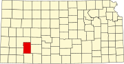 | |
| Unincorporated communities | ||
| Townships | ||
| International | |
|---|---|
| National | |