

McClusky is a city in Sheridan County, North Dakota, United States. It is the county seat of Sheridan County.[5] The population was 322 at the 2020 census.[3] McClusky was founded in 1905. It is the closest town to the geographical center of North Dakota, which lies approximately five miles to the southwest.[6]
History
McClusky was laid out in 1905 when the railroad was extended to that point.[7] The city was named for William Henderson McClusky, an early settler.[7] A post office called McClusky has been in operation since 1903.[8] The Sheridan County Courthouse was built in 1938.
Transportation
The Red River Valley and Western Railroad ran to McClusky and further west until the early 1990s, with formal abandonment of the rail line occurring in 2000. North Dakota Highway 200 which runs through downtown is popular with cross-country cyclists. There is also an airport for small planes, the McClusky Municipal Airport.
Geography
According to the United States Census Bureau, the city has a total area of 0.39 square miles (1.01 km2), all land.[9]
McClusky is considered the "heart" of North Dakota as it is the geographical center of North Dakota.
Demographics
| Census | Pop. | Note | %± |
|---|---|---|---|
| 1910 | 517 | — | |
| 1920 | 646 | 25.0% | |
| 1930 | 719 | 11.3% | |
| 1940 | 924 | 28.5% | |
| 1950 | 850 | −8.0% | |
| 1960 | 751 | −11.6% | |
| 1970 | 664 | −11.6% | |
| 1980 | 658 | −0.9% | |
| 1990 | 492 | −25.2% | |
| 2000 | 415 | −15.7% | |
| 2010 | 380 | −8.4% | |
| 2020 | 322 | −15.3% | |
| 2022 (est.) | 326 | [4] | 1.2% |
| U.S. Decennial Census[10] 2020 Census[3] | |||
2010 census
As of the census of 2010, there were 380 people, 206 households, and 103 families residing in the city. The population density was 974.4 inhabitants per square mile (376.2/km2). There were 278 housing units at an average density of 712.8 per square mile (275.2/km2). The racial makeup of the city was 91.8% White, 0.5% African American, 2.9% Native American, 0.5% Pacific Islander, 1.3% from other races, and 2.9% from two or more races. Hispanic or Latino of any race were 2.1% of the population.
There were 206 households, of which 13.6% had children under the age of 18 living with them, 39.8% were married couples living together, 7.8% had a female householder with no husband present, 2.4% had a male householder with no wife present, and 50.0% were non-families. 47.6% of all households were made up of individuals, and 27.7% had someone living alone who was 65 years of age or older. The average household size was 1.84 and the average family size was 2.58.
The median age in the city was 54 years. 17.1% of residents were under the age of 18; 6% were between the ages of 18 and 24; 16.8% were from 25 to 44; 23% were from 45 to 64; and 37.1% were 65 years of age or older. The gender makeup of the city was 44.5% male and 55.5% female.
2000 census
As of the census of 2000, there were 500 people, 205 households, and 110 families residing in the city. The population density was 1,072.9 inhabitants per square mile (414.2/km2). There were 247 housing units at an average density of 638.6 per square mile (246.6/km2). The racial makeup of the city was 99.28% White and 0.72% Native American. Hispanic or Latino of any race were 0.48% of the population.
There were 205 households, out of which 18.0% had children under the age of 18 living with them, 47.8% were married couples living together, 5.4% had a female householder with no husband present, and 45.9% were non-families. 43.4% of all households were made up of individuals, and 27.3% had someone living alone who was 65 years of age or older. The average household size was 1.93 and the average family size was 2.64.
In the city, the population was spread out, with 16.9% under the age of 18, 4.1% from 18 to 24, 17.8% from 25 to 44, 24.6% from 45 to 64, and 36.6% who were 65 years of age or older. The median age was 56 years. For every 100 females, there were 82.8 males. For every 100 females age 18 and over, there were 82.5 males.
The median income for a household in the city was $21,731, and the median income for a family was $32,344. Males had a median income of $26,094 versus $15,625 for females. The per capita income for the city was $14,874. About 12.4% of families and 21.5% of the population were below the poverty line, including 33.3% of those under age 18 and 22.9% of those age 65 or over.
Education
McClusky School District is the local school district.
Notable person
- John E. Davis, mayor of McClusky, 25th Governor of North Dakota
Climate
This climatic region is typified by large seasonal temperature differences, with warm to hot (and often humid) summers and cold (sometimes severely cold) winters. According to the Köppen Climate Classification system, McClusky has a humid continental climate, abbreviated "Dfb" on climate maps.[11]
| Climate data for McClusky, North Dakota (1991–2020 normals, extremes 1922–present) | |||||||||||||
|---|---|---|---|---|---|---|---|---|---|---|---|---|---|
| Month | Jan | Feb | Mar | Apr | May | Jun | Jul | Aug | Sep | Oct | Nov | Dec | Year |
| Record high °F (°C) | 59 (15) |
65 (18) |
81 (27) |
95 (35) |
105 (41) |
105 (41) |
115 (46) |
105 (41) |
106 (41) |
93 (34) |
76 (24) |
62 (17) |
115 (46) |
| Mean daily maximum °F (°C) | 23.0 (−5.0) |
27.3 (−2.6) |
40.4 (4.7) |
57.0 (13.9) |
70.6 (21.4) |
79.4 (26.3) |
85.3 (29.6) |
85.2 (29.6) |
75.3 (24.1) |
58.3 (14.6) |
40.4 (4.7) |
27.2 (−2.7) |
55.8 (13.2) |
| Daily mean °F (°C) | 13.0 (−10.6) |
16.8 (−8.4) |
29.2 (−1.6) |
44.3 (6.8) |
57.3 (14.1) |
66.9 (19.4) |
72.3 (22.4) |
71.2 (21.8) |
61.6 (16.4) |
46.3 (7.9) |
30.4 (−0.9) |
17.8 (−7.9) |
43.9 (6.6) |
| Mean daily minimum °F (°C) | 3.0 (−16.1) |
6.3 (−14.3) |
18.0 (−7.8) |
31.7 (−0.2) |
44.0 (6.7) |
54.4 (12.4) |
59.4 (15.2) |
57.1 (13.9) |
47.8 (8.8) |
34.4 (1.3) |
20.4 (−6.4) |
8.5 (−13.1) |
32.1 (0.1) |
| Record low °F (°C) | −38 (−39) |
−53 (−47) |
−33 (−36) |
−10 (−23) |
9 (−13) |
26 (−3) |
30 (−1) |
26 (−3) |
7 (−14) |
−6 (−21) |
−23 (−31) |
−36 (−38) |
−53 (−47) |
| Average precipitation inches (mm) | 0.49 (12) |
0.45 (11) |
0.67 (17) |
1.23 (31) |
2.48 (63) |
3.36 (85) |
2.53 (64) |
2.30 (58) |
1.91 (49) |
1.39 (35) |
0.69 (18) |
0.67 (17) |
18.17 (462) |
| Average snowfall inches (cm) | 7.8 (20) |
5.6 (14) |
5.9 (15) |
4.4 (11) |
0.4 (1.0) |
0.0 (0.0) |
0.0 (0.0) |
0.0 (0.0) |
0.0 (0.0) |
2.8 (7.1) |
8.8 (22) |
9.3 (24) |
45.0 (114) |
| Average precipitation days (≥ 0.01 in) | 5.2 | 4.7 | 4.9 | 5.5 | 9.2 | 10.3 | 8.6 | 6.8 | 6.6 | 6.5 | 5.5 | 5.6 | 79.4 |
| Average snowy days (≥ 0.1 in) | 4.8 | 3.7 | 2.5 | 1.1 | 0.2 | 0.0 | 0.0 | 0.0 | 0.0 | 1.1 | 3.7 | 4.7 | 21.8 |
| Source: NOAA[12][13] | |||||||||||||
References
- ^ "ArcGIS REST Services Directory". United States Census Bureau. Retrieved September 20, 2022.
- ^ a b U.S. Geological Survey Geographic Names Information System: McClusky, North Dakota
- ^ a b c "Explore Census Data". United States Census Bureau. Retrieved November 12, 2023.
- ^ a b "City and Town Population Totals: 2020-2022". United States Census Bureau. November 12, 2023. Retrieved November 12, 2023.
- ^ "Find a County". National Association of Counties. Archived from the original on May 31, 2011. Retrieved June 7, 2011.
- ^ "Geographic Centers of the Fifty States". About.com. Retrieved August 1, 2013.
- ^ a b Congressional Record Vol. 151-Part 11: Proceedings and Debates of the 109th Congress: First Session. Government Printing Office. p. 15439. GGKEY:0ZQD77AXT5Z.
- ^ "Sheridan County". Jim Forte Postal History. Retrieved October 25, 2015.
- ^ "US Gazetteer files 2010". United States Census Bureau. Archived from the original on January 12, 2012. Retrieved June 14, 2012.
- ^ United States Census Bureau. "Census of Population and Housing". Retrieved January 21, 2014.
- ^ Climate Summary for McClusky, North Dakota
- ^ "NowData - NOAA Online Weather Data". National Oceanic and Atmospheric Administration. Retrieved September 18, 2021.
- ^ "Station: Mc Cluksy, ND". U.S. Climate Normals 2020: U.S. Monthly Climate Normals (1991-2020). National Oceanic and Atmospheric Administration. Retrieved September 18, 2021.
Municipalities and communities of Sheridan County, North Dakota, United States | ||
|---|---|---|
| Cities | 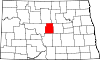 | |
| Townships | ||
| Unorganized territories | ||
| CDP | ||
| International | |
|---|---|
| National | |