[2] Name on the Register
Image
Date listed[3]
Location
City or town
Description
1
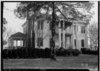
Andalusia Andalusia February 8, 1980 (#80000968 ) NW of Milledgeville on U.S. 441 33°07′31″N 83°16′04″W / 33.12526°N 83.26775°W / 33.12526; -83.26775 (Andalusia ) Milledgeville The home of Flannery O'Connor from 1951 until her death[4]
2
Atkinson Hall, Georgia College Atkinson Hall, Georgia College January 20, 1972 (#72000359 ) Georgia College campus 33°04′49″N 83°13′51″W / 33.080278°N 83.230833°W / 33.080278; -83.230833 (Atkinson Hall, Georgia College ) Milledgeville
3
Barrowville Upload image December 14, 1978 (#78000958 ) E of Milledgeville on GA 22/24 33°05′18″N 83°12′17″W / 33.088333°N 83.204722°W / 33.088333; -83.204722 (Barrowville ) Milledgeville
4
Maj. Francis Boykin House Maj. Francis Boykin House November 14, 1978 (#78000959 ) 10 mi. (16 km) SE of Milledgeville off GA 24 33°00′41″N 83°05′22″W / 33.011389°N 83.089444°W / 33.011389; -83.089444 (Maj. Francis Boykin House ) Milledgeville
5
Central Building, State Lunatic Asylum Central Building, State Lunatic Asylum July 20, 1978 (#78000960 ) Broad St. 33°03′01″N 83°13′19″W / 33.050278°N 83.221944°W / 33.050278; -83.221944 (Central Building, State Lunatic Asylum ) Milledgeville
6
Central State Hospital Cemeteries Central State Hospital Cemeteries July 12, 2005 (#05000694 ) 3 mi. SE of Milledgeville, centered on Cedar Lm, at Central State Hospital, bet. US 441 and GA 112 33°02′20″N 83°13′12″W / 33.038889°N 83.22°W / 33.038889; -83.22 (Central State Hospital Cemeteries ) Hardwick
7
Devereux-Coleman House Devereux-Coleman House April 8, 1993 (#93000214 ) 167 Kenan Dr. 33°08′49″N 83°17′00″W / 33.1469°N 83.2833°W / 33.1469; -83.2833 (Devereux-Coleman House ) Milledgeville
8
Fort-Hammond-Willis House Fort-Hammond-Willis House March 25, 2003 (#03000173 ) 1760 Irwinton Rd. 33°03′27″N 83°13′46″W / 33.05748°N 83.22958°W / 33.05748; -83.22958 (Fort-Hammond-Willis House ) Milledgeville
9
Fowler Apartments Fowler Apartments August 21, 1997 (#97000861 ) 430 W. McIntosh St. 33°04′52″N 83°14′01″W / 33.08123°N 83.23354°W / 33.08123; -83.23354 (Fowler Apartments ) Milledgeville
10
Milledgeville Historic District Milledgeville Historic District June 28, 1972 (#72000360 ) Bounded by Irwin, Thomas, and Warren Sts. and Fishing Creek 33°04′42″N 83°13′43″W / 33.078333°N 83.228611°W / 33.078333; -83.228611 (Milledgeville Historic District ) Milledgeville
11
Old Governor's Mansion Old Governor's Mansion May 13, 1970 (#70000194 ) 120 S. Clark St. 33°04′43″N 83°13′53″W / 33.07864°N 83.23131°W / 33.07864; -83.23131 (Old Governor's Mansion ) Milledgeville National Historic Landmark
12
Old State Capitol Old State Capitol May 13, 1970 (#70000195 ) Greene St. 33°04′40″N 83°13′32″W / 33.07770°N 83.22547°W / 33.07770; -83.22547 (Old State Capitol ) Milledgeville
13
Samuel Rockwell House Samuel Rockwell House April 19, 1978 (#78000961 ) 165 Allen Memorial Dr. 33°03′24″N 83°13′57″W / 33.05676°N 83.2326°W / 33.05676; -83.2326 (Samuel Rockwell House ) Milledgeville
14
Roe-Harper House Upload image March 6, 1986 (#77000437 ) SE of conjunction of US 441 and Corral Rd. 33°09′57″N 83°16′39″W / 33.165833°N 83.2775°W / 33.165833; -83.2775 (Roe-Harper House ) Milledgeville
15
Rose Hill Rose Hill April 3, 2017 (#100000821 ) 1534 Irwinton Rd. 33°03′40″N 83°13′35″W / 33.06111°N 83.22636°W / 33.06111; -83.22636 (Rose Hill ) Milledgeville Now part of Lockerly Arboretum
16
John Rutherford House John Rutherford House March 21, 1978 (#78000962 ) 550 Allen Memorial Dr. 33°03′18″N 83°14′28″W / 33.055°N 83.241111°W / 33.055; -83.241111 (John Rutherford House ) Milledgeville
17
Storehouse, State Lunatic Asylum Storehouse, State Lunatic Asylum June 15, 1978 (#78000963 ) Broad St. and Lawrence Rd. 33°03′03″N 83°13′26″W / 33.050833°N 83.223889°W / 33.050833; -83.223889 (Storehouse, State Lunatic Asylum ) Milledgeville
18
Thalian Hall Thalian Hall March 21, 1978 (#78000964 ) Allen Memorial and Ivey Drs. 33°03′19″N 83°14′43″W / 33.055278°N 83.245278°W / 33.055278; -83.245278 (Thalian Hall ) Milledgeville Demolished in 1990
19
Westbrook-Hubert Farm Upload image June 13, 1997 (#97000558 ) 143 Little Rd. 33°09′24″N 83°20′17″W / 33.156667°N 83.338056°W / 33.156667; -83.338056 (Westbrook-Hubert Farm ) Meriwether
20
Westover Westover February 12, 1987 (#87000094 ) 151 Meriwether Rd. NW 33°07′50″N 83°17′44″W / 33.130556°N 83.295556°W / 33.130556; -83.295556 (Westover ) Milledgeville
21
Woodville Woodville June 22, 1979 (#79000695 ) 3 mi. (4.8 km) S of Milledgeville on GA 243 33°01′04″N 83°14′32″W / 33.017778°N 83.242222°W / 33.017778; -83.242222 (Woodville ) Milledgeville
22
Dr. Charles and Louise Zattau House Dr. Charles and Louise Zattau House July 3, 2012 (#12000381 ) 290 Lakeside Dr. 33°06′01″N 83°14′18″W / 33.100192°N 83.238244°W / 33.100192; -83.238244 (Dr. Charles and Louise Zattau House ) Milledgeville