[3] Name on the Register[4]
Image
Date listed[5]
Location
City or town
Description
1
Archaeological Site 39BK0003 Upload image September 11, 2023 (#100008354 ) Address Restricted Bruce vicinity
2
Archaeological Site 39BK0102 Upload image February 29, 2024 (#100008355 ) Address Restricted Bruce vicinity
3
Brookings Central Residential Historic District Brookings Central Residential Historic District June 3, 1994 (#94000558 ) Roughly bounded by 3rd St., 6th St. (Highway 14 ), Medary Ave., and 5th Ave.; also 521 and 601 4th St. 44°18′35″N 96°47′33″W / 44.309722°N 96.7925°W / 44.309722; -96.7925 (Brookings Central Residential Historic District ) Brookings 4th St. addresses represent a boundary increase
4
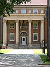
Brookings City Hall Brookings City Hall June 17, 1982 (#82003914 ) 4th St. 44°18′32″N 96°47′57″W / 44.308889°N 96.799167°W / 44.308889; -96.799167 (Brookings City Hall ) Brookings
5
Brookings Commercial Historic District Brookings Commercial Historic District April 19, 1988 (#88000029 ) Roughly along Main Ave. between the former C&NW railroad line and the alley north of 5th St. 44°18′32″N 96°47′53″W / 44.308889°N 96.798056°W / 44.308889; -96.798056 (Brookings Commercial Historic District ) Brookings
6
Brookings County Courthouse Brookings County Courthouse December 12, 1976 (#76001715 ) 4th St. and 6th Ave. 44°18′32″N 96°47′43″W / 44.308889°N 96.795278°W / 44.308889; -96.795278 (Brookings County Courthouse ) Brookings
7
Brookings University Residential Historic District Upload image February 12, 1999 (#99000210 ) Roughly bounded by Harvey Dunn St., Medary Ave., 6th St., and Main Ave. 44°18′52″N 96°47′34″W / 44.314444°N 96.792778°W / 44.314444; -96.792778 (Brookings University Residential Historic District ) Brookings
8
W. A. Caldwell House W. A. Caldwell House November 3, 1986 (#86002990 ) 804 6th Ave. 44°18′52″N 96°47′38″W / 44.314444°N 96.793889°W / 44.314444; -96.793889 (W. A. Caldwell House ) Brookings
9
Carnegie Public Library Carnegie Public Library May 7, 1980 (#80003717 ) 524 4th St. 44°18′32″N 96°47′43″W / 44.308889°N 96.795278°W / 44.308889; -96.795278 (Carnegie Public Library ) Brookings
10
Chicago and Northwestern Railroad Depot Chicago and Northwestern Railroad Depot October 8, 1976 (#76001716 ) Main St. 44°18′25″N 96°47′57″W / 44.306944°N 96.799167°W / 44.306944; -96.799167 (Chicago and Northwestern Railroad Depot ) Brookings
11
Ivan Cobel House Ivan Cobel House August 14, 2003 (#03000762 ) 727 Main Ave. 44°18′47″N 96°47′56″W / 44.313056°N 96.798889°W / 44.313056; -96.798889 (Ivan Cobel House ) Brookings
12
Coolidge Sylvan Theatre Coolidge Sylvan Theatre February 26, 1987 (#87000224 ) Medary Ave. 44°18′59″N 96°47′13″W / 44.316389°N 96.786944°W / 44.316389; -96.786944 (Coolidge Sylvan Theatre ) Brookings
13
Coughlin Campanile Coughlin Campanile February 26, 1987 (#87000223 ) Medary Ave. 44°18′57″N 96°47′16″W / 44.315833°N 96.787778°W / 44.315833; -96.787778 (Coughlin Campanile ) Brookings
14
Experimental Rammed Earth Machine Shed Experimental Rammed Earth Machine Shed August 26, 1993 (#93000869 ) Northwestern corner of the South Dakota State University campus 44°19′14″N 96°47′24″W / 44.320682°N 96.790091°W / 44.320682; -96.790091 (Experimental Rammed Earth Machine Shed ) Brookings
15
Experimental Rammed Earth Wall Experimental Rammed Earth Wall June 28, 1991 (#91000850 ) Medary Ave. behind Dean of Agricultural and Biological Sciences House on the South Dakota State University campus 44°19′17″N 96°47′21″W / 44.321396°N 96.789189°W / 44.321396; -96.789189 (Experimental Rammed Earth Wall ) Brookings
16
Fishback House Fishback House October 8, 1976 (#76001717 ) 501 8th St. 44°18′52″N 96°47′47″W / 44.314444°N 96.796389°W / 44.314444; -96.796389 (Fishback House ) Brookings
17
Graham House Graham House June 3, 1994 (#94000559 ) 927 7th St. 44°19′39″N 96°47′33″W / 44.3275°N 96.7925°W / 44.3275; -96.7925 (Graham House ) Brookings
18
John L. Hall House John L. Hall House November 29, 2010 (#10000955 ) 121 Samara Ave. 44°19′28″N 96°55′42″W / 44.324444°N 96.928333°W / 44.324444; -96.928333 (John L. Hall House ) Volga
19
E. E. Haugen House E. E. Haugen House March 1, 2010 (#10000047 ) 202 5th St. 44°18′37″N 96°48′07″W / 44.310322°N 96.801883°W / 44.310322; -96.801883 (E. E. Haugen House ) Brookings
20
Henry-Martinson House Henry-Martinson House December 20, 1977 (#77001237 ) 405 Kasan Ave. 44°19′16″N 96°55′36″W / 44.321111°N 96.926667°W / 44.321111; -96.926667 (Henry-Martinson House ) Volga
21
Intermill House Upload image May 9, 1997 (#97000427 ) 46408 203rd St. 44°26′36″N 96°55′30″W / 44.443333°N 96.925°W / 44.443333; -96.925 (Intermill House ) Bruce
22
Lockhart House Lockhart House November 29, 2010 (#10000954 ) 1001 6th Ave. 44°19′01″N 96°47′43″W / 44.316944°N 96.795278°W / 44.316944; -96.795278 (Lockhart House ) Brookings
23
G. A. Mathews House Upload image November 26, 1986 (#86002989 ) 423 Eighth St. 44°18′53″N 96°47′50″W / 44.314811°N 96.797359°W / 44.314811; -96.797359 (G. A. Mathews House ) Brookings
24
Herman F. Micheel Gothic Arched-Roof Barn Herman F. Micheel Gothic Arched-Roof Barn January 25, 1991 (#90002207 ) 5 miles north and 3 miles west of White 44°30′35″N 96°42′28″W / 44.509689°N 96.707696°W / 44.509689; -96.707696 (Herman F. Micheel Gothic Arched-Roof Barn ) White
25
Mortimer Cabin Upload image October 26, 2017 (#100001397 ) 20247 Oakwood Shoreline Dr. 44°25′51″N 96°59′44″W / 44.430857°N 96.995673°W / 44.430857; -96.995673 (Mortimer Cabin ) Bruce
26
Nick's Hamburger Shop Nick's Hamburger Shop November 6, 1986 (#86003008 ) 427 Main Ave. 44°18′36″N 96°47′56″W / 44.31°N 96.798889°W / 44.31; -96.798889 (Nick's Hamburger Shop ) Brookings
27
Pioneer Park Bandshell Pioneer Park Bandshell November 19, 2007 (#07001208 ) Southwestern corner of the junction of U.S. Route 14 and 1st Ave. 44°18′46″N 96°48′18″W / 44.312778°N 96.805°W / 44.312778; -96.805 (Pioneer Park Bandshell ) Brookings
28
St. Mary's School St. Mary's School October 24, 1996 (#96001228 ) 220 E. 3rd St. 44°14′05″N 96°28′47″W / 44.234722°N 96.479722°W / 44.234722; -96.479722 (St. Mary's School ) Elkton
29
Sexauer Seed Company Historic District Sexauer Seed Company Historic District November 8, 2001 (#01001225 ) Roughly bounded by Main Ave., the Dakota, Minnesota and Eastern railroad tracks, 2nd St., and 6th Ave. 44°18′21″N 96°47′50″W / 44.305833°N 96.797222°W / 44.305833; -96.797222 (Sexauer Seed Company Historic District ) Brookings
30
George P. Sexauer House George P. Sexauer House January 26, 1990 (#89002333 ) 929 4th St. 44°18′33″N 96°47′18″W / 44.309167°N 96.788333°W / 44.309167; -96.788333 (George P. Sexauer House ) Brookings
31
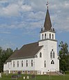
Singsaas Lutheran Church Singsaas Lutheran Church October 23, 2003 (#03001070 ) 19715 487th Ave.[6] 44°31′34″N 96°27′54″W / 44.526016°N 96.464985°W / 44.526016; -96.464985 (Singsaas Lutheran Church ) Lake Hendricks Township
32
South Dakota Department of Transportation Bridge No. 06-129-020 Upload image November 30, 1999 (#99001433 ) Local road over the Big Sioux River 44°30′53″N 96°52′11″W / 44.514722°N 96.869722°W / 44.514722; -96.869722 (South Dakota Department of Transportation Bridge No. 06-129-020 ) Bruce Destroyed in 2011
33
South Dakota Department of Transportation Bridge No. 06-142-190 South Dakota Department of Transportation Bridge No. 06-142-190 November 30, 1999 (#99001431 ) Local road over the Big Sioux River 44°16′06″N 96°50′35″W / 44.268333°N 96.843056°W / 44.268333; -96.843056 (South Dakota Department of Transportation Bridge No. 06-142-190 ) Brookings
34
Sterling Methodist Church Sterling Methodist Church October 19, 1989 (#89001723 ) 20200 471st Ave[7] 44°27′21″N 96°47′13″W / 44.455946°N 96.786894°W / 44.455946; -96.786894 (Sterling Methodist Church ) Bruce
35
Stock Judging Pavilion Stock Judging Pavilion October 19, 1978 (#78002538 ) 11th St. and Medary Ave. on the South Dakota State University campus 44°19′08″N 96°47′18″W / 44.318889°N 96.788333°W / 44.318889; -96.788333 (Stock Judging Pavilion ) Brookings
36
Trygstad Law and Commerce Building Trygstad Law and Commerce Building February 23, 1984 (#84003244 ) 401 Main Ave. 44°18′33″N 96°47′54″W / 44.309167°N 96.798333°W / 44.309167; -96.798333 (Trygstad Law and Commerce Building ) Brookings
37
Volga Auditorium Volga Auditorium July 5, 2000 (#00000723 ) 212 Kasan Ave. 44°19′30″N 96°55′35″W / 44.325°N 96.926389°W / 44.325; -96.926389 (Volga Auditorium ) Volga
38
Volga Hospital Upload image February 6, 2023 (#100008617 ) 203 Samara Ave. 44°19′25″N 96°55′43″W / 44.3235°N 96.9286°W / 44.3235; -96.9286 (Volga Hospital ) Volga
39
Vostad Farm Vostad Farm April 14, 2005 (#05000283 ) 2905 16th Ave., W. 44°20′30″N 96°49′46″W / 44.341667°N 96.829444°W / 44.341667; -96.829444 (Vostad Farm ) Brookings
40
Solomon Walters House Solomon Walters House April 26, 1978 (#78002539 ) Railway St. 44°26′08″N 96°53′27″W / 44.435422°N 96.890798°W / 44.435422; -96.890798 (Solomon Walters House ) Bruce
41
Wenona Hall and Wecota Hall Wenona Hall and Wecota Hall May 7, 1980 (#80003718 ) Medary Ave. 44°19′04″N 96°47′20″W / 44.317778°N 96.788889°W / 44.317778; -96.788889 (Wenona Hall and Wecota Hall ) Brookings
42
Woodbine Cottage Woodbine Cottage January 26, 1990 (#89002332 ) 929 Harvey Dunn St. 44°19′05″N 96°47′18″W / 44.318056°N 96.788333°W / 44.318056; -96.788333 (Woodbine Cottage ) Brookings
43
Woodbine Cottage Experimental Rammed Earth Wall Woodbine Cottage Experimental Rammed Earth Wall June 28, 1991 (#91000849 ) West of the junction of 10th St. and Medary Ave. on the South Dakota State University campus 44°19′01″N 96°47′19″W / 44.316944°N 96.788611°W / 44.316944; -96.788611 (Woodbine Cottage Experimental Rammed Earth Wall ) Brookings


