

Sheridan County is a county in the U.S. state of Nebraska. As of the 2020 United States Census, the population was 5,127.[1] Its county seat is Rushville.[2] The county was formed in 1885, and was named for General Philip H. Sheridan.[3]
In the Nebraska license plate system, Sheridan County is represented by the prefix 61 (it had the sixty-first-largest number of vehicles registered in the state when the license plate system was established in 1922).
Geography
Sheridan County lies on the north line of Nebraska. Its north boundary line abuts the south boundary line of the state of South Dakota. An upper reach of the Niobrara River flows eastward through the upper central part of the county. The terrain consists of arid rolling hills, dotted with small lakes in the eastern and southern parts of the county.[4] The county has a total area of 2,470 square miles (6,400 km2), of which 2,441 square miles (6,320 km2) is land and 29 square miles (75 km2) (1.2%) is water.[5] It is the fourth-largest county in Nebraska by area.
Major highways
Adjacent counties
- Oglala Lakota County, South Dakota - north
- Cherry County - east
- Grant County - southeast
- Garden County - south
- Morrill County - southwest
- Dawes County - west
- Box Butte County - west
Protected areas
Demographics
| Census | Pop. | Note | %± |
|---|---|---|---|
| 1890 | 8,687 | — | |
| 1900 | 3,066 | −64.7% | |
| 1910 | 7,328 | 139.0% | |
| 1920 | 9,625 | 31.3% | |
| 1930 | 10,793 | 12.1% | |
| 1940 | 9,869 | −8.6% | |
| 1950 | 9,539 | −3.3% | |
| 1960 | 9,049 | −5.1% | |
| 1970 | 7,285 | −19.5% | |
| 1980 | 7,544 | 3.6% | |
| 1990 | 6,750 | −10.5% | |
| 2000 | 6,198 | −8.2% | |
| 2010 | 5,469 | −11.8% | |
| 2020 | 5,127 | −6.3% | |
| 2022 (est.) | 4,996 | −2.6% | |
| US Decennial Census[8] 1790-1960[9] 1900-1990[10] 1990-2000[11] 2010[12] 2020[13] 2022[14] | |||
As of the 2000 United States Census,[15] there were 6,198 people, 2,549 households, and 1,728 families in the county. The population density was 2 people per square mile (0.77 people/km2). There were 3,013 housing units at an average density of 1.2 units per square mile (0.46/km2). The racial makeup of the county was 88.11% White, 0.08% Black or African American, 9.23% Native American, 0.15% Asian, 0.02% Pacific Islander, 0.34% from other races, and 2.08% from two or more races. 1.47% of the population were Hispanic or Latino of any race. 31.6% were of German, 8.8% English, 7.8% Irish and 7.3% American ancestry.
There were 2,549 households, out of which 30.00% had children under the age of 18 living with them, 56.80% were married couples living together, 8.00% had a female householder with no husband present, and 32.20% were non-families. 29.60% of all households were made up of individuals, and 16.30% had someone living alone who was 65 years of age or older. The average household size was 2.38 and the average family size was 2.95.
The county population contained 25.60% under the age of 18, 6.20% from 18 to 24, 22.90% from 25 to 44, 23.60% from 45 to 64, and 21.70% who were 65 years of age or older. The median age was 42 years. For every 100 females there were 96.00 males. For every 100 females age 18 and over, there were 91.50 males.
The median income for a household in the county was $29,484, and the median income for a family was $35,167. Males had a median income of $21,892 versus $18,423 for females. The per capita income for the county was $14,844. About 11.00% of families and 13.20% of the population were below the poverty line, including 20.30% of those under age 18 and 7.50% of those age 65 or over.
Communities
Cities
Villages
Census-designated place
Unincorporated communities
Ghost town
1910 Census-designated places
Politics
Sheridan County voters have traditionally voted Republican; every national election since 1940 has seen Sheridan County choose the Republican Party presidential candidate. The county, alongside neighboring Garden County were the only two counties not to back Democratic Governor Ben Nelson in his 1994 landslide.
| Year | Republican | Democratic | Third party | |||
|---|---|---|---|---|---|---|
| No. | % | No. | % | No. | % | |
| 2020 | 2,292 | 85.39% | 340 | 12.67% | 52 | 1.94% |
| 2016 | 2,211 | 84.78% | 287 | 11.00% | 110 | 4.22% |
| 2012 | 2,021 | 81.76% | 390 | 15.78% | 61 | 2.47% |
| 2008 | 1,941 | 78.84% | 454 | 18.44% | 67 | 2.72% |
| 2004 | 2,136 | 82.19% | 430 | 16.54% | 33 | 1.27% |
| 2000 | 2,105 | 81.72% | 392 | 15.22% | 79 | 3.07% |
| 1996 | 1,834 | 67.50% | 573 | 21.09% | 310 | 11.41% |
| 1992 | 1,698 | 56.68% | 535 | 17.86% | 763 | 25.47% |
| 1988 | 2,251 | 77.67% | 612 | 21.12% | 35 | 1.21% |
| 1984 | 2,661 | 86.93% | 377 | 12.32% | 23 | 0.75% |
| 1980 | 2,749 | 84.04% | 370 | 11.31% | 152 | 4.65% |
| 1976 | 2,003 | 67.83% | 810 | 27.43% | 140 | 4.74% |
| 1972 | 2,386 | 83.22% | 481 | 16.78% | 0 | 0.00% |
| 1968 | 2,236 | 76.29% | 454 | 15.49% | 241 | 8.22% |
| 1964 | 2,440 | 67.85% | 1,156 | 32.15% | 0 | 0.00% |
| 1960 | 2,870 | 71.50% | 1,144 | 28.50% | 0 | 0.00% |
| 1956 | 2,618 | 74.57% | 893 | 25.43% | 0 | 0.00% |
| 1952 | 3,512 | 80.68% | 841 | 19.32% | 0 | 0.00% |
| 1948 | 2,180 | 64.86% | 1,181 | 35.14% | 0 | 0.00% |
| 1944 | 2,570 | 71.37% | 1,031 | 28.63% | 0 | 0.00% |
| 1940 | 3,161 | 66.87% | 1,566 | 33.13% | 0 | 0.00% |
| 1936 | 1,907 | 42.52% | 2,428 | 54.14% | 150 | 3.34% |
| 1932 | 1,820 | 37.41% | 2,945 | 60.53% | 100 | 2.06% |
| 1928 | 3,030 | 70.22% | 1,226 | 28.41% | 59 | 1.37% |
| 1924 | 1,509 | 41.46% | 661 | 18.16% | 1,470 | 40.38% |
| 1920 | 1,714 | 64.53% | 784 | 29.52% | 158 | 5.95% |
| 1916 | 604 | 32.35% | 1,158 | 62.02% | 105 | 5.62% |
| 1912 | 377 | 22.56% | 630 | 37.70% | 664 | 39.74% |
| 1908 | 709 | 46.68% | 733 | 48.26% | 77 | 5.07% |
| 1904 | 673 | 61.57% | 171 | 15.65% | 249 | 22.78% |
| 1900 | 626 | 45.59% | 703 | 51.20% | 44 | 3.20% |
See also
References
- ^ "Sheridan County, Nebraska". United States Census Bureau. Retrieved June 24, 2023.
- ^ "Find a County". National Association of Counties. Retrieved June 7, 2011.
- ^ "Sheridan County". Archived from the original on July 4, 2008. Retrieved March 24, 2010.
- ^ Sheridan County NE Google Maps (accessed 26 January 2019J)
- ^ "2010 Census Gazetteer Files". US Census Bureau. August 22, 2012. Archived from the original on November 13, 2013. Retrieved December 11, 2014.
- ^ Smith Lake State Wildlife Management Area, Hay Springs NE Google Maps (accessed 26 January 2019J)
- ^ Walgren Lake State Recreation Area, Hay Springs NE Google Maps (accessed 26 January 2019)
- ^ "US Decennial Census". US Census Bureau. Retrieved December 11, 2014.
- ^ "Historical Census Browser". University of Virginia Library. Retrieved December 11, 2014.
- ^ "Population of Counties by Decennial Census: 1900 to 1990". US Census Bureau. Retrieved December 11, 2014.
- ^ "Census 2000 PHC-T-4. Ranking Tables for Counties: 1990 and 2000" (PDF). US Census Bureau. Archived (PDF) from the original on March 27, 2010. Retrieved December 11, 2014.
- ^ "QuickFacts". United States Census Bureau. July 1, 2022. Retrieved June 23, 2023.
- ^ "Sheridan County, Nebraska". United States Census Bureau. Retrieved June 24, 2023.
- ^ "State & County QuickFacts". United States Census Bureau. Retrieved September 22, 2013.
- ^ "U.S. Census website". US Census Bureau. Retrieved January 31, 2008.
- ^ Election Results
- ^ The leading "other" candidate, Progressive Theodore Roosevelt, received 512 votes, while Socialist candidate Eugene Debs received 122 votes and Prohibition Eugene Chafin received 30 votes.
Places adjacent to Sheridan County, Nebraska | ||||||||||||||||
|---|---|---|---|---|---|---|---|---|---|---|---|---|---|---|---|---|
| ||||||||||||||||
Municipalities and communities of Sheridan County, Nebraska, United States | ||
|---|---|---|
| Cities | 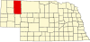 | |
| Villages | ||
| CDP | ||
| Unincorporated communities | ||
| Ghost town | ||
| Indian reservation | ||
| Footnotes | ‡This populated place also has portions in an adjacent county or counties | |
42°30′N 102°26′W / 42.50°N 102.43°W
| International | |
|---|---|
| National | |
| Other | |