

Size of this preview: 800 × 527 pixels. Other resolutions: 320 × 211 pixels | 640 × 421 pixels | 1,024 × 674 pixels | 1,252 × 824 pixels.
Original file (1,252 × 824 pixels, file size: 1.4 MB, MIME type: image/jpeg)
|
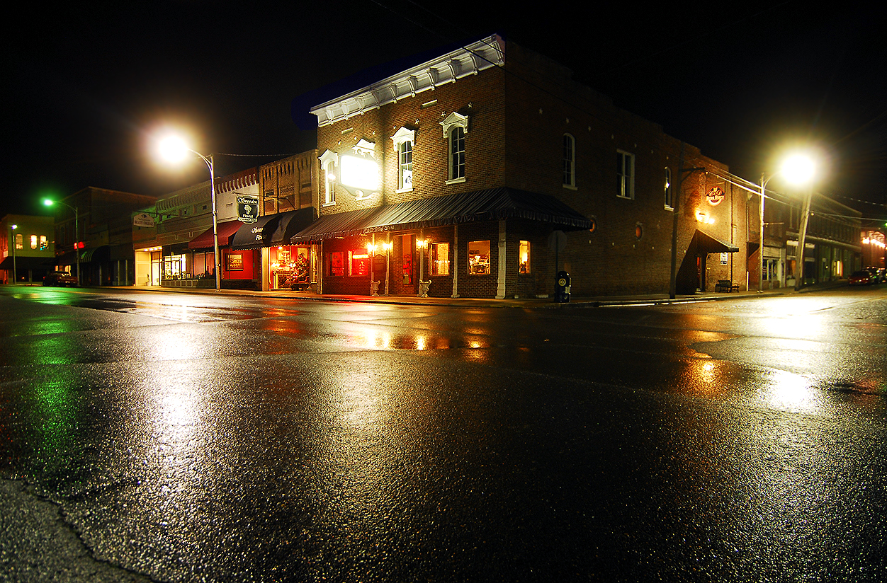
This is an image of a place or building that is listed on the National Register of Historic Places in the United States of America. Its reference number is 96000941. |
Summary
| Description |
English: Historic downtown Russellville |
| Date | |
| Source |
I created this work entirely by myself. Transferred from en.wikipedia |
| Author | Photolitherland (talk)Chris Litherland |
| Object location | | View this and other nearby images on: OpenStreetMap |
|---|
Licensing
Photolitherland at en.wikipedia, the copyright holder of this work, hereby publishes it under the following license:
This file is licensed under the Creative Commons Attribution-Share Alike 3.0 Unported license.
Attribution: Photolitherland at en.wikipedia
- You are free:
- to share – to copy, distribute and transmit the work
- to remix – to adapt the work
- Under the following conditions:
- attribution – You must give appropriate credit, provide a link to the license, and indicate if changes were made. You may do so in any reasonable manner, but not in any way that suggests the licensor endorses you or your use.
- share alike – If you remix, transform, or build upon the material, you must distribute your contributions under the same or compatible license as the original.
Original upload log
The original description page was here. All following user names refer to en.wikipedia.
- 2009-02-28 01:49 Photolitherland 1252×824 (1463815 bytes) {{Information |Description=Historic downtown Russellville |Source=I created this work entirely by myself. |Date=2009-02 |Author=~~~Chris Litherland |other_versions= }}
File history
Click on a date/time to view the file as it appeared at that time.
| Date/Time | Thumbnail | Dimensions | User | Comment | |
|---|---|---|---|---|---|
| current | 09:06, 28 March 2013 | | 1,252 × 824 (1.4 MB) | Túrelio | Reverted to version as of 02:38, 9 January 2012 |
| 09:02, 28 March 2013 |  | 640 × 1,136 (92 KB) | 38aytac38 | {{Information |Description ={{en|1=Bbb}} {{nl|1=Hhh}} |Source ={{own}} |Author =38aytac38 |Date = |Permission = |other_versions =Hhhs }} | |
| 02:38, 9 January 2012 |  | 1,252 × 824 (1.4 MB) | BotMultichillT | {{BotMoveToCommons|en.wikipedia|year={{subst:CURRENTYEAR}}|month={{subst:CURRENTMONTHNAME}}|day={{subst:CURRENTDAY}}}} == {{int:filedesc}} == {{Information |description={{en|1=Historic downtown Russellville}} |date=Feb-2009 |source=I created this work en |
File usage
The following pages on the English Wikipedia use this file (pages on other projects are not listed):
Global file usage
The following other wikis use this file:
- Usage on azb.wikipedia.org
- Usage on es.wikipedia.org
- Usage on fa.wikipedia.org
- Usage on it.wikipedia.org
- Usage on ko.wikipedia.org
- Usage on ro.wikipedia.org
- Usage on sh.wikipedia.org
- Usage on sr.wikipedia.org
- Usage on tl.wikipedia.org
- Usage on tr.wikipedia.org
- Usage on uk.wikipedia.org
- Usage on www.wikidata.org
- Usage on zh.wikipedia.org