

McCracken is a city in Rush County, Kansas, United States.[1] As of the 2020 census, the population of the city was 152.[3]
History
McCracken was founded in 1886 when the railroad was extended to that point.[4] It was named for J.K. McCracken, a railroad employee.[4][5][6]
Geography
According to the United States Census Bureau, the city has a total area of 0.95 square miles (2.46 km2), all of it land.[7]
Climate
The climate in this area is characterized by hot, humid summers and generally mild to cool winters. According to the Köppen Climate Classification system, McCracken has a humid subtropical climate, abbreviated "Cfa" on climate maps.[8]
Demographics
| Census | Pop. | Note | %± |
|---|---|---|---|
| 1890 | 281 | — | |
| 1900 | 312 | 11.0% | |
| 1910 | 371 | 18.9% | |
| 1920 | 491 | 32.3% | |
| 1930 | 594 | 21.0% | |
| 1940 | 534 | −10.1% | |
| 1950 | 553 | 3.6% | |
| 1960 | 406 | −26.6% | |
| 1970 | 333 | −18.0% | |
| 1980 | 292 | −12.3% | |
| 1990 | 231 | −20.9% | |
| 2000 | 211 | −8.7% | |
| 2010 | 190 | −10.0% | |
| 2020 | 152 | −20.0% | |
| U.S. Decennial Census | |||
2020 census
The 2020 United States census counted 152 people, 85 households, and 38 families in McCracken.[9][10] The population density was 152.5 per square mile (58.9/km2). There were 125 housing units at an average density of 125.4 per square mile (48.4/km2).[10][11] The racial makeup was 96.71% (147) white or European American (95.39% non-Hispanic white), 0.0% (0) black or African-American, 0.0% (0) Native American or Alaska Native, 0.0% (0) Asian, 0.0% (0) Pacific Islander or Native Hawaiian, 1.32% (2) from other races, and 1.97% (3) from two or more races.[12] Hispanic or Latino of any race was 4.61% (7) of the population.[13]
Of the 85 households, 10.6% had children under the age of 18; 35.3% were married couples living together; 25.9% had a female householder with no spouse or partner present. 48.2% of households consisted of individuals and 21.2% had someone living alone who was 65 years of age or older.[10] The average household size was 1.9 and the average family size was 2.7.[14] The percent of those with a bachelor’s degree or higher was estimated to be 8.6% of the population.[15]
14.5% of the population was under the age of 18, 5.3% from 18 to 24, 19.7% from 25 to 44, 31.6% from 45 to 64, and 28.9% who were 65 years of age or older. The median age was 49.0 years. For every 100 females, there were 97.4 males.[10] For every 100 females ages 18 and older, there were 94.0 males.[10]
The 2016-2020 5-year American Community Survey estimates show that the median household income was $38,571 (with a margin of error of +/- $6,641) and the median family income was $40,000 (+/- $19,820).[16] Males had a median income of $21,563 (+/- $18,268) versus $20,357 (+/- $6,847) for females. The median income for those above 16 years old was $20,795 (+/- $5,800).[17] Approximately, 0.0% of families and 1.9% of the population were below the poverty line, including 0.0% of those under the age of 18 and 0.0% of those ages 65 or over.[18][19]
2010 census
As of the census[20] of 2010, there were 190 people, 96 households, and 50 families residing in the city. The population density was 200.0 inhabitants per square mile (77.2/km2). There were 130 housing units at an average density of 136.8 per square mile (52.8/km2). The racial makeup of the city was 93.7% White, 0.5% African American, 2.1% Native American, and 3.7% from two or more races.
There were 96 households, of which 16.7% had children under the age of 18 living with them, 42.7% were married couples living together, 6.3% had a female householder with no husband present, 3.1% had a male householder with no wife present, and 47.9% were non-families. 43.8% of all households were made up of individuals, and 23.9% had someone living alone who was 65 years of age or older. The average household size was 1.98 and the average family size was 2.76.
The median age in the city was 53 years. 19.5% of residents were under the age of 18; 4.7% were between the ages of 18 and 24; 15.4% were from 25 to 44; 31.6% were from 45 to 64; and 28.9% were 65 years of age or older. The gender makeup of the city was 48.9% male and 51.1% female.
2000 census
As of the census[21] of 2000, there were 211 people, 106 households, and 57 families residing in the city. The population density was 220.8 inhabitants per square mile (85.3/km2). There were 139 housing units at an average density of 145.5 per square mile (56.2/km2). The racial makeup of the city was 98.10% White, 0.47% Native American, and 1.42% from two or more races. Hispanic or Latino of any race were 0.47% of the population.
There were 106 households, out of which 24.5% had children under the age of 18 living with them, 43.4% were married couples living together, 8.5% had a female householder with no husband present, and 45.3% were non-families. 44.3% of all households were made up of individuals, and 28.3% had someone living alone who was 65 years of age or older. The average household size was 1.99 and the average family size was 2.74.
In the city, the population was spread out, with 23.7% under the age of 18, 2.4% from 18 to 24, 19.4% from 25 to 44, 26.1% from 45 to 64, and 28.4% who were 65 years of age or older. The median age was 47 years. For every 100 females, there were 85.1 males. For every 100 females age 18 and over, there were 85.1 males.
The median income for a household in the city was $29,750, and the median income for a family was $34,750. Males had a median income of $31,250 versus $25,250 for females. The per capita income for the city was $13,957. About 12.3% of families and 13.7% of the population were below the poverty line, including 19.5% of those under the age of eighteen and 9.9% of those 65 or over.
Education
The community is served by La Crosse USD 395 public school district.[22] The LaCrosse High School mascot is LaCrosse Leopards.[23]
McCracken High School was closed through school unification. The McCracken Mustangs[24] won the Kansas State High School boys class 1A basketball championship in 1972.[25]
Media
Part of the 1973 film Paper Moon was shot in the McCracken area. All of the major building “filming locations”, including the hotel and cafe, are gone, and today are empty lots.
References
- ^ a b c d U.S. Geological Survey Geographic Names Information System: McCracken, Kansas
- ^ "2019 U.S. Gazetteer Files". United States Census Bureau. Retrieved July 24, 2020.
- ^ a b "Profile of McCracken, Kansas in 2020". United States Census Bureau. Archived from the original on December 5, 2021. Retrieved December 5, 2021.
- ^ a b "History of Rush County". Rush County Economic Development. Archived from the original on March 22, 2012. Retrieved June 22, 2014.
- ^ Kansas State Historical Society (1916). Biennial Report of the Board of Directors of the Kansas State Historical Society. Kansas State Printing Plant. pp. 278.
- ^ "Profile for McCracken, Kansas". ePodunk. Retrieved June 22, 2014.
- ^ "US Gazetteer files 2010". United States Census Bureau. Archived from the original on January 12, 2012. Retrieved July 6, 2012.
- ^ Climate Summary for McCracken, Kansas
- ^ "US Census Bureau, Table P16: HOUSEHOLD TYPE". data.census.gov. Retrieved January 3, 2024.
- ^ a b c d e "US Census Bureau, Table DP1: PROFILE OF GENERAL POPULATION AND HOUSING CHARACTERISTICS". data.census.gov. Retrieved January 3, 2024.
- ^ Bureau, US Census. "Gazetteer Files". Census.gov. Retrieved December 30, 2023.
- ^ "US Census Bureau, Table P1: RACE". data.census.gov. Retrieved January 3, 2024.
- ^ "US Census Bureau, Table P2: HISPANIC OR LATINO, AND NOT HISPANIC OR LATINO BY RACE". data.census.gov. Retrieved January 3, 2024.
- ^ "US Census Bureau, Table S1101: HOUSEHOLDS AND FAMILIES". data.census.gov. Retrieved January 3, 2024.
- ^ "US Census Bureau, Table S1501: EDUCATIONAL ATTAINMENT". data.census.gov. Retrieved January 3, 2024.
- ^ "US Census Bureau, Table S1903: MEDIAN INCOME IN THE PAST 12 MONTHS (IN 2020 INFLATION-ADJUSTED DOLLARS)". data.census.gov. Retrieved January 3, 2024.
- ^ "US Census Bureau, Table S2001: EARNINGS IN THE PAST 12 MONTHS (IN 2020 INFLATION-ADJUSTED DOLLARS)". data.census.gov. Retrieved January 3, 2024.
- ^ "US Census Bureau, Table S1701: POVERTY STATUS IN THE PAST 12 MONTHS". data.census.gov. Retrieved January 3, 2024.
- ^ "US Census Bureau, Table S1702: POVERTY STATUS IN THE PAST 12 MONTHS OF FAMILIES". data.census.gov. Retrieved January 3, 2024.
- ^ "U.S. Census website". United States Census Bureau. Retrieved July 6, 2012.
- ^ "U.S. Census website". United States Census Bureau. Retrieved January 31, 2008.
- ^ "USD 395 District Map" (PDF). Kansas Department of Transportation. Archived (PDF) from the original on May 5, 2020.
- ^ "LaCrosse Public Schools". USD 395. Retrieved January 4, 2017.
- ^ "McCracken Mustangs", Hays Daily News, September 11, 1975, p.18.
- ^ "Basketball". KSHSAA. Retrieved January 3, 2017.
Further reading
External links
- McCracken - Directory of Public Officials
- History of Cities in Rush County
- McCracken Info, Legends of Kansas
- Rush County maps: Current, Historic, KDOT
Municipalities and communities of Rush County, Kansas, United States | ||
|---|---|---|
| Cities | 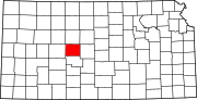 | |
| Unincorporated communities | ||
| Ghost towns | ||
| Townships |
| |
| International | |
|---|---|
| National | |