Contents

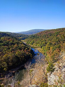
Black Mountain is a summit in western Madison County in the U.S. state of Missouri. The peak has an elevation of 1,503 feet (458 m).[1] The St. Francis River flows past the east side of the mountain at an elevation of about 560 feet. Missouri Route E passes the east and south side of the mountain. The community of French Mills lies adjacent to the St. Francis just to the south of the mountain.[2]
Black Mountain has the name of the local Black family.[3]
See also
References
- ^ U.S. Geological Survey Geographic Names Information System: Black Mountain (Missouri)
- ^ Des Arc NE, Missouri, 7.5 Minute Topographic Quadrangle, USGS, 1968
- ^ "Madison County Place Names, 1928–1945". The State Historical Society of Missouri. Archived from the original on June 24, 2016. Retrieved October 31, 2016.

