Contents
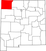
Cedar Hill is an unincorporated community and census-designated place in San Juan County, New Mexico, United States. Its population was 847 as of the 2010 census.[4] The community is located on U.S. Route 550, near the Colorado border. Cedar Hill was originally known as Cox's Crossing. The name was chosen during a Literacy Society meeting by picking names out of a hat. A post office operated from 1892 to 1966.[5]
Geography
Cedar Hill is located at 36°56′13″N 107°53′25″W / 36.9369472°N 107.8903431°W.[2] According to the U.S. Census Bureau, the community has an area of 5.561 square miles (14.40 km2); 5.352 square miles (13.86 km2) of its area is land, and 0.209 square miles (0.54 km2) is water.[4]
Demographics
| Census | Pop. | Note | %± |
|---|---|---|---|
| 2020 | 1,130 | — | |
| U.S. Decennial Census[6][3] | |||
Education
The school district is Aztec Municipal Schools.[7] Aztec High School is the local high school.
References
- ^ "ArcGIS REST Services Directory". United States Census Bureau. Retrieved October 12, 2022.
- ^ a b c U.S. Geological Survey Geographic Names Information System: Cedar Hill, New Mexico
- ^ a b "Census Population API". United States Census Bureau. Retrieved October 12, 2022.
- ^ a b "2010 Census Gazetteer Files - Places: New Mexico". U.S. Census Bureau. Retrieved December 21, 2016.
- ^ Julyan, Robert (1996). The Place Names of New Mexico. University of New Mexico Press. p. 71. ISBN 0826316891.
- ^ "Census of Population and Housing". Census.gov. Retrieved June 4, 2016.
- ^ "2020 CENSUS - SCHOOL DISTRICT REFERENCE MAP: San Juan County, NM" (PDF). U.S. Census Bureau. Retrieved July 12, 2022.


