

No higher resolution available.
1842_District_3_detail_of_Congressional_Districts_of_Massachusetts_map_LC_g3761f_ct002131.jpg (341 × 203 pixels, file size: 77 KB, MIME type: image/jpeg)
| Description |
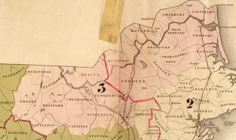
English: Detail of: Title: A map showing the Congressional districts of Massachusetts as established by the Act of Sept. 16, 1842 /
[S.l. : s.n., ca. 1842?] Call Number: G3761.F7 1842 .M3 Repository: Library of Congress Geography and Map Division Washington, D.C. 20540-4650 USA dcu Digital Id: g3761f ct002131 http://hdl.loc.gov/loc.gmd/g3761f.ct002131 Library of Congress Catalog Number: 2007630411 |
| Date | circa 1842? |
| Source | Library of Congress Geography and Map Division. https://www.loc.gov/item/2007630411 |
| Author | Author unknown |
This media file is in the public domain in the United States. This applies to U.S. works where the copyright has expired, often because its first publication occurred prior to January 1, 1929, and if not then due to lack of notice or renewal. See this page for further explanation.
|
 | |
 |
This image might not be in the public domain outside of the United States; this especially applies in the countries and areas that do not apply the rule of the shorter term for US works, such as Canada, Mainland China (not Hong Kong or Macao), Germany, Mexico, and Switzerland. The creator and year of publication are essential information and must be provided. See Wikipedia:Public domain and Wikipedia:Copyrights for more details.
|
File history
Click on a date/time to view the file as it appeared at that time.
| Date/Time | Thumbnail | Dimensions | User | Comment | |
|---|---|---|---|---|---|
| current | 19:06, 26 November 2013 | | 341 × 203 (77 KB) | M2545 | {{Information |Description={{en|1=Detail of: Title: A map showing the Congressional districts of Massachusetts as established by the Act of Sept. 16, 1842 / [S.l. : s.n., ca. 1842?] Call Number: G3761.F7 1842 .M3 Repository: Library of Congress Geog... |
File usage
The following pages on the English Wikipedia use this file (pages on other projects are not listed):
Global file usage
The following other wikis use this file:
- Usage on fr.wikipedia.org