


Size of this preview: 630 × 600 pixels. Other resolutions: 252 × 240 pixels | 504 × 480 pixels | 807 × 768 pixels | 1,061 × 1,010 pixels.
Original file (1,061 × 1,010 pixels, file size: 1.01 MB, MIME type: image/png)
Summary
| Description |
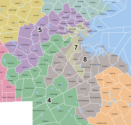
English: Map of 2013 Massachusetts congressional district boundaries for districts 5, 7, 8 (original map) |
| Date | |
| Source | Massachusetts legislature website |
| Author | Commonwealth of Massachusetts General Court |
Licensing

|
The copyright holder of this work allows anyone to use it for any purpose including unrestricted redistribution, commercial use, and modification.
Usage notes:
|
"Available for public use" as a record of Massachusetts government
File history
Click on a date/time to view the file as it appeared at that time.
| Date/Time | Thumbnail | Dimensions | User | Comment | |
|---|---|---|---|---|---|
| current | 12:45, 18 September 2013 | | 1,061 × 1,010 (1.01 MB) | Mistermatt240 | User created page with UploadWizard |
File usage
No pages on the English Wikipedia use this file (pages on other projects are not listed).
Global file usage
The following other wikis use this file: