


Size of this preview: 743 × 600 pixels. Other resolutions: 298 × 240 pixels | 595 × 480 pixels | 952 × 768 pixels | 1,269 × 1,024 pixels | 1,466 × 1,183 pixels.
Original file (1,466 × 1,183 pixels, file size: 434 KB, MIME type: image/jpeg)
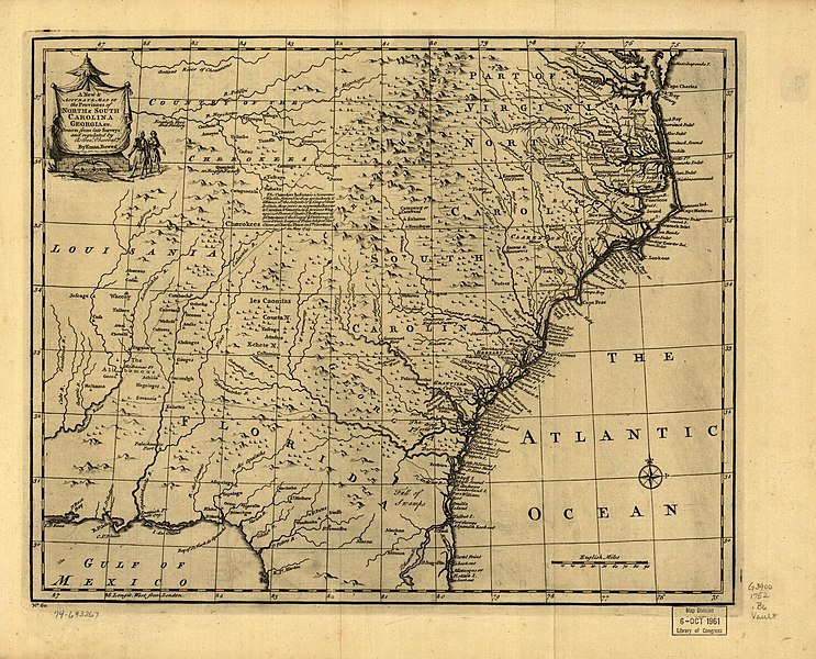
Summary
| Description |
English: Scale ca. 1:2,900,000. Relief shown pictorially. "No. 60." From the author (Bowen, Emanuel, -1767): A complete atlas or distinct view of the known world. [London, 1752] |
| Date | |
| Source |
U.S. Library of Congress https://www.loc.gov/resource/g3900.np000148/?r=0.065,0.271,0.574,0.202,0 |
| Author |
Bowen, Emanuel, -1767. Courtesy of Library of Congress, Geography and Map Division. |
Licensing
|
This work is in the public domain in its country of origin and other countries and areas where the copyright term is the author's life plus 70 years or fewer. This work is in the public domain in the United States because it was published (or registered with the U.S. Copyright Office) before January 1, 1929. | |
| This file has been identified as being free of known restrictions under copyright law, including all related and neighboring rights. | |
File history
Click on a date/time to view the file as it appeared at that time.
| Date/Time | Thumbnail | Dimensions | User | Comment | |
|---|---|---|---|---|---|
| current | 16:35, 23 October 2019 | | 1,466 × 1,183 (434 KB) | G. Moore | User created page with UploadWizard |
File usage
The following pages on the English Wikipedia use this file (pages on other projects are not listed):