


Size of this JPG preview of this TIF file: 800 × 576 pixels. Other resolutions: 320 × 230 pixels | 640 × 461 pixels | 1,024 × 737 pixels | 1,280 × 922 pixels | 2,560 × 1,843 pixels | 5,128 × 3,692 pixels.
Original file (5,128 × 3,692 pixels, file size: 18.06 MB, MIME type: image/tiff)
Summary
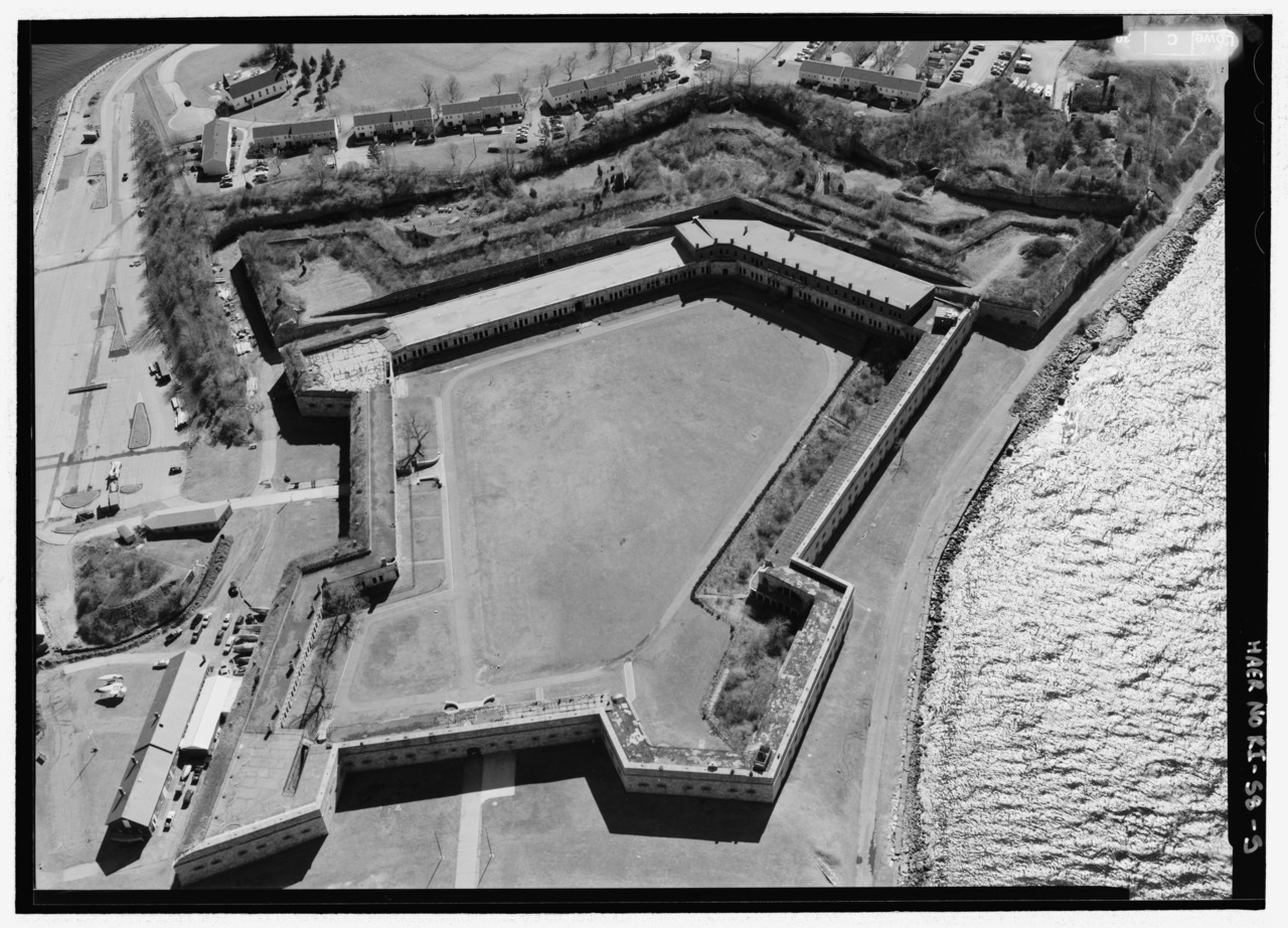
| Aerial view of Fort Adams. - Fort Hamilton, Rose Island, Newport, Newport County, RI | ||||
|---|---|---|---|---|
| Title |
Aerial view of Fort Adams. - Fort Hamilton, Rose Island, Newport, Newport County, RI |
|||
| Description |
de Tousard, Anne Louis; Rochefontaine, Stephen; U.S. Department of the Navy; U.S. Coast Guard; Lockett, Dana, field team; Croteau, Todd, project manager; Christianson, Justine, transmitter; Lowe, Jet, photographer; Johnson, Charlotte, historian. This photo shows only Fort Adams; it does not show Fort Hamilton or Rose Island. |
|||
| Depicted place | Rhode Island; Newport County; Newport | |||
| Date | Documentation compiled after 1968 | |||
| Dimensions | 5 x 7 in. | |||
| Current location |
Library of Congress Prints and Photographs Division Washington, D.C. 20540 USA http://hdl.loc.gov/loc.pnp/pp.print |
|||
| Accession number |
HAER RI-58-5 |
|||
| Credit line |
|
|||
| Notes |
|
|||
| References |
|
|||
| Source | https://www.loc.gov/pictures/item/ri0477.photos.203049p | |||
| Permission (Reusing this file) |
|
|||

| Object location | | View this and other nearby images on: OpenStreetMap |
|---|
File history
Click on a date/time to view the file as it appeared at that time.
| Date/Time | Thumbnail | Dimensions | User | Comment | |
|---|---|---|---|---|---|
| current | 22:34, 1 August 2014 |  | 5,128 × 3,692 (18.06 MB) | Fæ | GWToolset: Creating mediafile for Fæ. HABS 31 July 2014 (3000:3200) |
File usage
The following pages on the English Wikipedia use this file (pages on other projects are not listed):
Global file usage
The following other wikis use this file:
- Usage on fr.wikipedia.org