

No higher resolution available.
American_south_animated_map.gif (566 × 365 pixels, file size: 32 KB, MIME type: image/gif, looped, 7 frames, 22 s)
| Description |
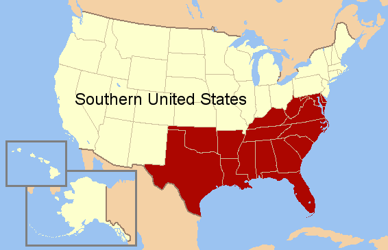
English: Animated map of the Southern United States. Discusses many different regions in this area. |
| Date | (UTC) |
| Source |
|
| Author |
|
I, the copyright holder of this work, hereby publish it under the following licenses:
| This file is licensed under the Creative Commons Attribution-Share Alike 3.0 Unported license. | ||
| ||
| This licensing tag was added to this file as part of the GFDL licensing update. |

|
Permission is granted to copy, distribute and/or modify this document under the terms of the GNU Free Documentation License, Version 1.2 or any later version published by the Free Software Foundation; with no Invariant Sections, no Front-Cover Texts, and no Back-Cover Texts. A copy of the license is included in the section entitled GNU Free Documentation License. |
You may select the license of your choice.
Original upload log
This image is a derivative work of the following images:
- File:US_map-South_Modern.png licensed with Cc-by-sa-3.0-migrated, GFDL
- 2010-06-13T22:20:50Z Ras67 566x365 (6186 Bytes) cropped
- 2007-07-15T15:01:30Z Lecter 572x371 (13768 Bytes) {{Information |Description= Based on GNU [[Image:US map-South.PNG]] |Source= [http://en.wikipedia.org/wiki/Image:US_map-South_Modern.png] |Date= |Author= [http://en.wikipedia.org/wiki/User:Astrokey44 User:Astrokey44] |Permiss
Uploaded with derivativeFX
File history
Click on a date/time to view the file as it appeared at that time.
| Date/Time | Thumbnail | Dimensions | User | Comment | |
|---|---|---|---|---|---|
| current | 01:08, 11 September 2011 | | 566 × 365 (32 KB) | Swarm | slow down animation |
| 00:57, 11 September 2011 |  | 566 × 365 (32 KB) | Swarm | {{Information |Description=Animated map of the Southern United States |Source=*File:US_map-South_Modern.png |Date=2011-09-11 00:56 (UTC) |Author=*File:US_map-South_Modern.png: [http://en.wikipedia.org/wiki/User:Astrokey44 User:Astrokey44] *der |
File usage
The following pages on the English Wikipedia use this file (pages on other projects are not listed):
Global file usage
The following other wikis use this file:
- Usage on fa.wikipedia.org
- Usage on it.wikipedia.org