

Size of this preview: 780 × 599 pixels. Other resolutions: 312 × 240 pixels | 625 × 480 pixels | 1,000 × 768 pixels | 1,280 × 984 pixels | 2,168 × 1,666 pixels.
Original file (2,168 × 1,666 pixels, file size: 351 KB, MIME type: image/png)
|
This is an image of a place or building that is listed on the National Register of Historic Places in the United States of America. Its reference number is 80000363. |
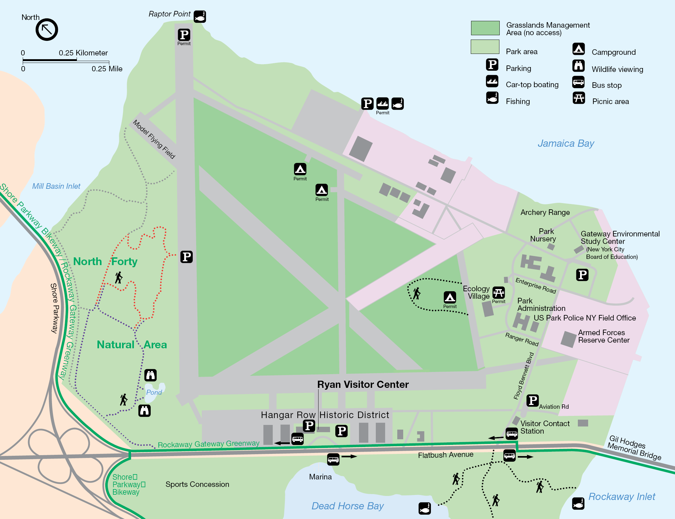
1998 map from brochure for Floyd Bennett Field; converted from this PDF file found on this page of the National Park Service web site.
| This image or media file contains material based on a work of a National Park Service employee, created as part of that person's official duties. As a work of the U.S. federal government, such work is in the public domain in the United States. See the NPS website and NPS copyright policy for more information. |
| Object location | | View this and other nearby images on: OpenStreetMap |
|---|
File history
Click on a date/time to view the file as it appeared at that time.
| Date/Time | Thumbnail | Dimensions | User | Comment | |
|---|---|---|---|---|---|
| current | 08:46, 18 August 2005 | | 2,168 × 1,666 (351 KB) | Pharos |
File usage
The following pages on the English Wikipedia use this file (pages on other projects are not listed):
Global file usage
The following other wikis use this file:
- Usage on ceb.wikipedia.org
- Usage on de.wikipedia.org
- Usage on es.wikipedia.org
- Usage on fr.wikipedia.org
- Usage on it.wikipedia.org
- Usage on no.wikipedia.org
- Usage on www.wikidata.org