


Size of this preview: 537 × 600 pixels. Other resolutions: 215 × 240 pixels | 430 × 480 pixels | 688 × 768 pixels | 917 × 1,024 pixels | 1,620 × 1,809 pixels.
Original file (1,620 × 1,809 pixels, file size: 110 KB, MIME type: image/jpeg)
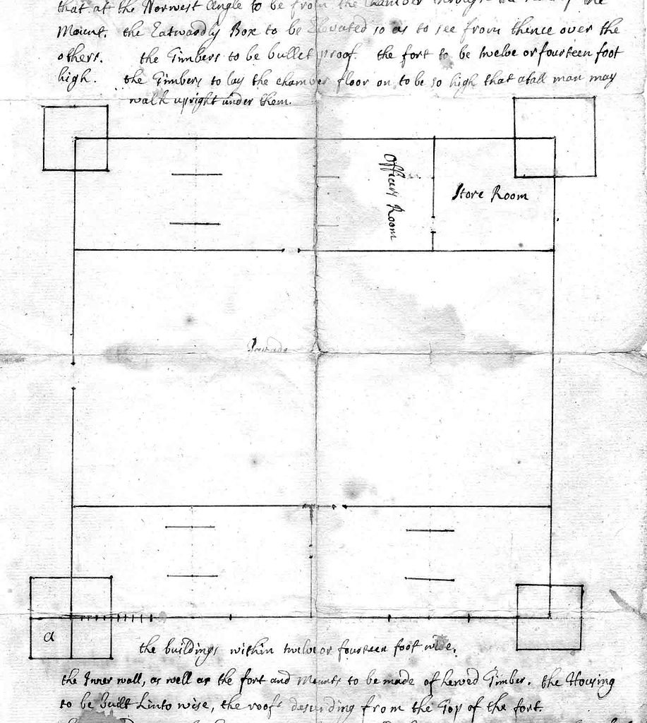
Summary
| Description | Letter containing a plan for Fort Dummer, in the southeastern corner of what is now Vermont. |
| Date | |
| Source | VHist.com: http://www.vhist.com/vtbrattleboro/maps/2-equivalent-lands-and-fort-dummer/ |
| Author | Thomas Stoddard |
Licensing
|
This is a faithful photographic reproduction of a two-dimensional, public domain work of art. The work of art itself is in the public domain for the following reason:
The official position taken by the Wikimedia Foundation is that "faithful reproductions of two-dimensional public domain works of art are public domain".
This photographic reproduction is therefore also considered to be in the public domain in the United States. In other jurisdictions, re-use of this content may be restricted; see Reuse of PD-Art photographs for details. |


File history
Click on a date/time to view the file as it appeared at that time.
| Date/Time | Thumbnail | Dimensions | User | Comment | |
|---|---|---|---|---|---|
| current | 00:48, 17 March 2013 | | 1,620 × 1,809 (110 KB) | Magicpiano | {{Information |Description=Letter containing a plan for w:Fort Dummer, in the southeastern corner of what is now Vermont. |Source=VHist.com: http://www.vhist.com/vtbrattleboro/maps/2-equivalent-lands-and-fort-dummer/ |Date=1724 |Author=Thomas Stod... |
File usage
The following pages on the English Wikipedia use this file (pages on other projects are not listed):
Global file usage
The following other wikis use this file:
- Usage on he.wikipedia.org
- Usage on ja.wikipedia.org
- Usage on ru.wikipedia.org
- Usage on www.wikidata.org