

Size of this JPG preview of this PDF file: 776 × 600 pixels. Other resolutions: 311 × 240 pixels | 621 × 480 pixels | 994 × 768 pixels | 1,280 × 989 pixels | 1,650 × 1,275 pixels.
Original file (1,650 × 1,275 pixels, file size: 899 KB, MIME type: application/pdf)
Summary
| Description |
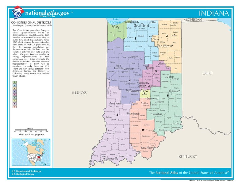
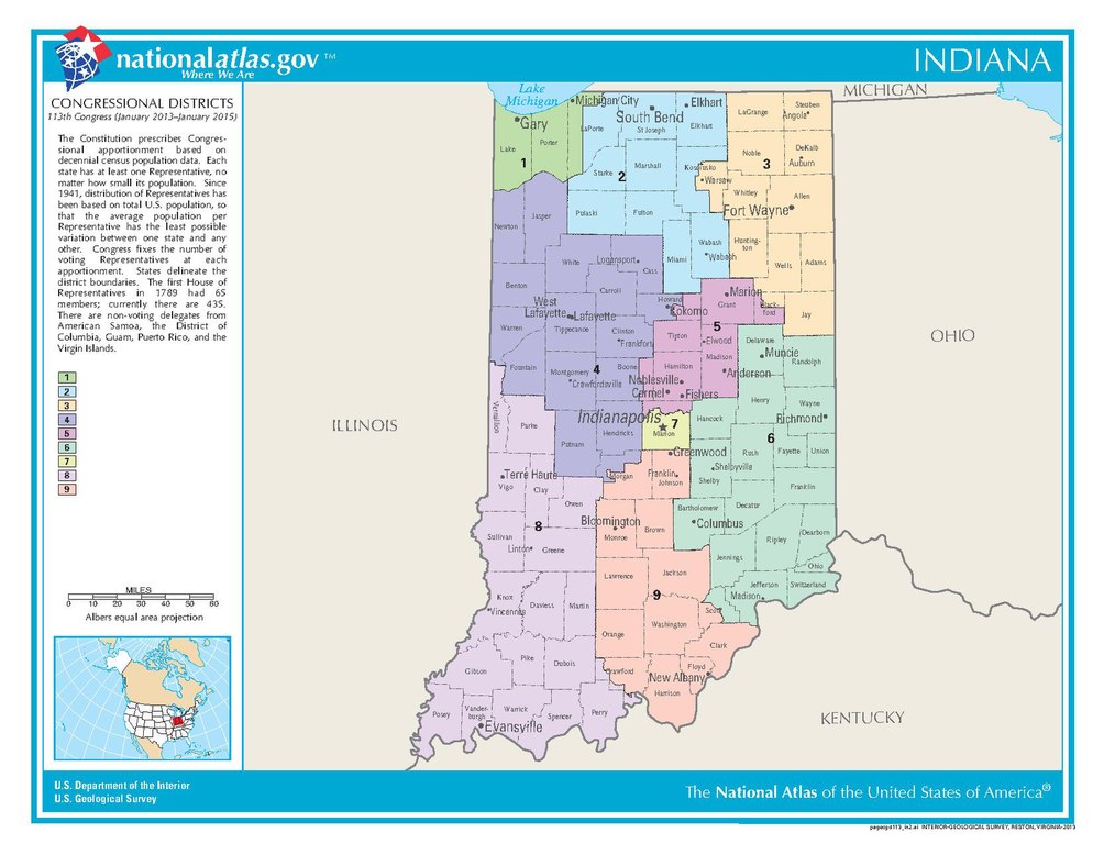
English: U.S. congressional districts in Indiana, 2013-2023 |
| Date | |
| Source | http://nationalatlas.gov/printable/images/pdf/congdist/pagecgd113_in.pdf |
| Author | U.S. Geological Survey, U.S. Dept. of the Interior |
Licensing
This map was obtained from an edition of the National Atlas of the United States. Like almost all works of the U.S. federal government, works from the National Atlas are in the public domain in the United States.
Online access: NationalAtlas.gov | 1970 print edition: Library of Congress, Perry-Castañeda Library
|
File history
Click on a date/time to view the file as it appeared at that time.
| Date/Time | Thumbnail | Dimensions | User | Comment | |
|---|---|---|---|---|---|
| current | 13:29, 20 December 2013 | 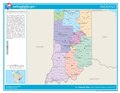 | 1,650 × 1,275 (899 KB) | GoldRingChip | User created page with UploadWizard |
File usage
No pages on the English Wikipedia use this file (pages on other projects are not listed).
Global file usage
The following other wikis use this file:
- Usage on fa.wikipedia.org
- Usage on fr.wikipedia.org
- Usage on it.wikipedia.org
- Usage on ru.wikipedia.org
- Usage on uk.wikipedia.org
- Usage on zh.wikipedia.org