

Original file (900 × 511 pixels, file size: 79 KB, MIME type: image/jpeg)
Summary
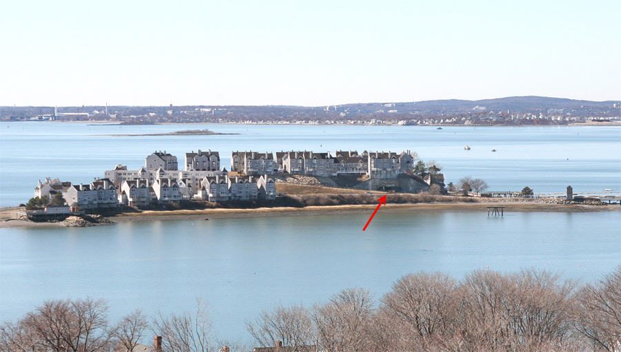
This image, taken in 2010, looks westerly from the top of the tall fire control tower on Pt. Allerton in Hull, MA toward Spinnaker Island. Formerly known as Hog Island, the site of Fort Duvall (1920-1947), it was purchased by a developer and almost totally covered with condominiums. The arrow points to the surviving casemate for one of the huge 16-inch coast defense guns of the fort, now used for parking. It is reported that the developer had such a difficult time demolishing the first of the two casemates that he let this one remain, intact. The coastline beyond the island is Quincy. A low bridge connecting the island to Hull is just out of the image, to the right.
Licensing
File history
Click on a date/time to view the file as it appeared at that time.
| Date/Time | Thumbnail | Dimensions | User | Comment | |
|---|---|---|---|---|---|
| current | 18:09, 12 July 2010 | | 900 × 511 (79 KB) | Pgrig (talk | contribs) | This image, taken in 2010, looks westerly from the top of the tall fire control tower on Pt. Allerton in Hull, MA toward Spinnaker Island. Formerly known as Hog Island, the site of Fort Duvall (1920-1947), it was purchased by a developer and almost totall |
You cannot overwrite this file.