


Size of this preview: 725 × 599 pixels. Other resolutions: 290 × 240 pixels | 581 × 480 pixels | 929 × 768 pixels | 1,224 × 1,012 pixels.
Original file (1,224 × 1,012 pixels, file size: 1.81 MB, MIME type: image/png)
Summary
| Description |
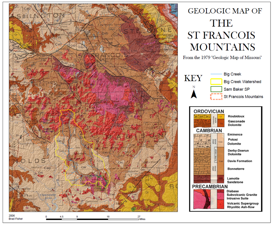
English: Map of the geology of the St. Francois Mountains in Missouri. |
| Date | |
| Source | Own work |
| Author | Tiercel76 |
| Permission (Reusing this file) |
No |
map near Ironton, Missouri
Licensing
| I, the copyright holder of this work, release this work into the public domain. This applies worldwide. In some countries this may not be legally possible; if so: I grant anyone the right to use this work for any purpose, without any conditions, unless such conditions are required by law. |
File history
Click on a date/time to view the file as it appeared at that time.
| Date/Time | Thumbnail | Dimensions | User | Comment | |
|---|---|---|---|---|---|
| current | 18:34, 13 May 2009 | | 1,224 × 1,012 (1.81 MB) | Tiercel76~commonswiki | {{Information |Description={{en|1=Map of the geology of the St. Francois Mountains in Missouri.}} |Source=Own work by uploader |Author=Tiercel76 |Date=2006 |Permission=No |other_versions=No }} map near Ironton, Missouri <!--{{ImageUploa |
File usage
The following pages on the English Wikipedia use this file (pages on other projects are not listed):
Global file usage
The following other wikis use this file:
- Usage on ru.wikipedia.org