

Mulford is a Census-designated place (CDP) in and governed by Garfield County, Colorado, United States. The CDP is a part of the Glenwood Springs, CO Micropolitan Statistical Area. The population of the Mulford CDP was 259 at the United States Census 2020.[3] The Carbondale post office (Zip Code 81623) serves the area.[4]
Geography
Mulford is located in southeastern Garfield County, in the Roaring Fork River valley. It is bordered to the east by Catherine. Colorado State Highway 82 forms the northern edge of the Mulford CDP, leading northwest 14 miles (23 km) to Glenwood Springs, the county seat, and southeast 27 miles (43 km) to Aspen. The town of Carbondale is 3 miles (5 km) to the west.
The Mulford CDP has an area of 428 acres (1.731 km2), all land.[1]
Demographics
| Year | Pop. | ±% |
|---|---|---|
| 2010 | 174 | — |
| 2020 | 259 | +48.9% |
| Source: United States Census Bureau | ||
The United States Census Bureau initially defined the Mulford CDP for the United States Census 2010.
See also
References
- ^ a b c "State of Colorado Census Designated Places - BAS20 - Data as of January 1, 2020". United States Census Bureau. Retrieved December 22, 2020.
- ^ a b c U.S. Geological Survey Geographic Names Information System: Mulford, Colorado
- ^ a b United States Census Bureau. "Mulford CDP, Colorado". Retrieved April 10, 2023.
- ^ a b "Zip Code 81623 Map and Profile". zipdatamaps.com. 2020. Retrieved December 22, 2020.
External links
Municipalities and communities of Garfield County, Colorado, United States | ||
|---|---|---|
| Cities | 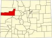 | |
| Towns | ||
| CDPs | ||
| Unincorporated communities | ||
| Ghost town | ||