


Size of this preview: 800 × 577 pixels. Other resolutions: 320 × 231 pixels | 640 × 461 pixels | 939 × 677 pixels.
Original file (939 × 677 pixels, file size: 126 KB, MIME type: image/jpeg)
| Description |
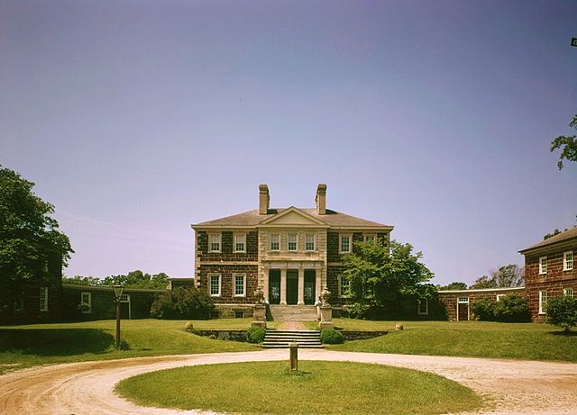
English: Mount Airy, State Route 646 vicinity, Warsaw vicinity, Richmond, VA. NORTHEAST FACADE. (Color corrected) |
|||||
| Date | ||||||
| Source |
Historic American Buildings Survey,Library of Congress, Prints & Photographs Division, HABS [or HAER or HALS], Reproduction number "HABS VA,80-WAR.V,4-44"
|
|||||
| Author | Jack E. Boucher | |||||
| Permission (Reusing this file) |
|
|||||
| Other versions |
 |


File history
Click on a date/time to view the file as it appeared at that time.
| Date/Time | Thumbnail | Dimensions | User | Comment | |
|---|---|---|---|---|---|
| current | 00:13, 18 November 2010 | | 939 × 677 (126 KB) | Altairisfar | {{Information |Description={{en|Mount Airy, State Route 646 vicinity, Warsaw vicinity, Richmond, VA. NORTHEAST FACADE. (Color corrected)}} |Source=Historic American Buildings Survey,Library of Congress, Prints & Photographs Division, HABS [or HAER or HALS |
File usage
The following pages on the English Wikipedia use this file (pages on other projects are not listed):
Global file usage
The following other wikis use this file:
- Usage on da.wikipedia.org
- Usage on fr.wikipedia.org
- Usage on lt.wikipedia.org
- Usage on www.wikidata.org