

Size of this preview: 750 × 600 pixels. Other resolutions: 300 × 240 pixels | 600 × 480 pixels | 961 × 768 pixels | 1,280 × 1,023 pixels | 2,560 × 2,047 pixels | 2,769 × 2,214 pixels.
Original file (2,769 × 2,214 pixels, file size: 1.54 MB, MIME type: image/jpeg)
| Description |
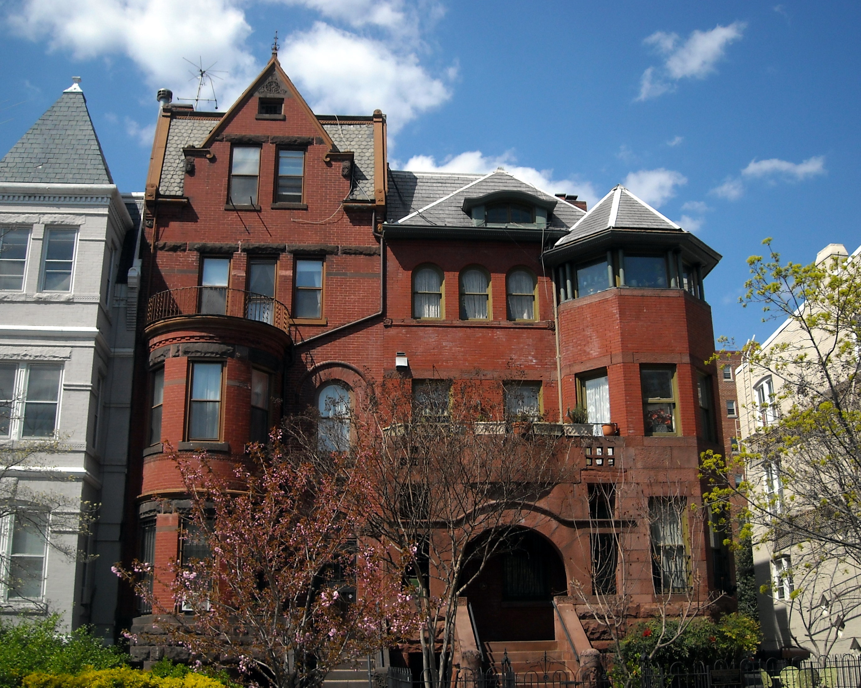
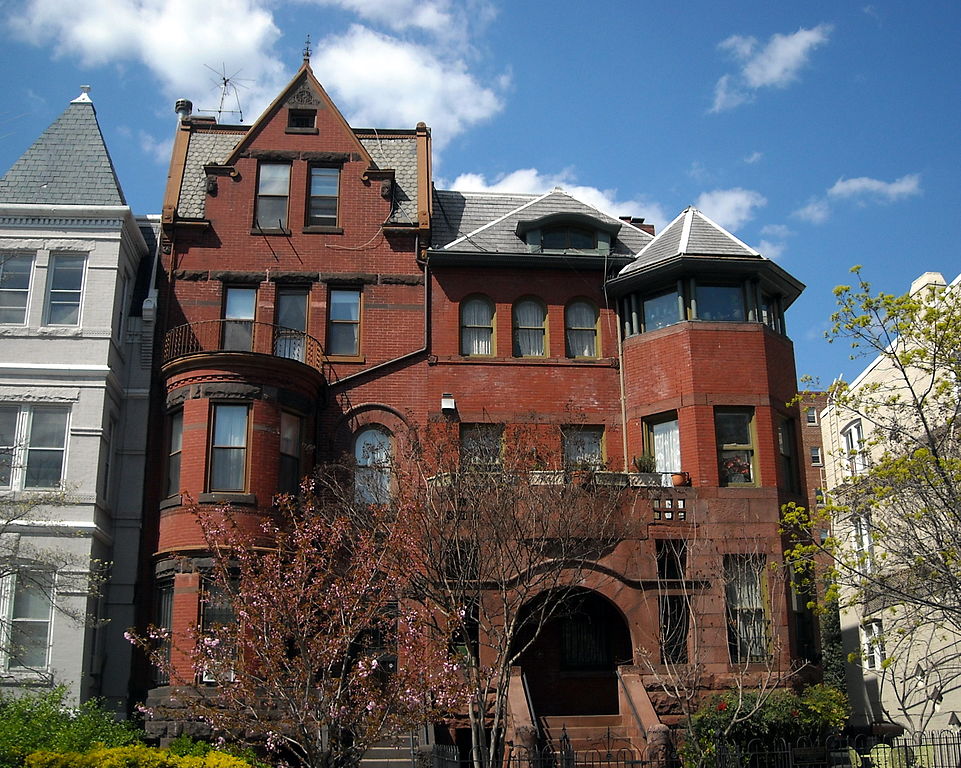
English: Homes located at 1628 (left) and 1630 (right) 19th Street NW in the Dupont Circle neighborhood of Washington, D.C. The buildings are contributing properties to the Dupont Circle Historic District, listed on the National Register of Historic Places in 1978. Previous occupants of 1628 19th Street NW, built in 1891 and designed by architect George S. Cooper, include Medical Director of the Navy Dr. Frank Anderson, Attorney General of Alabama William C. Fitts, attorney and Reporter of Decisions of the Supreme Court Charles Henry Butler, Solicitor of the Treasury Felix A. Reeve, Medal of Honor recipient Admiral William A. Moffett, Fannie L. Ricketts (widow of General James B. Ricketts), and Brigadier General Nelson B. Sweitzer. Previous occupants of 1630 19th Street NW, built around 1892 and designed by architect Clarence L. Harding, include Oklahoma Representative Alice Mary Robertson, treasurer of Southern Railway Harrie C. Ansley, and Adolph C. Miller's private secretary D.C. Elliott. |
| Date | |
| Source | Own work |
| Author | AgnosticPreachersKid |
| Permission (Reusing this file) |
I, the copyright holder of this work, hereby publish it under the following license: This file is licensed under the Creative Commons Attribution-Share Alike 4.0 International license.
|
| Camera location | | View this and other nearby images on: OpenStreetMap |
|---|
File history
Click on a date/time to view the file as it appeared at that time.
| Date/Time | Thumbnail | Dimensions | User | Comment | |
|---|---|---|---|---|---|
| current | 12:01, 2 September 2009 | | 2,769 × 2,214 (1.54 MB) | APK | {{Information |Description={{en|1=The Romanesque Revival building located at 1630 19th Street, NW in the Dupont Circle neighborhood of [[:e |
File usage
The following pages on the English Wikipedia use this file (pages on other projects are not listed):
Global file usage
The following other wikis use this file:
- Usage on fr.wikipedia.org
- Usage on no.wikipedia.org
- Usage on pt.wikipedia.org
- Usage on uk.wikipedia.org