

Size of this preview: 800 × 468 pixels. Other resolutions: 320 × 187 pixels | 640 × 375 pixels | 1,240 × 726 pixels.
Original file (1,240 × 726 pixels, file size: 99 KB, MIME type: image/jpeg)
Summary
| Description |
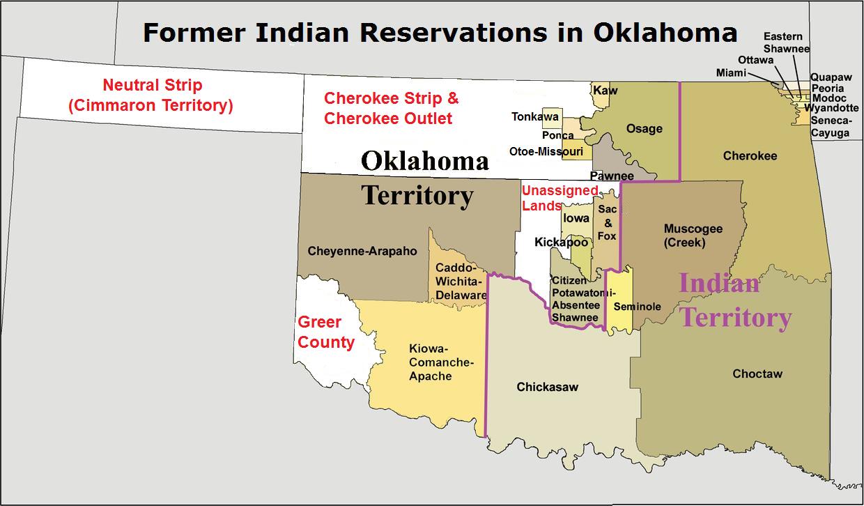
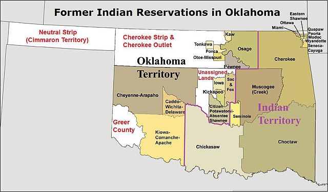
English: Map showing "Former Indian Reservations in Oklahoma" as originally defined In 1998 by the IRS issued Notice 98-45 |
| Date | |
| Source | File:Okterritory.png |
| Author | Kmusser |
Licensing
This file is licensed under the Creative Commons Attribution-Share Alike 3.0 Unported license.
- You are free:
- to share – to copy, distribute and transmit the work
- to remix – to adapt the work
- Under the following conditions:
- attribution – You must give appropriate credit, provide a link to the license, and indicate if changes were made. You may do so in any reasonable manner, but not in any way that suggests the licensor endorses you or your use.
- share alike – If you remix, transform, or build upon the material, you must distribute your contributions under the same or compatible license as the original.
| Annotations | This image is annotated: View the annotations at Commons |
File history
Click on a date/time to view the file as it appeared at that time.
| Date/Time | Thumbnail | Dimensions | User | Comment | |
|---|---|---|---|---|---|
| current | 16:22, 26 January 2013 | | 1,240 × 726 (99 KB) | Gbbinning | User created page with UploadWizard |
File usage
The following pages on the English Wikipedia use this file (pages on other projects are not listed):
Global file usage
The following other wikis use this file:
- Usage on ca.wikipedia.org
- Usage on it.wikipedia.org