

Size of this preview: 800 × 592 pixels. Other resolutions: 320 × 237 pixels | 640 × 474 pixels | 1,024 × 758 pixels | 1,280 × 947 pixels | 2,560 × 1,895 pixels | 4,433 × 3,281 pixels.
Original file (4,433 × 3,281 pixels, file size: 3.26 MB, MIME type: image/jpeg)
Summary
| Description |
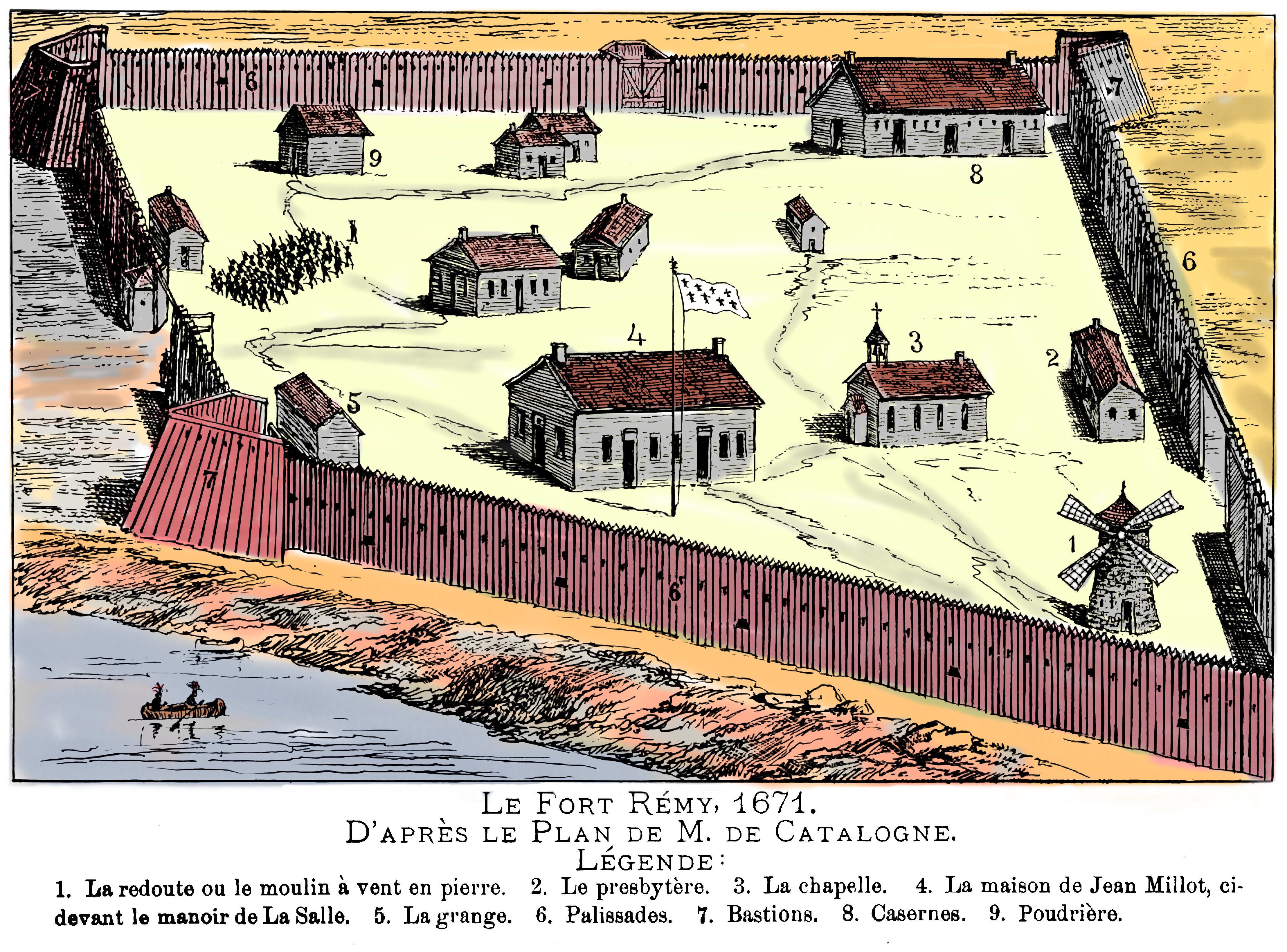
Français : Le Fort Rémy, 1671. D'après le plan de M. De Catalogne. 1. La redoute ou le moulin à vent en pierre. 2. Le presbytère. 3. La Chapelle. 4. La maison de Jean Millot, ci-devant le manoir de La Salle. 5. La grange. 6. Palissades. 7. Bastions. 8. Casernes. 9. Poudrière. English: Fort Remy in Lachine (Montreal) in 1671. |
| Date | |
| Source |
https://books.google.ca/books?id=X18vAAAAYAAJ Éditeur Gebhardt-Berthiaume, 1889 Original provenant de Université de Harvard |
| Author | Tiré d'un livre de Désiré Girouard, publié en 1889. |
Licensing
|
This work is in the public domain in its country of origin and other countries and areas where the copyright term is the author's life plus 70 years or fewer. This work is in the public domain in the United States because it was published (or registered with the U.S. Copyright Office) before January 1, 1929. | |
| This file has been identified as being free of known restrictions under copyright law, including all related and neighboring rights. | |
| Camera location | | View this and other nearby images on: OpenStreetMap |
|---|
File history
Click on a date/time to view the file as it appeared at that time.
| Date/Time | Thumbnail | Dimensions | User | Comment | |
|---|---|---|---|---|---|
| current | 01:33, 19 November 2014 | | 4,433 × 3,281 (3.26 MB) | Pierre5018 | User created page with UploadWizard |
File usage
The following pages on the English Wikipedia use this file (pages on other projects are not listed):
Global file usage
The following other wikis use this file:
- Usage on fr.wikipedia.org
- Usage on sv.wikipedia.org