

Size of this preview: 464 × 599 pixels. Other resolutions: 186 × 240 pixels | 372 × 480 pixels | 595 × 768 pixels | 1,275 × 1,646 pixels.
Original file (1,275 × 1,646 pixels, file size: 1.31 MB, MIME type: image/png)
Summary
| Description |
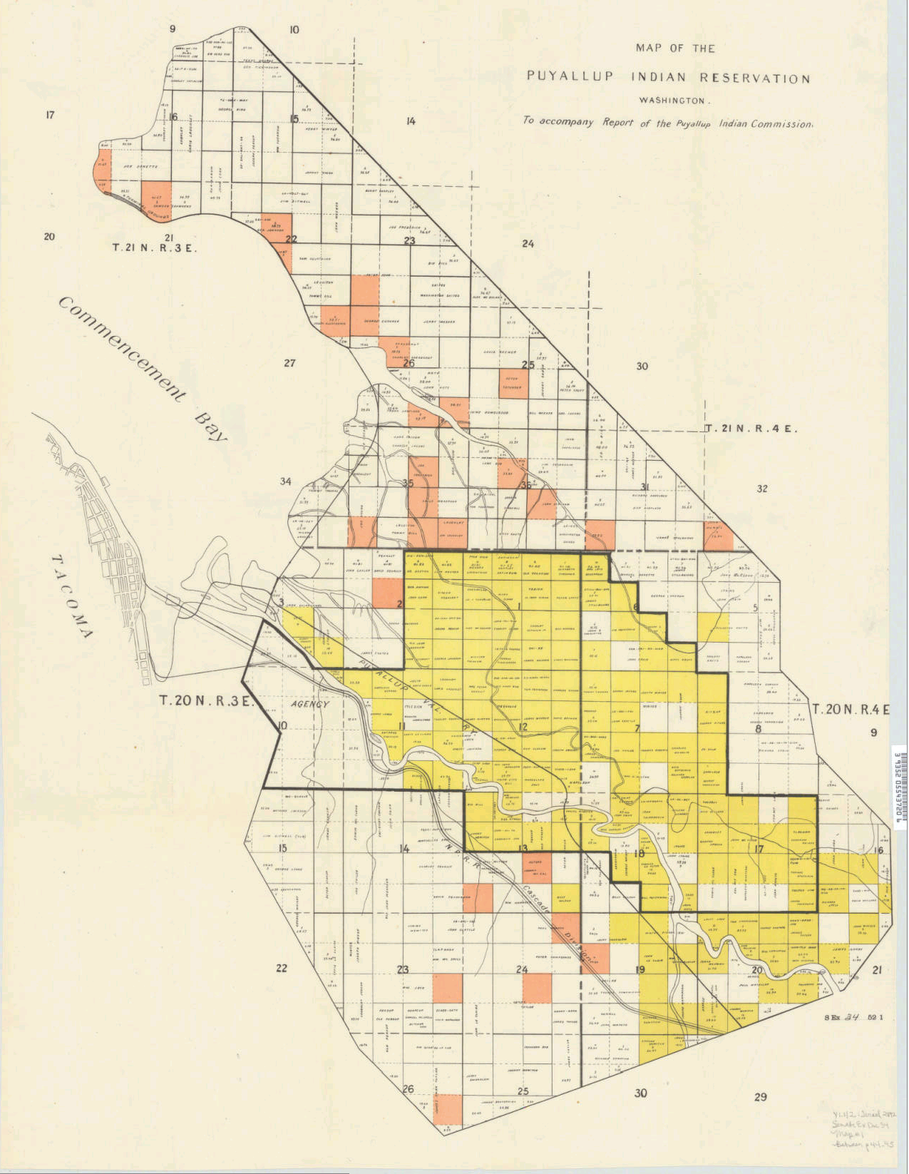
English: Message from the President of the United States, transmitting the report of the Puyallup Indian Commission and accompanying papers. Washington : G.P.O., 1892. (Ex. Doc. / 52d Congress, 1st Session, Senate ; no. 34). Removed from: Executive documents of the Senate of the United States for the first session of the fifty-second Congress, 1891-'92
Color cadastral map of the Puyallup Indian Reservation, indicating land ownership and acreage of plots. Divided into sixteenth sections. Includes creeks and railroads. Township range is given. Also includes part of Commencement Bay and Tacoma. Indexed in: CIS US serial set index, pt. 14, 2892 (52-1) S.exdoc. 34, map 1. Scale ca. 1:22,500 |
| Date | |
| Source | via University of Washington/Washington State University Digital Collections http://content.libraries.wsu.edu/cdm/singleitem/collection/maps/id/219 |
| Author | President of the United States, transmitting the report of the Puyallup Indian Commission |
Licensing
This file is a work of an employee of the Executive Office of the President of the United States, taken or made as part of that person's official duties. As a work of the U.S. federal government, it is in the public domain.
|
 |
File history
Click on a date/time to view the file as it appeared at that time.
| Date/Time | Thumbnail | Dimensions | User | Comment | |
|---|---|---|---|---|---|
| current | 03:13, 17 February 2017 | | 1,275 × 1,646 (1.31 MB) | Bri | User created page with UploadWizard |
File usage
The following pages on the English Wikipedia use this file (pages on other projects are not listed):