

The Grand Mesa National Scenic Byway is a 63-mile (101 km) National Scenic Byway, National Forest Scenic Byway, and Colorado Scenic and Historic Byway located in Delta and Mesa counties, Colorado, USA. The byway traverses Grand Mesa, the most extensive flat-topped mountain on Earth, and reaches an elevation of 10,849 feet (3,307 m). The byway comprises Colorado State Highway 65 from Cedaredge to Interstate 70 Exit 49 and Forest Service Road 100 to the Land's End Observatory.
Route
Gallery
-

-
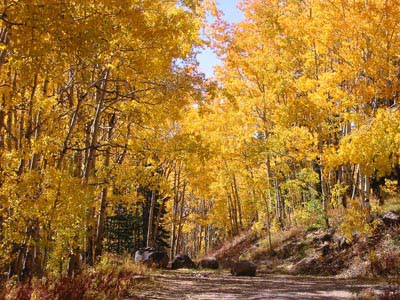 Aspen in autumn color change on the Grand Mesa National Scenic Byway
 -


See also
Notes
References
- ^ "Grand Mesa". Colorado Department of Transportation. 2021. Retrieved March 28, 2022.
- ^ "Grand Mesa Scenic and Historic Byway". America's Scenic Byways. Retrieved April 7, 2022.
External links
KML is not from Wikidata
- America's Byways
- America's Scenic Byways: Colorado
- Colorado Department of Transportation
- Colorado Tourism Office
- History Colorado
- National Forest Scenic Byways