


Size of this preview: 800 × 600 pixels. Other resolutions: 320 × 240 pixels | 640 × 480 pixels | 1,024 × 768 pixels | 1,280 × 960 pixels | 2,016 × 1,512 pixels.
Original file (2,016 × 1,512 pixels, file size: 1.61 MB, MIME type: image/jpeg)
Summary
| Description |
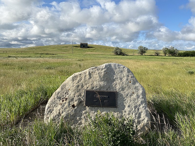
English: Comertown Historic District The Dakota, Missouri Valley and Western Railroad, later operated by The Soo Line, arrived in this area in 1913. George Onstad purchased building lots from W. W. Comer at that time. The Postal Service approved the town name in 1915. There was civic and business activity until 1957, when the post office closed and 1959, when the Lutheran Church was moved. There are no current residents as of this writing. There is one maintained structure in the townsite.
|
||
| Date | |||
| Source | Own work | ||
| Author | Jon Roanhaus |
| Camera location | | View this and other nearby images on: OpenStreetMap |
|---|
Licensing
I, the copyright holder of this work, hereby publish it under the following license:
This file is licensed under the Creative Commons Attribution-Share Alike 4.0 International license.
- You are free:
- to share – to copy, distribute and transmit the work
- to remix – to adapt the work
- Under the following conditions:
- attribution – You must give appropriate credit, provide a link to the license, and indicate if changes were made. You may do so in any reasonable manner, but not in any way that suggests the licensor endorses you or your use.
- share alike – If you remix, transform, or build upon the material, you must distribute your contributions under the same or compatible license as the original.
File history
Click on a date/time to view the file as it appeared at that time.
| Date/Time | Thumbnail | Dimensions | User | Comment | |
|---|---|---|---|---|---|
| current | 00:32, 7 August 2022 | | 2,016 × 1,512 (1.61 MB) | Jon Roanhaus | Uploaded own work with UploadWizard |
File usage
The following pages on the English Wikipedia use this file (pages on other projects are not listed):