


Size of this preview: 800 × 465 pixels. Other resolutions: 320 × 186 pixels | 640 × 372 pixels | 1,024 × 595 pixels | 1,280 × 743 pixels | 1,870 × 1,086 pixels.
Original file (1,870 × 1,086 pixels, file size: 1.39 MB, MIME type: image/jpeg)
Summary
| Description |
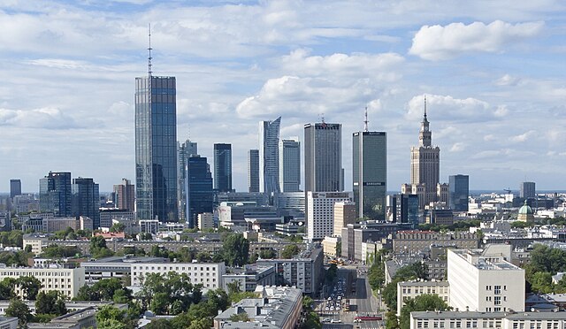
Polski: Widok na aleję Niepodległości w Warszawie z powietrza w kierunku północnym na odcinek pomiędzy skrzyżowaniem z Trasą Łazienkowską (ul. Wawelska / al. Armii Ludowej) a Koszykową. W tle wysoka zabudowa centrum. |
| Date | |
| Source | Own work |
| Author | Emptywords |
| Other versions |

| Camera location | | View this and other nearby images on: OpenStreetMap |
|---|
.jpg¶ms=052.215946_N_0021.005172_E_globe:Earth_type:camera__&language=en)
Licensing
I, the copyright holder of this work, hereby publish it under the following license:
This file is licensed under the Creative Commons Attribution-Share Alike 4.0 International license.
- You are free:
- to share – to copy, distribute and transmit the work
- to remix – to adapt the work
- Under the following conditions:
- attribution – You must give appropriate credit, provide a link to the license, and indicate if changes were made. You may do so in any reasonable manner, but not in any way that suggests the licensor endorses you or your use.
- share alike – If you remix, transform, or build upon the material, you must distribute your contributions under the same or compatible license as the original.
File history
Click on a date/time to view the file as it appeared at that time.
| Date/Time | Thumbnail | Dimensions | User | Comment | |
|---|---|---|---|---|---|
| current | 19:57, 2 April 2023 | | 1,870 × 1,086 (1.39 MB) | Schläger4 | File:Aleja Niepdlegosci Warsaw 2022 aerial.jpg cropped 47 % horizontally, 59 % vertically using CropTool with lossless mode. |
File usage
The following pages on the English Wikipedia use this file (pages on other projects are not listed):
Global file usage
The following other wikis use this file:
- Usage on bn.wikipedia.org
- Usage on bs.wikipedia.org
- Usage on cs.wikipedia.org
- Usage on de.wikipedia.org
- Usage on el.wikipedia.org
- Usage on es.wikipedia.org
- Usage on fr.wikipedia.org
- Usage on it.wikipedia.org
- Usage on ja.wikipedia.org
- Usage on ko.wikipedia.org
- Usage on lv.wikipedia.org
- Usage on pl.wikipedia.org
- Usage on ru.wikipedia.org
- Usage on sd.wikipedia.org
- Usage on simple.wikipedia.org
- Usage on sk.wikipedia.org
- Usage on sl.wikipedia.org
- Usage on tr.wikipedia.org
- Usage on uk.wikipedia.org
- Usage on vi.wikipedia.org
.jpg)