


Size of this preview: 800 × 591 pixels. Other resolutions: 320 × 236 pixels | 640 × 473 pixels | 1,024 × 756 pixels | 1,280 × 945 pixels | 2,560 × 1,891 pixels | 3,893 × 2,875 pixels.
Original file (3,893 × 2,875 pixels, file size: 3.16 MB, MIME type: image/jpeg)
Summary
| Description |
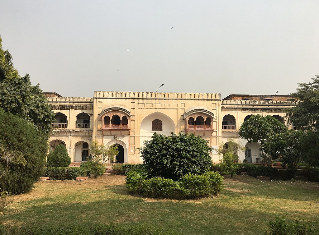
English: Ghaziuddin Khan Madrasa and Tomb; Madarasa Ghazi-ud-din has a rather lively history from the time it was built in the late-seventeenth century. It was a school for religious instruction until 1829 when English education and modern sciences were introduced and its name changed to Anglo-Arabic College. Later in the nineteenth century the school was re-named Delhi College.
|
||
| Date | |||
| Source | Own work | ||
| Author | Rashid Jorvee |
| Camera location | | View this and other nearby images on: OpenStreetMap |
|---|
Licensing
I, the copyright holder of this work, hereby publish it under the following license:
This file is licensed under the Creative Commons Attribution-Share Alike 4.0 International license.
- You are free:
- to share – to copy, distribute and transmit the work
- to remix – to adapt the work
- Under the following conditions:
- attribution – You must give appropriate credit, provide a link to the license, and indicate if changes were made. You may do so in any reasonable manner, but not in any way that suggests the licensor endorses you or your use.
- share alike – If you remix, transform, or build upon the material, you must distribute your contributions under the same or compatible license as the original.

|
This image was uploaded as part of Wiki Loves Monuments 2018.
|
 |
File history
Click on a date/time to view the file as it appeared at that time.
| Date/Time | Thumbnail | Dimensions | User | Comment | |
|---|---|---|---|---|---|
| current | 12:41, 10 August 2022 | | 3,893 × 2,875 (3.16 MB) | FacetsOfNonStickPans | Cropped 3 % horizontally, 5 % vertically, rotated 1.62° using CropTool with precise mode. |
| 17:33, 17 September 2018 |  | 4,032 × 3,024 (3.05 MB) | Rashid Jorvee | User created page with UploadWizard |
File usage
The following pages on the English Wikipedia use this file (pages on other projects are not listed):
Global file usage
The following other wikis use this file:
- Usage on bs.wikipedia.org