


Size of this preview: 800 × 494 pixels. Other resolutions: 320 × 198 pixels | 640 × 396 pixels | 1,024 × 633 pixels | 1,280 × 791 pixels | 2,560 × 1,582 pixels | 3,872 × 2,393 pixels.
Original file (3,872 × 2,393 pixels, file size: 4.07 MB, MIME type: image/jpeg)
Summary
| Description |
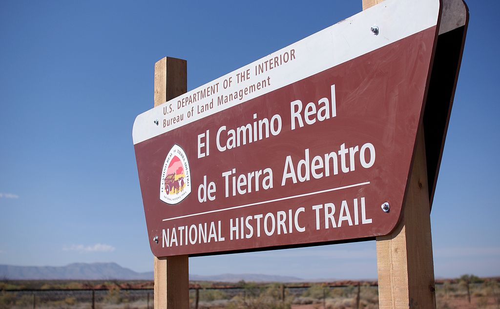
The Yost Escarpment Trailhead sign, just off of Upham Road east of Truth or Consequences, New Mexico, and a mile south of Spaceport America. The El Camino Real de Tierra Adentro (Spanish for "The Royal Road of the Interior Land") is an ancient travel route between Santa Fe and Mexico City, whose use started in the late 16th century. The portion that travels through New Mexico passes through an arid desert known as the Jornada del Muerto (Spanish for "Journey of the Dead Man"), within which was recently created a National Historic Trail. Portions of this trail are open for hiking. |
| Date | |
| Source |
El Camino Real de Tierra Adentro National Historic Trail
|
| Author | Samat Jain from New York City, USA |
| Camera location | | View this and other nearby images on: OpenStreetMap |
|---|
Licensing
This file is licensed under the Creative Commons Attribution-Share Alike 2.0 Generic license.
- You are free:
- to share – to copy, distribute and transmit the work
- to remix – to adapt the work
- Under the following conditions:
- attribution – You must give appropriate credit, provide a link to the license, and indicate if changes were made. You may do so in any reasonable manner, but not in any way that suggests the licensor endorses you or your use.
- share alike – If you remix, transform, or build upon the material, you must distribute your contributions under the same or compatible license as the original.
| This image, originally posted to Flickr, was reviewed on March 16, 2012 by the administrator or reviewer File Upload Bot (Magnus Manske), who confirmed that it was available on Flickr under the stated license on that date. |
File history
Click on a date/time to view the file as it appeared at that time.
| Date/Time | Thumbnail | Dimensions | User | Comment | |
|---|---|---|---|---|---|
| current | 13:58, 16 March 2012 | | 3,872 × 2,393 (4.07 MB) | File Upload Bot (Magnus Manske) | {{Information |Description=The Yost Escarpment Trailhead sign, just off of Upham Road east of Truth or Consequences, New Mexico, and a mile south of Spaceport America. The [http://en.wikipedia.org/wiki/El_Camino_Real_de_Tierra_Adentro El Camino Real d... |
File usage
The following pages on the English Wikipedia use this file (pages on other projects are not listed):
Global file usage
The following other wikis use this file:
- Usage on de.wikipedia.org
- Usage on en.wikivoyage.org
- Usage on es.wikipedia.org
- Usage on he.wikipedia.org
- Usage on hr.wikipedia.org
- Usage on it.wikivoyage.org
- Usage on ja.wikipedia.org
- Usage on mt.wikipedia.org
- Usage on no.wikipedia.org
- Usage on pnb.wikipedia.org
- Usage on tr.wikipedia.org
- Usage on ur.wikipedia.org