


Size of this preview: 800 × 600 pixels. Other resolutions: 320 × 240 pixels | 640 × 480 pixels | 1,024 × 768 pixels | 1,280 × 960 pixels | 2,560 × 1,920 pixels | 2,816 × 2,112 pixels.
Original file (2,816 × 2,112 pixels, file size: 2.59 MB, MIME type: image/jpeg)
Summary
| Description |
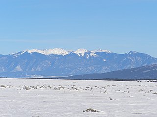
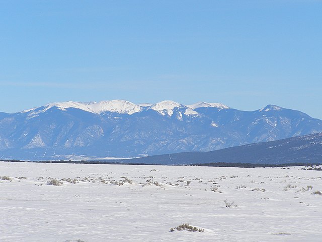
English: Latir Peak Wilderness area — in the Sangre de Cristo Mountains, within Carson National Forest, northern New Mexico.
|
| Date | |
| Source | Latir Peak Wilderness |
| Author | David Herrera |
Licensing
This file is licensed under the Creative Commons Attribution 2.0 Generic license.
- You are free:
- to share – to copy, distribute and transmit the work
- to remix – to adapt the work
- Under the following conditions:
- attribution – You must give appropriate credit, provide a link to the license, and indicate if changes were made. You may do so in any reasonable manner, but not in any way that suggests the licensor endorses you or your use.
| This image was originally posted to Flickr by dherrera_96 at https://www.flickr.com/photos/56181704@N00/474898320. It was reviewed on 6 August 2010 by FlickreviewR and was confirmed to be licensed under the terms of the cc-by-2.0. |
File history
Click on a date/time to view the file as it appeared at that time.
| Date/Time | Thumbnail | Dimensions | User | Comment | |
|---|---|---|---|---|---|
| current | 00:15, 6 August 2010 | | 2,816 × 2,112 (2.59 MB) | FlickreviewR | Replacing image by its original image from Flickr |
| 18:42, 11 March 2008 |  | 500 × 375 (91 KB) | Axcordion~commonswiki | Latir Peak Wilderness, taken from milepost 394 along US-285, ten miles north of Tres Piedras and 14 miles south of the New Mexico/Colorado border. Uploaded to Flickr by user dherrera_96 on April 27, 2007. http://www.flickr.com/photos/dph1110/474898320/ |
File usage
The following pages on the English Wikipedia use this file (pages on other projects are not listed):
Global file usage
The following other wikis use this file:
- Usage on ig.wikipedia.org
- Usage on ru.wikipedia.org
- Usage on www.wikidata.org