

No higher resolution available.
Palo-Alto-Battlefield-NHS.jpg (279 × 437 pixels, file size: 13 KB, MIME type: image/jpeg)
Summary
| Description |
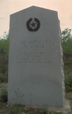
English: Historical marker of the Battle of Palo Alto. Cropped from a National Park Service/Palo Alto Battlefield National Historic Site image.
|
||
| Source | http://photo.itc.nps.gov/storage/images/paal/paal-ImageF.00001.jpeg | ||
| Author |
| Object location | | View this and other nearby images on: OpenStreetMap |
|---|
26°1′17″N 97°28′50″W / 26.02139°N 97.4806°W, near Brownsville, Texas.
Licensing
| This image or media file contains material based on a work of a National Park Service employee, created as part of that person's official duties. As a work of the U.S. federal government, such work is in the public domain in the United States. See the NPS website and NPS copyright policy for more information. |
File history
Click on a date/time to view the file as it appeared at that time.
| Date/Time | Thumbnail | Dimensions | User | Comment | |
|---|---|---|---|---|---|
| current | 13:05, 9 May 2008 | | 279 × 437 (13 KB) | Dr.emmettbrown | == Summary == Historical marker of the Battle of Palo Alto. Cropt from a National Park Service/Palo Alto Battlefield National Historic Site image. [http://photo.itc.nps.gov/storage/images/paal/paal-ImageF.00001.jpeg] Approximate location: {{ |
File usage
The following pages on the English Wikipedia use this file (pages on other projects are not listed):
Global file usage
The following other wikis use this file:
- Usage on de.wikipedia.org
- Usage on es.wikipedia.org
- Usage on ja.wikipedia.org
- Usage on nl.wikipedia.org
- Usage on zh.wikipedia.org